Ouaka is one of the 20 prefectures of the Central African Republic. It borders the Democratic Republic of the Congo, covers an area of 49,900 km2, and has a population of 276,710, with a population density of 5.5 inhabitants/km2. The prefecture is named after the Ouaka River and its capital is Bambari.

Bria is the capital of Haute-Kotto, one of the 14 prefectures of the Central African Republic. As of the 2003 census the town had a population of 35,204.

Bambari is a town in the Central African Republic, lying on the Ouaka River. It has a population of 41,356 and is the capital of Ouaka prefecture. Bambari is an important market town and is home to Bambari Airport, and the Roman Catholic Diocese of Bambari.

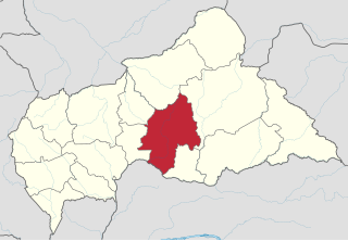
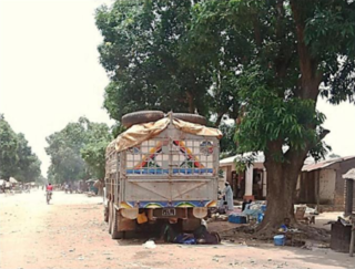
Kaga-Bandoro is a market town and capital of the Nana-Grébizi prefecture of the Central African Republic. It represents the seat of the Roman Catholic Diocese of Kaga–Bandoro. The town has been renamed twice.
N'Délé or Ndele is a market town and sub prefecture in the north eastern Central African Republic, lying east of the Bamingui-Bangoran National Park. Ndélé is the capital of Bamingui-Bangoran, one of the 16 prefectures of the Central African Republic. N'Délé had a population of 10,850 as of the 2003 census; and a calculated 2013 population of 13,704.

Birao is the capital of Vakaga, one of the 14 prefectures of the Central African Republic and was an administrative post in the colony of Ubangui-Shari. In March 2007, the town was almost completely burnt down in the fighting between rebels and government troops in the area.
Gambo is a town located in the Central African Republic prefecture of Mbomou. The town is named after Gambo, a Nzakara chief who ruled the area in the years before 1931.

Rafaï is a town and sub-prefecture on the Chinko River, in the Central African Republic prefecture of Mbomou. Its estimated population is about 14,000 people.
Ouadda is a town located in the Central African Republic prefecture of Haute-Kotto.
Ippy is a town located in the Central African Republic prefecture of Ouaka, near the geographic center of the country. It is 364 kilometers from the city of Bangui directly. Driving distance, however, is 496 kilometers.
Kouango is a town located in the Central African Republic prefecture of Ouaka.
Kembé is a town located in the Central African Republic prefecture of Basse-Kotto. The Kotto Falls double waterfall is nearby.
Bakouma is a sub-prefecture in the prefecture of Mbomou in Central African Republic. The area is known for its prosperity of mineral resources which have for a long time remained unexploited.
Ouanda Djallé is a sub-prefecture and town in the prefecture of Vakaga in the Central African Republic. It is located 130 km south of Birao. By population it is one of the smallest sub-prefectures in the country.
Grimari is a city located in the Ouaka prefecture in Central African Republic, approximately 222.7 kilometres (138.4 mi) away from the capital, Bangui. The politician Abel Goumba was born in Grimari.
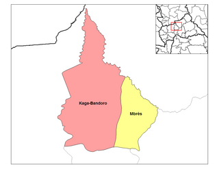
Mbrès is a sub-prefecture and town in the Nana-Grébizi Prefecture of the northern Central African Republic.

Markounda, formerly Fort-Brusseaux, is a sub-prefecture and town in the Ouham Prefecture of the north-western Central African Republic. The sub-prefecture borders with Chad.
Bambouti is a sub-prefecture of Haut-Mbomou in the Central African Republic. The town is abandoned by the country.

Mboki is a town and sub-prefecture in the Haut-Mbomou prefecture of the south-eastern Central African Republic.
Djoubissi, also known as Ndjoubissi, is a village situated in Ouaka Prefecture, Central African Republic.


