
Box Hill is a suburb of Melbourne, Victoria, Australia, 14 kilometres (8.7 mi) east of the city's Central Business District (CBD). Its local government area is the City of Whitehorse. At the 2016 census, Box Hill had a population of 11,395.

Port Melbourne is an inner suburb of Melbourne, Australia, 3 km south-west from the Melbourne central business district. It is split between the local government areas of Melbourne and Port Phillip. The area to the north of the West Gate Freeway is in the City of Melbourne. The area to the south is in the City of Port Phillip. At the 2016 Census, Port Melbourne had a population of 16,175.
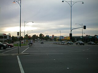
Nunawading is a suburb of Melbourne, Victoria, Australia, 18 km east of Melbourne's Central Business District. Its local government area is the City of Whitehorse and the City of Manningham govern part of it. At the 2016 Census, Nunawading had a population of 11,876.
Vermont is a suburb of Melbourne, Victoria, Australia, 20 km (12 mi) east of Melbourne's Central Business District. Its local government area comprises the cities of Maroondah and Whitehorse. At the 2016 census, Vermont had a population of 10,442.
Kew is an inner suburb of Melbourne, Australia, 5 km east from Melbourne's Central Business District. Its local government area is the City of Boroondara. At the 2016 Census, Kew had a population of 24,605.
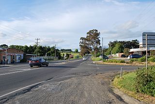
Coldstream is a locality and township within Greater Melbourne beyond the Melbourne metropolitan area Urban Growth Boundary, 36 km north-east from Melbourne's central business district. Its Local Government Area is the Shire of Yarra Ranges. At the 2016 census, Coldstream had a population of 2,164.
The Patch is a suburb in Melbourne, Victoria, Australia, 39 km east from Melbourne's central business district. Its local government area is the Shire of Yarra Ranges. At the 2016 census, The Patch had a population of 1,065.
Langwarrin is a suburb of Melbourne, Victoria, Australia, 42 km (26 mi) south-east from Melbourne's central business district. Its local government area is Frankston City. At the 2016 census, Langwarrin had a population of 22,588.

Broadmeadows is a suburb of Melbourne, Victoria, Australia, 16 km (9.9 mi) north of Melbourne's central business district. Its local government area is the City of Hume. At the 2016 Census, Broadmeadows had a population of 11,970.
Caulfield is a suburb of Melbourne, Victoria, Australia, 12 kilometres (7.5 mi) south-east of Melbourne's central business district. Its local government area is the City of Glen Eira.

Elsternwick is an inner suburb of Melbourne, Victoria, Australia, 9 km south-east of Melbourne's central business district. Its local government area is the City of Glen Eira. At the 2016 Census Elsternwick had a population of 10,349.

Seymour is a historic railway township located in the Southern end of the Goulburn Valley in the Shire of Mitchell, Victoria, Australia and is located 104 kilometres (65 mi) north of Melbourne. At the 2016 census, Seymour had a population of 6,327. The township services the surrounding agricultural industries as well as the nearby military base of Puckapunyal, which is an important training centre for the Australian Army. Other important sectors of employment in Seymour include retail, light engineering, agricultural services support, medical services, and education.

Mount Victoria is a small township in the Blue Mountains of New South Wales, Australia. It is the westernmost village in the City of Blue Mountains, located about 120 kilometres (75 mi) by road from the Sydney central business district and at an altitude of about 1,052 metres (3,451 ft) AHD . The settlement had a population of 823 people at the 2011 Census.

Yelta is a small locality in Victoria, Australia. It was for a short time in the 1870s and 1880s the Victorian administrative centre of what is now Sunraysia and the Millewa. This role was then taken over by Mildura. At the 2011 census, Yelta and the surrounding area had a population of 281.

Although most Australian civilians lived far from the front line of World War II, the Australian home front during World War II played a significant role in the Allied victory and led to permanent changes to Australian society.
Tenix Defence was Australia's largest defence contractor with core capabilities in Aerospace, Land, Marine and Electronic Systems applications. BAE Systems announced its intention to acquire the company from Tenix in January 2008 and the acquisition was completed in June 2008 for A$775 million. BAE Systems Australia thus became Australia's largest defence contractor.
Monomeith is a bounded rural locality in Victoria, Australia, 67 kilometres (42 mi) south-east of Melbourne's Central Business District, located within the Shire of Cardinia local government area. Monomeith recorded a population of 72 at the 2016 Census.

Bonegilla is a bounded rural locality of the City of Wodonga local government area in north-east Victoria, Australia, 10 kilometres (6.2 mi) east of Wodonga, and around 300 kilometres (190 mi) north-east of Melbourne. In the 2016 census, Bonegilla and surrounding area had a population of 693.
The Army Logistic Training Centre (ALTC) is an Australian Army training establishment that is part of Forces Command. Established on 1 December 1995, through the amalgamation of a nine separate logistic, health and personnel services schools and the Army College of TAFE, ALTC is headquartered at Bandiana, Victoria, and was established in response to the need to provide more effective logistic training, which had been identified as a problem as early as 1981. ALTC's motto is "Excel with Honour".
