
Banten is the westernmost province on the island of Java, Indonesia. Its capital city is Serang and its largest city is Tangerang. The province borders West Java and the Special Capital Region of Jakarta on the east, the Java Sea on the north, the Indian Ocean on the south, and the Sunda Strait on the west and shares a maritime border with Lampung to the west. The province covers an area of 9,352.77 km2 (3,611.12 sq mi). It had a population of over 11.9 million in the 2020 census, up from about 10.6 million in 2010. The estimated mid-2023 population was 12.308 million. Formerly part of the province of West Java, Banten was split off to become a province on 17 October 2000.
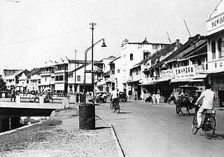
Batavia was the capital of the Dutch East Indies. The area corresponds to present-day Jakarta, Indonesia. Batavia can refer to the city proper or its suburbs and hinterland, the Ommelanden, which included the much larger area of the Residency of Batavia in the present-day Indonesian provinces of Jakarta, Banten and West Java.

The Great Post Road is the name for the historical road that runs across Java and connects Anyer with Panarukan. It was built during the administration of Herman Willem Daendels (1808–1811), governor-general of the Dutch East Indies, using unpaid forced labour that cost thousands of lives.
The Dutch Prix de Rome is based on the originally French Prix de Rome and is awarded annually to architects and artists younger than 35. The award was initiated in 1807 by Louis Bonaparte, then ruler of the Kingdom of Holland, and confirmed after independence by William I of the Netherlands. It was canceled in 1851 by the statesman Johan Rudolph Thorbecke and reinstated in 1870 by William III of the Netherlands. Since then the winners are selected by the Rijksakademie in Amsterdam.

Oud Eik en Duinen is a cemetery in The Hague, the Netherlands, formerly called Eik en Duinen and also nicknamed "the Dutch Père-Lachaise". The cemetery is built around a chapel constructed around 1247 by William II of Holland in honor of his father, Floris IV, Count of Holland. This chapel was partially demolished in 1581, and in the 17th century the area was again used as a cemetery. When Eik en Duinen was full, a new cemetery, Nieuw Eykenduynen, was constructed in 1891 across the road, and since then the old cemetery is known as "Old" Eik en Duinen.

The Timor and Dependencies Residency was an administrative subdivision (Residency) of the Dutch East Indies located in the Eastern half of Lesser Sunda Islands east of Lombok, it was separated in 1819 from the Governorate of Moluccas (Gouvernement der Molukken. Its capital was at Kupang.

The Dutch East Indies was a Dutch colony consisting of what is now Indonesia. The Anglo-Dutch Treaty of 1824, which ceded Dutch Malacca, a governorate of the Dutch East Indies that was transferred to Great Britain has consolidated modern-day rule to the Malacca state of Malaysia. It was divided into three governorates, namely the Great East, Borneo (Kalimantan) and Sumatra, and into three provinces in Java. Provinces and governorates were further divided into residencies. Residencies under the provinces were divided into regencies, and residencies under governorates were divided into departments and then further into regentschappen.

Onze Kunst van Heden was an exhibition held in the winter of 1939 through 1940 at the Rijksmuseum in Amsterdam. Due to the threat of invasion in the years leading up to World War II, the Netherlands' government stored many items from the Rijksmuseum's permanent collection. The resulting empty gallery space was utilized by contemporary Dutch artists to exhibit and sell their art. It was organized by the director of the Rijksmuseum Frederik Schmidt Degener. The show was open to all artists, with each artist allowed to enter four pieces. 902 artists exhibited 3,200 works of art in 74 rooms and cabinets of the Rijksmuseum.
„De kunstenaar kan in tijden van maatschappelijke benauwenis weinig positiefs doen om rampen af te wenden, maar wel kan hij door mede te helpen nationale uitingen op het eigenaardigst naar voren te brengen het gemeenschapsbesef versterken. Wanneer de belangstelling van het publiek uitgaat naar deze manifestatie, die in zulk een omvang in Holland nog niet gezien is, dan zal menige kunstenaar zich op zijn beurt gesterkt voelen".
"The artist can do little positive in times of social distress to avert disasters, but he can, by helping to bring out national expressions in the most idiosyncratic way, strengthen the sense of community. When the public is interested in this event, which has not yet been seen to such an extent in Holland, many artists will feel strengthened in turn."

Tapanoeli Residency was an administrative subdivision of the Dutch East Indies with its capital in Sibolga. It was located in northern Sumatra and existed in various forms from 1844 until the end of Dutch rule in 1942. The area it encompassed at various times corresponds to most of the western coast of the current day Indonesian province of North Sumatra and parts of Aceh, including much of the traditional heartland of Batak people. Lake Toba, a historically important crater lake, was also within the borders of the Residency.

The Gouvernment of Atjeh and Dependencies was an administrative subdivision (governorate) of the Dutch East Indies located in northern Sumatra in the region of present-day Aceh, Indonesia which existed from the late nineteenth century to 1938. The capital of the governorate was at Koetaradja. In 1938, due to a reorganization of the government structure of the Indies, it no longer had a governor and became a Residency instead, called the Atjeh and Dependencies Residency.

Preanger Regencies Residency, sometimes referred to as Preanger Residency and renamed Priangan Residency after 1931, was an administrative division (residency) of the Dutch East Indies located in Parahyangan, West Java which existed from 1817 to 1925. Its capital was in Cianjur until 1856 and thereafter in Bandung. The residency contained the municipality of Bandung and the regencies of Bandoeng, Soemedang, Tasikmalaja, Tjiamis and Garoet.
Semarang Residency was an administrative subdivision (Residency) of the Dutch East Indies located on the northern coast of Central Java and named after its capital city Semarang. It existed from 1818 to 1942, although its borders were changed many times during that period.

Koedoes Residency was an administrative division (Residency) of Central Java province of the Dutch East Indies with its capital at Kudus, which existed between 1928 and 1931. It was significantly larger than the present-day Kudus Regency, as it also contained Demak Regency and Jepara Regency.

Blora Residency was an administrative division (Residency) of Central Java province of the Dutch East Indies with its capital at Blora, which existed between 1928 and 1931. It was significantly larger than the present-day Blora Regency, as it also contained Grobogan Regency and Purwodadi.

Buitenzorg Residency was an administrative division (Residency) of the Dutch East Indies located in western Java which existed from 1817 to 1867 and from 1925 to 1942. Its seat was at Buitenzorg which was also the seat of the colonial government of the Indies after 1905.

Madoera Residency was an administrative subdivision (Residency) of the Dutch East Indies located on the island of Madura and with its capital at Pamekasan. It also included some smaller islands off Madura such as the Kangean Islands and Sapudi Islands. The Residency was divided into 4 districts : Pamekasan, Bangkalan, Sampang and Soemenep. It existed from the 1880s, when the Dutch established more direct control over the Island, to 1942 when the Japanese invaded the Indies, except for a brief period 1928-31 when it was divided into two smaller residencies.

