
Ledsham is a village and civil parish 4 miles (6 km) north of Castleford and 11 miles (18 km) east of Leeds in the county of West Yorkshire, England. The village is in the City of Leeds metropolitan borough and near to the A1 Great North Road. It has a population of 162, increasing to 181 at the 2011 Census.

Austhorpe is a civil parish and residential suburb of east Leeds, West Yorkshire, England. It is 5 miles (8.0 km) to the east of city centre and close to the A6120 dual carriageway and the M1 motorway.

Halton is a district of east Leeds, West Yorkshire, England, situated between Cross Gates to the north, Halton Moor to the west, Colton to the east and Whitkirk to the South. Temple Newsam lies directly south of the estate.

Woodhouse is a largely residential area just north of the city centre of Leeds and close to the University of Leeds. It is in the Hyde Park and Woodhouse ward of City of Leeds metropolitan district. The population of the ward at the 2011 Census was 25,914.

East Ardsley is a village in the City of Leeds metropolitan borough, in West Yorkshire, England.

Allerton Bywater is a semi-rural village and civil parish in the south-east of the City of Leeds metropolitan borough in West Yorkshire, England. The population of the civil parish as of the 2011 census was 4,717. The village itself is 2 miles (3.2 km) north of Castleford, with neighbouring villages Kippax and Great Preston all providing local amenities. St Aidan's Nature reserve borders the village attracting many visitors with its beauty and charm. Additionally ‘The Lines’ bridal path which runs from Garforth through to Allerton following the old train track provides a pleasant route for walkers, joggers and cyclists alike. The River Aire flows through the village to the south-west.
Colton is a district of east Leeds, West Yorkshire, England, situated between Cross Gates to the north, Halton and Halton Moor to the west, Whitkirk to the north-west and Austhorpe to the north-east. Temple Newsam lies directly south of the estate.

Carlton is a village in the south of the City of Leeds metropolitan borough in West Yorkshire, England, about 6 miles (13 km) from Leeds city centre.

Great Preston is a small rural village in the City of Leeds metropolitan borough, West Yorkshire, England. It has incorporated the once neighbouring hamlet of Little Preston.

West Ardsley is commonly used to refer to an area on the south-west edge of the City of Leeds metropolitan borough, possessing a WF postcode in the WF3 (Wakefield) postcode area while the village telephone numbers are "0113", the Leeds prefix. Historically part of the West Riding of Yorkshire, it roughly approximates to an amalgamation of Tingley, Woodkirk, Hill Top, Upper Green, Common Side, Beggarington Hill and a number of other hamlets. The parish church is at Woodkirk. Being in the middle of several towns, West Ardsley has become a dormitory settlement.

Hornby is a village and civil parish in the Hambleton district of North Yorkshire, England. It lies on a minor road between Great Smeaton and Appleton Wiske.

Collingham is a village and civil parish 2 miles (3 km) south east of Wetherby in West Yorkshire, England. It is in the City of Leeds metropolitan borough. The population of the civil parish as of the 2011 census was 2,991.

Bardsey, West Yorkshire, England is a small village in the City of Leeds metropolitan borough, 8 miles (13 km) north east of Leeds city centre. The village is in the LS17 Leeds postcode district. It is part of the civil parish of Bardsey cum Rigton. The village itself lies just off the A58 road between Leeds and Wetherby.

East Keswick is a village and civil parish in the City of Leeds metropolitan borough, West Yorkshire, England. It lies four miles south west of Wetherby. The population of the civil parish as of the 2011 census was 1,146.

Bagley is a village in the City of Leeds metropolitan borough, West Yorkshire, England, once in the township of Farsley. The remains of the village are on Bagley Lane, on the section between the A657 road in Rodley and the junction with Coalhill Lane.

Kirk Smeaton is the most southerly village of the large county of North Yorkshire, England. It is also a civil parish in the Selby District. Historically the village was part of the West Riding of Yorkshire until 1974.

Carlton is a civil parish in the City of Leeds in West Yorkshire, England. It consists of the villages of East Carlton and West Carlton, and in 2001 had a population of 169.

East Rigton is a hamlet in West Yorkshire, England, immediately to the east of Bardsey.

All Hallows Church in Bardsey, West Yorkshire, England is an active Anglican parish church in the archdeaconry of Leeds and the Diocese of Leeds.
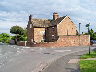
Bardsey cum Rigton is a civil parish in the metropolitan borough of the City of Leeds, West Yorkshire, England. It contains 16 listed buildings that are recorded in the National Heritage List for England. Of these, one is listed at Grade I, the highest of the three grades, and the others are at Grade II, the lowest grade. The parish contains the villages of Bardsey, and East Rigton, and is otherwise rural. The most important listed building is All Hallows Church which contains Anglo-Saxon material, and is listed at Grade I. The other listed buildings consist of houses and cottages, farmhouses and farm buildings, a sundial in the churchyard, a public house, and a milestone.
