
Sitamarhi is an Indian city and the district headquarters of the Sitamarhi district in the Mithila region of Bihar and is a part of the Tirhut Division. The name of the city had kept as honours the birthplace of the goddess, Sita. The Bihar government declared Sitamarhi a municipal council.

Muzaffarpur District is one of the thirty-eight districts of Bihar state, India. Muzaffarpur district is part of and also the headquarters of Tirhut Division Tirhut is the ancient name of all of northern Bihar.
Motipur is a town and a notified area in Muzaffarpur district. It is located 14 kilometres south of Mehsi in the Indian state of Bihar. In 2021, Motipur Nagar Panchayat was upgraded to Nagar Parishad.

Sugauli is a city and a notified area in East Champaran district in the Indian state of Bihar. It is the setting for Rudyard Kipling's story "Rikki-Tikki-Tavi", and the place where a treaty was signed with Nepal in 1816.

Wandoor is a town in Nilambur Taluk, Malappuram District, Kerala, India. It is located on the southeast of Chaliyar River, about 24 kilometres northeast of the district seat Malappuram, and 8 km south of the taluk seat Nilambur. In the year 2011, the town has a population of 50,973.
Dora Chapara is a small village in Bihar state, India, which mainly relies on farming and agriculture. It falls under Kathaiyan thana. It is in Fatehan Panchyat and Baruraj Legislative Seat. It falls under the Vaishali parliamentary seat. Nearest Railway station is Motipur.

Baruraj Assembly constituency is an assembly constituency in Muzaffarpur district in the Indian state of Bihar.
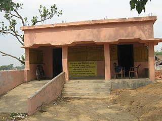
Gisara urf Gidhsara is an area in the Sitamarhi district of the state of Bihar, in north-east India. Due to frequent flooding, Gisara has significant alluvial deposits. Because of its geography, the area is rich in agriculture. The main market areas are around Gisara Bazar and Gisara Chauraha.
Tengraha is a village in Minapur Block in Muzaffarpur district of Bihar, India. It belongs to Tirhut Division. It is located 26 km north of the Muzaffarpur district headquarters, 8 km from Minapur, and 91 km from the state capital, Patna. It is surrounded by Gandak and Bagmati rivers. Most of the people in this village are farmers. This village, as well as the rest of Muzaffarpur district, is famous for its Lichee trees, which grow litchis fruit. Tengrari has a small shopping market. Balua Bazar is near Tengrari, which has a shopping market and Rishabh Vastralaya.
Bazidpur is a village in Shaheed Bhagat Singh Nagar district of Punjab State, India. It is situated on Wazidpur-Ludhiana link road and located 4.7 kilometres (2.9 mi) away from postal head office Garcha, 7 kilometres (4.3 mi) from Rahon, 15 kilometres (9.3 mi) from district headquarter Shaheed Bhagat Singh Nagar and 95.8 kilometres (59.5 mi) from state capital Chandigarh. The village is administrated by Sarpanch an elected representative of the village. The current head of Gram Panchayat Bazidpur is Harbhajan Singh who is a retired Army Officer.
Muzaffarpur is a village in Shaheed Bhagat Singh Nagar district of Punjab State, India. It is located 5.6 kilometres (3.5 mi) away from sub post office Jadla, 16.7 kilometres (10.4 mi) from Nawanshahr, 22 kilometres (14 mi) from district headquarter Shaheed Bhagat Singh Nagar and 85 kilometres (53 mi) from state capital Chandigarh. The village is administrated by Sarpanch an elected representative of the village.

Khanpur Urf Birbhanpur is a village in Salon block of Rae Bareli district, Uttar Pradesh, India. It is located 43 km from Raebareli, the district headquarters. As of 2011, Khanpur Urf Birbhanpur has a population of 1,929 people, in 363 households. It has one primary school and no healthcare facilities. It does not host a permanent market or a periodic haat.

Shaistabad Urf Bhurkushpur is a village in Lalganj block of Rae Bareli district, Uttar Pradesh, India. It is located 8 km from Lalganj, the block and tehsil headquarters. As of 2011, it has a population of 1,072 people, in 199 households. It has one primary school and no healthcare facilities, and it hosts a permanent market but not a weekly haat. It belongs to the nyaya panchayat of Bahai.
Satar Kataiya, or Sattar Kataiya, is a tehsil of Saharsa District, Bihar, India. Its seat of government is located in the village of Sattar. As of the year 2011, its population is 151,060.
Raj Khand is a village in Aurai Block, Muzaffarpur District, Bihar, India. It is located on Northern Bihar, about 45 kilometres northeast of the district capital Muzaffarpur, and 14 kilometres southeast of the block capital Aurai. As of the year 2011, it is home to 19,296 inhabitants.
Aurai is a block of Muzaffarpur District, Bihar, India. Its administrative center is the village of Aurai. As of 2011, the block has a total population of 290,545.
Maura, or Moura Jharkaha, is a village in Shankarpur Block, Madhepura District, Bihar, India. It is located on the north of the district, approximately 19 kilometres northeast of the district capital Madhepura, and 5 kilometres north of the block capital Shankarpur. As of 2011, it has a population of 42,528.
Kharik is a village and the administrative center of Kharik Block, Bhagalpur District, Bihar, India. It is located on the northern part of the district, approximately 14 kilometres north of the district capital Bhagalpur. In 2011, It has 42,354 inhabitants.
Saidpur Dabra is a village in Gopalpur Block, Bhagalpur District, Bihar, India. It is located near the state boundary with Jharkhand, about 21 kilometres northeast of the district seat Bhagalpur, and 19 kilometres northeast of the block seat Gopalpur. In the year 2011, it has a total population of 37,101.
Rarhi is a village in Jale Block, Darbhanga District, Bihar, India. It is located near the northern border of the country, about 27 kilometres northwest of the district capital Darbhanga, and 5 kilometres south of the block capital Jale, Bihar. In the year 2011, it has a population of 36,569.

