
Tehatta is the headquarters of the Tehatta subdivision in Nadia district in the Indian state of West Bengal. The place is a sub-divisions in the district of Nadia. It was declared as sub-division in 1996. Tehatta is located beside the India-Bangladesh border area.
Adavad, also spelled Adawad or Adwad, is a village in the Chopda Tehsil of Jalgaon District, Maharashtra, India. It is situated at the southern base of the Satpura Hills, about 30 kilometres northwest of the district seat Jalgaon, and 13 kilometres east of the subdistrict seat Chopda. As of the year 2011, it has a total population of 24,357.
Hadubangi, also romanized as Hadobhangi or Haddubangi, is a village in Kashinagara Tehsil, Gajapati District, Odisha, India. It is located near the Odia-Andhra Pradesh border, about 13 kilometres west of the district capital Paralakhemundi, and 11 kilometres southeast of the tehsil capital Kashinagara. As of the year 2011, It has a total population of 1,124.
Tehatta II is a community development block that forms an administrative division in Tehatta subdivision of Nadia district in the Indian state of West Bengal.

Thevalakkara is a village in the Karunagappally Taluk, Kollam District of the state of Kerala, India. It is located near the coast of the Indian Ocean, about 13 kilometres north of the district capital Kollam, and 7 kilometres southeast of the subdistrict capital Karunagappally. It contains a famouse Devi temple along with a church and a mosque. The kadappa at Thevalakara is where ship masts (kadappa) were made for centuries. In 2011, it has a total population of 42,977.
Chinchali is a village in Raybag Taluk, Belagavi District, Karnataka, India. It is located near the state boundary with Maharashtra, approximately 84 kilometres north of the district seat Belgaum, and 10 kilometres northeast of the taluk seat Raibag. In the year 2011, the village has a population of 18,986.
Mohare is a village in Bailhongal Taluk, Belagavi District of Karnataka, India. It is located near the state border with Maharashtra, about 26 kilometres east of the district seat Belgaum, and 16 kilometres northwest of the taluk seat Bailhongal. As of 2011, it has a total population of 2,365.

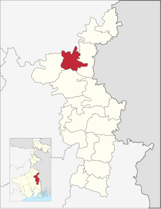
Tehatta I is a community development block that forms an administrative division in Tehatta subdivision of Nadia district in the Indian state of West Bengal.
Palashipara, is a village in the Tehatta II CD block in the Tehatta subdivision of the Nadia district, West Bengal, India.
Kishorpur is a village under the Karimpur II Community Development Block in Tehatta subdivision of Nadia district in the state of West Bengal. Nandanpur is the gram panchayat of Kishorpur village. This village is under the Karimpur police station.
Thanarpara is a village in the Karimpur II CD block in the Tehatta subdivision of the Nadia district in the state of West Bengal, India.
Rahmatpur is a village in the Karimpur II CD block in the Tehatta subdivision of the Nadia district in the state of West Bengal, India.
Gachirampara is a village in Dasda Block, North Tripura District, Tripura, India. It borders Dasda Laxmipur to the north, Paschim Tlangsanbari (Part) to the east, Lambachhara to the south, and Ramprasaipara to the west. In the year 2011, it has a total population of 21,601.
Raj Khand is a village in Aurai Block, Muzaffarpur District, Bihar, India. It is located on Northern Bihar, about 45 kilometres northeast of the district capital Muzaffarpur, and 14 kilometres southeast of the block capital Aurai. As of the year 2011, it is home to 19,296 inhabitants.
Dhamdaha is a village and the administrative division of Dhamdaha Block, Purnia District, Bihar, India. It is situated in the Eastern part of Bihar, about 26 kilometres southwest of the block capital Purnia. In the year 2011, the village has a total population of 37,987.
Jale, or Jalley, is a town and the administrative center of Jale Block, Darbhanga District, Bihar, India. It is located to the north of Bagmati River, about 32 kilometres northwest of the district capital Darbhanga. The town was named after Jaleshwari sthan which is a pilgrimage site in rural area of Darbhanga. In the year 2011, it has a total population of 37,256.
Umrapur is a village in Suti-II Block, Murshidabad District, West Bengal, India. It is located on the state border with Jharkhand, approximately 66 kilometres northwest of the district capital Berhampore, and 15 kilometres west of the block capital Aurangabad. In the year 2011, the village has a population of 19,855.
Rajaudha, also spelled as Rajodha, is a village in Porsa Tehsil, Morena District, Madhya Pradesh, India. It is located near the state border with Uttar Pradesh, about 49 kilometres northeast of the district capital Morena, and 6 kilometres northeast of the tehsil capital Porsa. As of the year 2011, it has a population of 16,524.
Kharik is a village and the administrative center of Kharik Block, Bhagalpur District, Bihar, India. It is located on the northern part of the district, approximately 14 kilometres north of the district capital Bhagalpur. In 2011, It has 42,354 inhabitants.


