
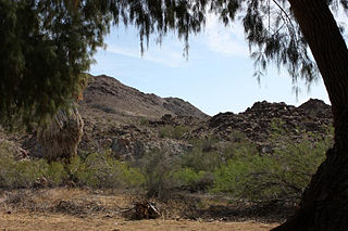
Joshua Tree is a census-designated place (CDP) in San Bernardino County, California, United States. The population was 7,414 at the 2010 census. At approximately 2,700 feet above sea level, Joshua Tree and its surrounding communities are located in the High Desert of California. The center of the business district in Joshua Tree is on California State Route 62.

The Santa Monica Mountains are a coastal mountain range in Southern California, next to the Pacific Ocean. It is part of the Transverse Ranges. The Santa Monica Mountains National Recreation Area encompasses this mountain range. Because of its proximity to densely populated regions, it is one of the most visited natural areas in California.
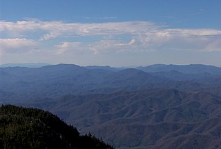
The Adirondack High Peaks are a set of 46 mountain peaks in the Adirondack Mountains of New York state. They have been popular hiking destinations since the late 1920s, when the list of peaks was published in Russell Carson's book Peaks and Peoples of the Adirondacks. Those who have climbed all 46 High Peaks are eligible to join the Adirondack Forty-Sixers club.

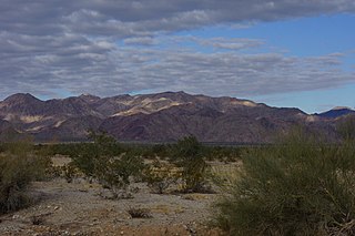
The Little San Bernardino Mountains are a short mountain range of the Transverse Ranges, located in southern California in the United States. They extend for approximately 40 mi (64 km) southeast from the San Bernardino Mountains through San Bernardino and Riverside Counties to near the northeast edge of the Salton Sink and Salton Sea.

The Wenatchee Mountains are a range of mountains in central Washington State, United States of America. A major subrange of the Cascade Range, extending east 50 miles (80 km) from the Cascade crest, the Wenatchee Mountains separate the drainage basins of the Yakima River from the Wenatchee River. The crest of the range forms part of the boundary between Chelan and Kittitas Counties.
The Unaka Range is a mountain range on the border of Tennessee and North Carolina, in the southeastern United States. It is a subrange of the Appalachian Mountains and is part of the Blue Ridge Mountains physiographic province. The Unakas stretch approximately from the Nolichucky River in the south to the Watauga River in the north.
The Chuckwalla Mountains are a mountain range in the transition zone between the Colorado Desert—Sonoran Desert and the Mojave Desert, climatically and vegetationally, in Riverside County of southern California.
The Bullion Mountains are located in the Mojave Desert of California southeast of the city of Barstow. The mountain range stretches for approximately 50 miles in a northwest-southeasterly direction north of Joshua Tree and Twentynine Palms.
The Coxcomb Mountains are a mountain range in eastern Riverside County, Southern California, and to a small extent in San Bernardino County.

The Sheep Hole Mountains are a mountain range in the Mojave Desert, to the north of Joshua Tree National Park, in San Bernardino County, California. The mountains were once Chemehuevi hunting grounds.
The Clark Mountain Range is located in southeastern California, north of Interstate 15 and the community of Mountain Pass. The range stretches approximately 15 miles (24 km) in a southwest-northeasterly direction, beginning in the Mojave National Preserve, and ending near Stateline Pass, about one mile (1.6 km) from the Nevada border. Clark Mountain, at 7,929 feet above sea level, is the principal peak of the range.
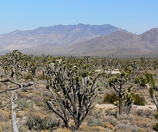
The Hexie Mountains are a desert mountain range located in Joshua Tree National Park, in southern California.

Intervale is an unincorporated community in Carroll County, New Hampshire, United States, located on the boundary between the towns of Bartlett and Conway in the White Mountains Region. The village is part of the Mount Washington Valley, a resort area that also includes the communities of North Conway and Jackson. The village has a separate ZIP code (03845) from surrounding communities in the Bartlett/Conway area.

The mountains in the McCullough Range lie mostly above the city of Henderson in the U.S. state of Nevada. The range has two distinct areas with the northern portion being primarily volcanic in origin, while the southern part of the range is primarily composed of metamorphic rock.
The Sylvania Mountains Wilderness is a federally designated wilderness area located 30 miles (48 km) east of Bishop in the state of California. The wilderness is 18,677acres in size and is managed by the Bureau of Land Management (BLM). The California Desert Protection Act of 1994 created the Sylvania Mountains Wilderness and was added to the National Wilderness Preservation System. The wilderness is bordered by Nevada stateline on the east, Piper Mountain Wilderness on the west and Death Valley National Park to the south.
The Calumet Mountains are a mountain range in San Bernardino County, California. They are north of Joshua Tree National Park and adjacent to the Sheep Hole Mountains in the Mojave Desert. The highest point is 829 meters.
The Cottonwood Mountains are a mountain range in Riverside County, California. They lie between the Little San Bernardino Mountains to the west, and Eagle Mountains to the east and the Hexie Mountains to the north. They are partially included in the Joshua Tree Wilderness.

The Iron Mountains are a mountain range in eastern San Bernardino County, California. The southern end of the range extends into Riverside County north of Granite Pass.

The Mecca Hills are a low mountain range located in Riverside County, southern California, in the United States.
The Mesquite Mountains are a mountain range in eastern San Bernardino County, California, near the border with Nevada. They are north of Interstate 15 in California and southeast of Death Valley.
