
Ostrołęka is a small city in northeastern Poland on the Narew river, about 120 km (75 mi) northeast of Warsaw, with a population of 51,012 (2021) and an area of 33.46 square kilometres (12.92 sq mi). It is the capital of both Ostrołęka County and Ostrołęka City County in the Masovian Voivodeship.

The Duchy of Warsaw, also known as the Grand Duchy of Warsaw and Napoleonic Poland, was a French client state established by Napoleon Bonaparte in 1807, during the Napoleonic Wars. It initially comprised the ethnically Polish lands ceded to France by Prussia under the terms of the Treaties of Tilsit, and was augmented in 1809 with territory ceded by Austria in the Treaty of Schönbrunn. It was the first attempt to re-establish Poland as a sovereign state after the 18th-century partitions and covered the central and southeastern parts of present-day Poland.
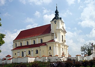
Siemiatycze is a town in eastern Poland, with 15,209 inhabitants (2004). It is the capital of Siemiatycze County in the Podlaskie Voivodeship.

Sokółka is a town in northeastern Poland, seat of the Sokółka County in Podlaskie Voivodeship. It is a busy rail junction located on the international Warsaw–Białystok–Grodno line, with additional connections which go to Suwałki and the Lithuanian border.

Supraśl is a town and former episcopal see in north-eastern Poland.

Kępno is a town in south-central Poland. It lies on the outskirts of the Greater Poland Voivodeship, bordering the historical region of Silesia and the Łódź Voivodeship. As of December 31, 2009 Kępno had a population of 14,760. One popular attraction in Kępno is the Rynek.

The first Battle of Raszyn was fought on 19 April 1809 between armies of the Austrian Empire under Archduke Ferdinand Karl Joseph of Austria-Este and the Duchy of Warsaw under Józef Antoni Poniatowski, as part of the War of the Fifth Coalition in the Napoleonic Wars. The battle was not decisive, but it did result in the Austrians obtaining their goal by capturing the Polish capital Warsaw.

Greater Poland uprising of 1806 was a Polish military insurrection which occurred in the region of Wielkopolska, also known as Greater Poland, against the occupying Prussian forces after the Partitions of the Polish–Lithuanian Commonwealth (1772–1795).
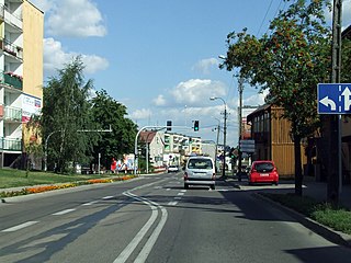
Żuromin is a town in north-central Poland, in Masovian Voivodeship, about 120 kilometres northwest of Warsaw. It is the capital of Żuromin County.
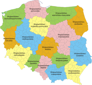
The administrative division of Poland since 1999 has been based on three levels of subdivision. The territory of Poland is divided into voivodeships (provinces); these are further divided into powiats, and these in turn are divided into gminas. Major cities normally have the status of both gmina and powiat. Poland currently has 16 voivodeships, 380 powiats, and 2,478 gminas.

Kamieniec or Kamieniec Suski is a village in the administrative district of Gmina Susz, within Iława County, Warmian-Masurian Voivodeship, in northern Poland. It lies approximately 4 kilometres (2 mi) north-east of Susz, 22 km (14 mi) north-west of Iława, and 75 km (47 mi) west of the regional capital Olsztyn.
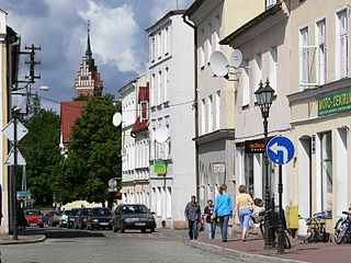
Górowo Iławeckie or simply Górowo, is a town in northern Poland, located in the Bartoszyce County, Warmian-Masurian Voivodeship, with 4,068 inhabitants (2016). The town has a land area of 3.32 square kilometres (1.28 sq mi) and is the smallest municipality (gmina) in terms of geographical size in Poland.

The siege of Danzig was the French encirclement and capture of Danzig during the War of the Fourth Coalition. On 19 March 1807, around 27,000 French troops under Marshal Lefebvre besieged around 14,400 Prussian troops under Marshal Kalckreuth garrisoning the city of Danzig.

Nowa Wieś is a village in the administrative district of Gmina Piotrków Kujawski, within Radziejów County, Kuyavian-Pomeranian Voivodeship, in central Poland.
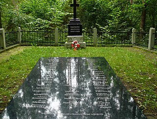
Jeziorko is a village in the administrative district of Gmina Piątnica, within Łomża County, Podlaskie Voivodeship, in north-eastern Poland. It lies approximately 6 kilometres (4 mi) north-east of Piątnica, 8 km (5 mi) north-east of Łomża, and 68 km (42 mi) west of the regional capital Białystok.

Kaletnik is a village in the administrative district of Gmina Szypliszki, within Suwałki County, Podlaskie Voivodeship, in north-eastern Poland, close to the border with Lithuania. It lies approximately 8 kilometres (5 mi) south of Szypliszki, 15 km (9 mi) north-east of Suwałki, and 119 km (74 mi) north of the regional capital Białystok.

The siege of Kolberg took place from March to 2 July 1807 during the War of the Fourth Coalition, part of the Napoleonic Wars. An army of the First French Empire and several foreign auxiliaries of France besieged the fortified town of Kolberg, the only remaining Prussian-held fortress in the Province of Pomerania. The siege was not successful and was lifted upon the announcement of the Peace of Tilsit.
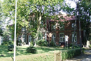
Zdziechowa is a village in the administrative district of Gmina Gniezno, within Gniezno County, Greater Poland Voivodeship, in west-central Poland. It lies approximately 6 kilometres (4 mi) north of Gniezno and 49 km (30 mi) north-east of the regional capital Poznań.

Rataje is a village in the administrative district of Gmina Pyzdry, within Września County, Greater Poland Voivodeship, in west-central Poland. It lies approximately 3 kilometres (2 mi) north-east of Pyzdry, 19 km (12 mi) south-east of Września, and 60 km (37 mi) south-east of the regional capital Poznań.
Łaniewo is a village in the administrative district of Gmina Lidzbark Warmiński, within Lidzbark County, Warmian-Masurian Voivodeship, in northern Poland. It lies approximately 9 kilometres (6 mi) west of Lidzbark Warmiński and 36 km (22 mi) north of the regional capital Olsztyn. It is located in Warmia.


