Roosevelt is an unincorporated community in Lubbock County, Texas, United States. It sits at an elevation of 3136 feet. The community is part of the Lubbock Metropolitan Statistical Area. It mainly consists of Roosevelt High school. There is also a Baptist Church here.

Mazanki is a village in the administrative district of Gmina Radzyń Chełmiński, within Grudziądz County, Kuyavian-Pomeranian Voivodeship, in north-central Poland. It lies approximately 3 kilometres (2 mi) south-east of Radzyń Chełmiński, 19 km (12 mi) south-east of Grudziądz, and 44 km (27 mi) north-east of Toruń.

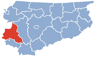
Budaqdərə is a village in the Lachin Rayon of Azerbaijan.
Padar is a village in the Qubadli Rayon of Azerbaijan.
Annopol Mały is a village in the administrative district of Gmina Czerniewice, within Tomaszów Mazowiecki County, Łódź Voivodeship, in central Poland. It lies approximately 4 kilometres (2 mi) north-west of Czerniewice, 19 km (12 mi) north of Tomaszów Mazowiecki, and 47 km (29 mi) east of the regional capital Łódź.
Wilczoruda-Parcela is a village in the administrative district of Gmina Pniewy, within Grójec County, Masovian Voivodeship, in east-central Poland. It lies approximately 14 kilometres (9 mi) west of Grójec and 43 km (27 mi) south-west of Warsaw.
Morzyczyn-Włóki is a village in the administrative district of Gmina Sadowne, within Węgrów County, Masovian Voivodeship, in east-central Poland.

Klouékanmè is a town, arrondissement, and commune in the Kouffo Department of south-western Benin. The commune covers an area of 250 square kilometers and as of 2013 had a population of 128,537 people.
Brzozów is a village in the administrative district of Gmina Gubin, within Krosno Odrzańskie County, Lubusz Voivodeship, in western Poland, close to the German border.
Międzyłęż is a village in the administrative district of Gmina Pelplin, within Tczew County, Pomeranian Voivodeship, in northern Poland. It lies approximately 10 kilometres (6 mi) east of Pelplin, 19 km (12 mi) south-east of Tczew, and 49 km (30 mi) south of the regional capital Gdańsk.
Rudno is a village in the administrative district of Gmina Tychowo, within Białogard County, West Pomeranian Voivodeship, in north-western Poland. It lies approximately 12 kilometres (7 mi) south-west of Tychowo, 22 km (14 mi) south-east of Białogard, and 115 km (71 mi) north-east of the regional capital Szczecin.
Grochów is a settlement in the administrative district of Gmina Gryfice, within Gryfice County, West Pomeranian Voivodeship, in northwestern Poland. It lies approximately 9 kilometres (6 mi) south of Gryfice and 61 km (38 mi) northeast of the regional capital Szczecin.
Recław is a village in the administrative district of Gmina Wolin, within Kamień County, West Pomeranian Voivodeship, in north-western Poland. It lies approximately 2 kilometres (1 mi) east of Wolin, 18 km (11 mi) south-west of Kamień Pomorski, and 48 km (30 mi) north of the regional capital Szczecin.

Gawroniec is a village in the administrative district of Gmina Połczyn-Zdrój, within Świdwin County, West Pomeranian Voivodeship, in north-western Poland. It lies approximately 12 kilometres (7 mi) south-west of Połczyn-Zdrój, 21 km (13 mi) south-east of Świdwin, and 100 km (62 mi) east of the regional capital Szczecin.
Phỉ Điền is a commune (xã) and village in Lục Ngạn District, Bắc Giang Province, in northeastern Vietnam.

The Danish War Museum is a museum of military history and arms on Slotsholmen in central Copenhagen, Denmark. It is located in Christian IVs arsenal Tøjhuset, from which it takes its former name. On 1 July 2018, the name was changed from the Royal Danish Arsenal Museum to The Danish War Museum, in order to make it easier for guest to discern the nature of the museum.
Mila is an unincorporated community in Northumberland County, in the U.S. state of Virginia. Mila is located at 37°50′32″N76°19′39″W.
Mõisaküla is a village in Lääneranna Parish, Pärnu County, in western Estonia.
Hừa Ngài is a commune (xã) and village of the Mường Chà District of Điện Biên Province, northwestern Vietnam.
Sadeq Abad is a city in Galikash County, Golestan Province, Iran. At the 2006 census, its population was 1,617, in 404 families.