Szałkowo is a village in the administrative district of Gmina Iława, within Iława County, Warmian-Masurian Voivodeship, in northern Poland. It lies approximately 7 kilometres (4 mi) north of Iława and 63 km (39 mi) west of the regional capital Olsztyn.
Szeplerzyzna is a village in the administrative district of Gmina Iława, within Iława County, Warmian-Masurian Voivodeship, in northern Poland. It lies approximately 3 kilometres (2 mi) south-west of Iława and 68 km (42 mi) west of the regional capital Olsztyn.
Ząbrowo is a village in the administrative district of Gmina Iława, within Iława County, Warmian-Masurian Voivodeship, in northern Poland. It lies approximately 9 kilometres (6 mi) north-west of Iława and 72 km (45 mi) west of the regional capital Olsztyn.
Gutowo is a village in the administrative district of Gmina Lubawa, within Iława County, Warmian-Masurian Voivodeship, in northern Poland. It lies approximately 30 km (19 mi) south-east of Iława and 55 km (34 mi) south-west of the regional capital Olsztyn.
Napromek is a village in the administrative district of Gmina Lubawa, within Iława County, Warmian-Masurian Voivodeship, in northern Poland. It lies approximately 22 km (14 mi) south-east of Iława and 54 km (34 mi) south-west of the regional capital Olsztyn.
Januszewo is a village in the administrative district of Gmina Susz, within Iława County, Warmian-Masurian Voivodeship, in northern Poland. It lies approximately 10 kilometres (6 mi) east of Susz, 15 km (9 mi) north of Iława, and 68 km (42 mi) west of the regional capital Olsztyn.
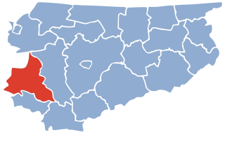
Żakowice is a village in the administrative district of Gmina Susz, within Iława County, Warmian-Masurian Voivodeship, in northern Poland. It lies approximately 9 kilometres (6 mi) south-west of Susz, 24 km (15 mi) west of Iława, and 85 km (53 mi) west of the regional capital Olsztyn.
Bajdy is a village in the administrative district of Gmina Zalewo, within Iława County, Warmian-Masurian Voivodeship, in northern Poland. It lies approximately 5 kilometres (3 mi) north-west of Zalewo, 31 km (19 mi) north of Iława, and 64 km (40 mi) west of the regional capital Olsztyn.
Brzeziniak is a settlement in the administrative district of Gmina Zalewo, within Iława County, Warmian-Masurian Voivodeship, in northern Poland. It lies approximately 3 kilometres (2 mi) north-west of Zalewo, 30 km (19 mi) north of Iława, and 61 km (38 mi) west of the regional capital Olsztyn.
Dajny is a village in the administrative district of Gmina Zalewo, within Iława County, Warmian-Masurian Voivodeship, in northern Poland.
Duba is a village in the administrative district of Gmina Zalewo, within Iława County, Warmian-Masurian Voivodeship, in northern Poland.
Karpowo is a village in the administrative district of Gmina Zalewo, within Iława County, Warmian-Masurian Voivodeship, in northern Poland. It lies approximately 11 kilometres (7 mi) south of Zalewo, 18 km (11 mi) north of Iława, and 58 km (36 mi) west of the regional capital Olsztyn.
Likszany is a settlement in the administrative district of Gmina Zalewo, within Iława County, Warmian-Masurian Voivodeship, in northern Poland. It lies approximately 8 kilometres (5 mi) south-west of Zalewo, 21 km (13 mi) north of Iława, and 63 km (39 mi) west of the regional capital Olsztyn.
Międzychód is a village in the administrative district of Gmina Zalewo, within Iława County, Warmian-Masurian Voivodeship, in northern Poland.
Murawki is a settlement in the administrative district of Gmina Zalewo, within Iława County, Warmian-Masurian Voivodeship, in northern Poland. It lies approximately 15 kilometres (9 mi) south-east of Zalewo, 18 km (11 mi) north-east of Iława, and 53 km (33 mi) west of the regional capital Olsztyn.
Polajny is a village in the administrative district of Gmina Zalewo, within Iława County, Warmian-Masurian Voivodeship, in northern Poland. It lies approximately 6 kilometres (4 mi) south of Zalewo, 23 km (14 mi) north of Iława, and 60 km (37 mi) west of the regional capital Olsztyn.
Pomielin is a village in the administrative district of Gmina Zalewo, within Iława County, Warmian-Masurian Voivodeship, in northern Poland. It lies approximately 9 kilometres (6 mi) south of Zalewo, 20 km (12 mi) north of Iława, and 59 km (37 mi) west of the regional capital Olsztyn.
Rudnia is a village in the administrative district of Gmina Zalewo, within Iława County, Warmian-Masurian Voivodeship, in northern Poland. It lies approximately 6 kilometres (4 mi) south of Zalewo, 23 km (14 mi) north of Iława, and 58 km (36 mi) west of the regional capital Olsztyn.
Urowo is a village in the administrative district of Gmina Zalewo, within Iława County, Warmian-Masurian Voivodeship, in northern Poland. It lies approximately 14 kilometres (9 mi) south-east of Zalewo, 18 km (11 mi) north-east of Iława, and 54 km (34 mi) west of the regional capital Olsztyn.
Witoszewo is a village in the administrative district of Gmina Zalewo, within Iława County, Warmian-Masurian Voivodeship, in northern Poland. It lies approximately 7 kilometres (4 mi) west of Zalewo, 27 km (17 mi) north of Iława, and 66 km (41 mi) west of the regional capital Olsztyn.