
Andul is a census town in Sankrail CD Block of Howrah Sadar subdivision in Howrah district in the Indian state of West Bengal.

Bagnan is a census town in Bagnan I CD Block of Uluberia subdivision in Howrah district in the state of West Bengal, India.
Dainhat is a town and a Municipality under Katwa police station of Katwa subdivision, in Purba Bardhaman district in the state of West Bengal, India.
Podrah is a census town in Sankrail CD Block of Howrah Sadar subdivision in Howrah district in the Indian state of West Bengal. It houses one of the largest Multispeciality hospital in the district of Howrah, NH Multispeciality Hospital.

Joka is a locality in South Kolkata, West Bengal, India. It is a part of greater Behala region. This place is mostly known for Indian Institute of Management Calcutta and ESIC Medical College and Hospital.

Amta I is a community development block that forms an administrative division in Uluberia subdivision of Howrah district in the Indian state of West Bengal.

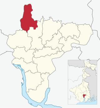
Jagatballavpur is a community development block that forms an administrative division in Howrah Sadar subdivision of Howrah district in the Indian state of West Bengal.
Udaynarayanpur is a community development block that forms an administrative division in Uluberia subdivision of Howrah district in the Indian state of West Bengal.

Shyampur I is a community development block that forms an administrative division in Uluberia subdivision of Howrah district in the Indian state of West Bengal.

Bagnan I is a community development block that forms an administrative division in Uluberia subdivision of Howrah district in the Indian state of West Bengal.

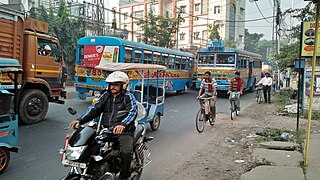
Jagatballavpur is a census town in Jagatballavpur CD Block in Howrah Sadar subdivision of Howrah district in the Indian state of West Bengal.

Bally Jagachha is a community development block that forms an administrative division in Howrah Sadar subdivision of Howrah district in the Indian state of West Bengal.
Domjur is a community development block that forms an administrative division in Howrah Sadar subdivision of Howrah district in the Indian state of West Bengal.

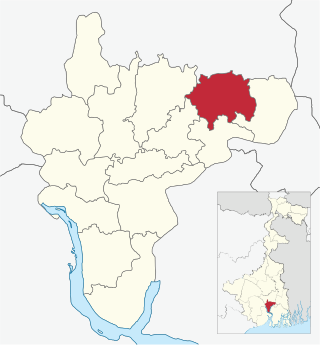
Panchla is a community development block that forms an administrative division in Howrah Sadar subdivision of Howrah district in the Indian state of West Bengal.

Sankrail is a community development block that forms an administrative division in Howrah Sadar subdivision of Howrah district in the Indian state of West Bengal.

Uluberia I is a community development block that forms an administrative division in Uluberia subdivision of Howrah district in the Indian state of West Bengal.

Uluberia II is a community development block that forms an administrative division in Uluberia subdivision of Howrah district in the Indian state of West Bengal.

Amta II is a community development block that forms an administrative division in Uluberia subdivision of Howrah district in the Indian state of West Bengal.

Bagnan II is a community development block that forms an administrative division in Uluberia subdivision of Howrah district in the Indian state of West Bengal.

Shyampur II is a community development block that forms an administrative division in Uluberia subdivision of Howrah district in the Indian state of West Bengal.
