Bassemkoukouri

Last updated
Bassemkoukouri
Burkina Faso location map.svg
Red pog.svg
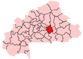
Bassemkoukouri
Location in Burkina Faso
Coordinates: 12°38′N0°38′W / 12.633°N 0.633°W / 12.633; -0.633 Coordinates: 12°38′N0°38′W / 12.633°N 0.633°W / 12.633; -0.633
CountryFlag of Burkina Faso.svg  Burkina Faso
Region Plateau-Central Region
Province Ganzourgou
Department Kogho Department
Population
 (2005 est.)
  Total807

Bassemkoukouri (or Bassomkoukouri) is a village in the Kogho Department of Ganzourgou Province in central Burkina Faso. The village has a population of 807. [1]

Kogho Department Department in Ganzourgou Province, Burkina Faso

Kogho is a department or commune of Ganzourgou Province in central-eastern Burkina Faso. Its capital lies at the town of Kogho. According to the 1996 census the department has a total population of 15,524.

Ganzourgou Province Province in Plateau-Central Region, Burkina Faso

Ganzourgou is a province of Burkina Faso and is in Plateau-Central Region. The capital of Ganzourgou is Zorgho, which is along the road between Ouagadougou and Niamey, Niger. Other important localities in the province are Mogtédo and Méguet. The population of Ganzourgou in 2006 was 319,830.

Burkina Faso Country in Africa

Burkina Faso is a landlocked country in West Africa. It covers an area of around 274,200 square kilometres (105,900 sq mi) and is surrounded by six countries: Mali to the north; Niger to the east; Benin to the southeast; Togo and Ghana to the south; and Ivory Coast to the southwest. The July 2019 population estimate by the United Nations was 20,321,378. Burkina Faso is a francophone country, with French as the official language of government and business. Roughly 40% of the population speaks the Mossi language. Formerly called the Republic of Upper Volta (1958–1984), the country was renamed "Burkina Faso" on 4 August 1984 by then-President Thomas Sankara. Its citizens are known as Burkinabé. Its capital is Ouagadougou.

Related Research Articles

Greenwich Village Neighborhood of Manhattan in New York City

Greenwich Village often referred to by locals as simply "the Village", is a neighborhood on the west side of Manhattan, New York City, within Lower Manhattan. Broadly, Greenwich Village is bounded by 14th Street to the north, Broadway to the east, Houston Street to the south, and the Hudson River to the west. Greenwich Village also contains several subsections, including the West Village west of Seventh Avenue and the Meatpacking District in the northwest corner of Greenwich Village.

<i>The Village Voice</i> American weekly newspaper

The Village Voice was an American news and culture paper, known for being the country's first alternative newsweekly. Founded in 1955 by Dan Wolf, Ed Fancher, John Wilcock, and Norman Mailer, the Voice began as a platform for the creative community of New York City. It is still kept alive online.

A census-designated place (CDP) is a concentration of population defined by the United States Census Bureau for statistical purposes only. CDPs have been used in each decennial census since 1980 as the counterparts of incorporated places, such as self-governing cities, towns, and villages, for the purposes of gathering and correlating statistical data. CDPs are populated areas that generally include one officially designated but currently unincorporated community, for which the CDP is named, plus surrounding inhabited countryside of varying dimensions and, occasionally, other, smaller unincorporated communities as well. CDPs include small rural communities, colonias located along the U.S. border with Mexico, and unincorporated resort and retirement communities and their environs.

East Village, Manhattan Neighborhood in Manhattan in New York City

The East Village is a neighborhood in the New York City borough of Manhattan. It is roughly defined as the neighborhood east of the Bowery and Third Avenue, between 14th Street on the north and Houston Street on the south.

The 1991 Nepal census was a widespread national census conducted by the Nepal Central Bureau of Statistics.

Belagali village in Karnataka, India

Belagali is a panchayat village in the southern state of Karnataka, India. It is located in the Mudhol taluka of Bagalkot district in Karnataka, about 4 km east of the town of Mahalingpur.

Mantur village in Karnataka, India

Mantur is a village in the southern state of Karnataka, India. It is located in the Mudhol taluk of Bagalkot district in Karnataka.

Arabhavi village in Karnataka, India

Arabhavi is a village in the southern state of Karnataka, India. It is located in the Mudalagi taluk of Belgaum district. It is the location of a college of horticulture that is attached to University of Horticulture Sciences, Bagalkot.

Bekkeri village in Karnataka, India

Bekkeri is a village in the southern state of Karnataka, India. It is located in the Raybag taluk of Belgaum district in Karnataka.

Belawadi village in Karnataka, India

Belawadi is a village in the southern state of Karnataka, India. It is located in the Bailhongal taluk of Belgaum district in Karnataka.

Balekundri (K.H.) village in Karnataka, India

Balekundri (K.H.) is a village in the southern state of Karnataka, India. It is located in the Belgaum taluk of Belgaum district in Karnataka.

Hulagabali village in Karnataka, India

Hulagabali is a village in the southern state of Karnataka, India. It is located in the Athani taluk of Belgaum district in Karnataka. The basic occupation in Hulagabali is agriculture and there are also many landlords in the village who are famous in agriculture. Sugar cane is the highest percentage of agriculture as per the survey. A birappa Temple located in this village is largely famous in surrounding villages, where the Birappa fair has celebrates twice a year which celebrated by huge crowd devotees from others village also. The famous landlords are Adagali (Sahukar), Karachuri (Sahukar), Patil (Gouda).

Itagi village in Karnataka, India

Itagi is a village in the southern state of Karnataka, India. It is located in the Khanapur taluk of Belgaum district in Karnataka.

Kadrolli village in Karnataka, India

Kadrolli is a village in the southern state of Karnataka, India. It is located in the Bailhongal taluk of Belgaum district in Karnataka.

Katakol Hobali in Karnataka, India

Katkol is a village in the southern state of Karnataka, India. It is located in the Ramdurg taluk of Belgaum district in Karnataka.

Koganoli village in Karnataka, India

Koganoli is a village in the southern state of Karnataka, India. It is located in the Chikodi taluk of Belgaum district in Karnataka.

Koujalgi village in Karnataka, India

Koujalgi is a village in the southern state of Karnataka, India. It is located in the Gokak taluk of Belgaum district in Karnataka.

Kurli, Karnataka village in Karnataka, India

Kurli is a village in the southern state of Karnataka, India. It is located in the Chikodi taluk of Belgaum district in Karnataka.

Mamadapur, Belgaum village in Karnataka, India

Mamadapur is a village in the southern state of Karnataka, India. It is located in the Gokak taluk of Belgaum district in Karnataka. It is the birthplace of Wrangler D.C. Pavate

Karajagi Village in Karnataka, India

Karajagi is a village in jath, in the state of Maharashtra]], India. It is located in the [jath]] taluk of sangli district.

References

  1. "Burkinabé government inforoute communale". Archived from the original on 2008-12-04. Retrieved 2008-06-11.