
Verrières-le-Buisson is a commune in the southern suburbs of Paris, France. It is 13.3 km (8.3 mi) from the centre of Paris, in the Essonne department just outside the inner ring of the Île-de-France.

Châtenay-Malabry is a commune in the southwestern suburbs of Paris, France. It is located 10.8 km (6.7 mi) from the center of Paris.
Ancín is a town and municipality located in the province and autonomous community of Navarra, northern Spain.
The Communauté d'agglomération des Hauts de Bièvre is a former Communauté d'agglomération, in France. It covered seven communes, five in the Hauts-de-Seine and two in the Essonne département. It was merged into the Métropole du Grand Paris in January 2016.
Verrières is the name or part of the name of several communes in France:

The arrondissement of Palaiseau is an arrondissement of France in the Essonne department in the Île-de-France region. Since the January 2017 reorganization of the arrondissements of Essonne, it has 68 communes.
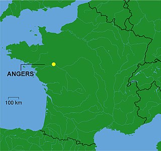
The Communauté urbaine Angers Loire Métropole is the communauté urbaine, an intercommunal structure, centred on the city of Angers. It is located in the Maine-et-Loire department, in the Pays de la Loire region, western France. It was created in January 2016, replacing the previous Communauté d'agglomération d'Angers Loire Métropole. It was expanded with the commune of Loire-Authion in January 2018. Its population was 301,245 in 2015, of which 155,984 in Angers proper.

Massy-Verrières is a station of the Île-de-France RER, located in Massy, at the junction of RER B and RER C. Its station is nearby Verrières-le-Buisson.

Le Buisson-de-Cadouin is a commune in the Dordogne department in southwestern France. It is situated on the left bank of the river Dordogne. The Gare du Buisson is a railway junction, with connections to Bordeaux, Sarlat-la-Canéda, Agen and Périgueux.
Hurepoix is an area of Île-de-France, in south west of Paris, localised between departments of Yvelines, Hauts-de-Seine and Essonne, it was an old province of the French Kingdom. The main city was Dourdan.
The Arboretum municipal de Verrières-le-Buisson, more formally the Arboretum municipal de Verrières-le-Buisson, Réserve naturelle volontaire Roger de Vilmorin, Maison des Arbres et des Oiseaux, is a municipal arboretum located at 1, voie de l'Aulne, Verrières-le-Buisson, Essonne, Île-de-France, France. It is open weekends without charge.
The Arboretum Vilmorin is a private arboretum located at 2 rue d'Estienne d'Orves, Verrières-le-Buisson, Essonne, Île-de-France, France. It is open by appointment only. A newer portion of the family arboretum was acquired by the municipality in 1975, and is now open to the public as the Arboretum municipal de Verrières-le-Buisson.
The Communauté d'agglomération Paris-Saclay(or CAPS) is an administrative entity in the Essonne département, near Paris. Administrative center: Orsay. It was formed on 1 January 2016 by the merger of the former Communauté d'agglomération du Plateau de Saclay and the Communauté d'agglomération Europ'Essonne.
Louis-Balthazar de La Chevardière was a French music publisher in the second half of the 18th century.
The canton of Angers-6 is an administrative division of the Maine-et-Loire department, in western France. It was created at the French canton reorganisation which came into effect in March 2015. Its seat is in Angers.
The canton of Gif-sur-Yvette is an administrative division of the Essonne department, Île-de-France region, northern France. Its borders were modified at the French canton reorganisation which came into effect in March 2015. Its seat is in Gif-sur-Yvette.
The canton of Caen-2 is an administrative division of the Calvados department, northwestern France. Its borders were modified at the French canton reorganisation which came into effect in March 2015. Its seat is in Caen.
The canton of Charente-Champagne is an administrative division of the Charente department, southwestern France. It was created at the French canton reorganisation which came into effect in March 2015. Its seat is in Châteauneuf-sur-Charente.
Buisson is a French surname and place name. It may refer to:


