Tanwaka

Last updated
Tanwaka
Burkina Faso location map.svg
Red pog.svg
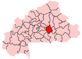
Tanwaka
Location in Burkina Faso
Coordinates: 12°9′N0°45′W / 12.150°N 0.750°W / 12.150; -0.750
CountryFlag of Burkina Faso.svg Burkina Faso
Region Plateau-Central Region
Province Ganzourgou
Department Boudry Department
Population
 (2005 est.)
  Total
1,116

Tanwaka is a town in the Boudry Department of Ganzourgou Province in central Burkina Faso. In 2005, the town was recorded to have a population of 1,116. [1]

Contents

Geography

The terrain around Tanwaka is flat. The highest point in the area is 361 metres (1,150 ft) above sea level and is 2.3 km (1.4 mi) west of Tanwaka. The nearest larger town is Mogtédo, 17.7 km (11 mi) northwest of Tanwaka.

Climate

The average temperature is 28 °C. The warmest month is April, at 33  °C, and the coolest is August, at 24 °C. The average annual rainfall is 1,055 millimeters (42 in). The wettest month is August, at 297 millimeters (11 in), and the driest is December, at 1 millimeter (0.4 in)

References

  1. Burkinabé government inforoute communale Archived 2008-12-04 at the Wayback Machine