Sapaga | |
|---|---|
 Interactive map of Sapaga | |
| Country | |
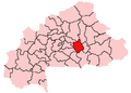
| Region | Plateau-Central Region |
| Province | Ganzourgou |
| Department | Zorgho Department |
| Population (2005 est.) | |
• Total | 3,316 |
Sapaga is a village in the Zorgho Department of Ganzourgou Province in central Burkina Faso. The village has a population of 3,316. [1]