Moreton-in-Marsh is a market town in the Evenlode Valley, within the Cotswolds district and Area of Outstanding Natural Beauty in Gloucestershire, England.
Blockley is a village, civil parish and ecclesiastical parish in the Cotswold district of Gloucestershire, England, about 3 miles (5 km) northwest of Moreton-in-Marsh. Until 1931 Blockley was an exclave of Worcestershire.

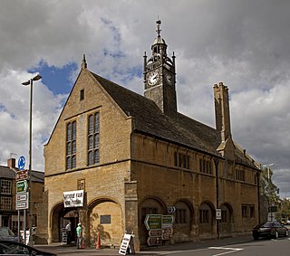
Northleach is a market town and former civil parish, now in parish Northleach with Eastington, in the Cotswold district, in Gloucestershire, England. The town is in the valley of the River Leach in the Cotswolds, about 10 miles (16 km) northeast of Cirencester and 11 miles (18 km) east-southeast of Cheltenham. The 2011 Census recorded the parish's population as 1,854, the same as Northleach built-up-area. The 2021 Census recorded the population as 1,931.

Bagendon is a village and civil parish in the Cotswold district of Gloucestershire, England, about four miles (6 km) north of Cirencester. According to the 2001 census it had a population of 265, decreasing to 239 at the 2011 census. The hamlet of Perrott's Brook is adjacent to Bagendon's southeast.
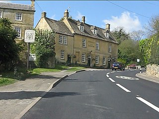
Bourton-on-the-Hill is a village and civil parish in the Cotswold district of Gloucestershire, England, about 2 miles (3 km) west of Moreton-in-Marsh. In 2010 it had an estimated population of 288. The village overlooks the surrounding hills of the Cotswolds and lies on the Heart of England Way, which heads southwards to Bourton-on-the-Water and northwards to Cannock Chase. The village is also connected by a footpath to the Cotswold Way, via Blockley and Chipping Campden.

Mickleton is a village and civil parish in the Cotswold District of Gloucestershire, England. It is the northernmost settlement in Gloucestershire, lying close to the borders with Worcestershire and Warwickshire, 3 miles (4.8 km) north of Chipping Campden, 8 miles (13 km) east of Evesham and 8 miles (13 km) south of Stratford-upon-Avon. The population of the parish was 1,677 at the 2011 Census.

Sir Edward Guy Dawber, RA was an English architect working in the late Arts and Crafts style, whose work is particularly associated with the Cotswolds.

Moreton Say is a small village and sparsely populated civil parish in Shropshire, England, near the borders with Cheshire and Staffordshire, just northwest of the town of Market Drayton. It is sometimes spelled Moreton Saye or Moreton Sea. The civil parish, which also covers the hamlets of Longford and Longslow, had a total population of 429 at the 2001 census, increasing to 485 at the 2011 Census. The parish is 5,999 acres.

Upper Slaughter is a village in the Cotswold district of Gloucestershire, England, 4 miles (6.4 km) south west of Stow-on-the-Wold. The village lies off the A429, which is known as the Fosse Way, and is located one mile away from its twin village Lower Slaughter, as well as being near the villages Bourton-on-the-Water, Daylesford, Upper Swell and Lower Swell. It is built on both banks of the River Eye. The Anglican parish church is dedicated to Saint Peter.

Miserden is a village and civil parish in Stroud District, Gloucestershire, England, 4 miles north east of Stroud. The parish includes Whiteway Colony and the hamlets of Sudgrove and The Camp. In the 2001 census the parish had a population of 420, increasing to 449 at the 2011 census.
Cold Aston is a village and civil parish in Gloucestershire, England, approximately 18 miles (29 km) to the east of Gloucester. It lies in the Cotswolds, an Area of Outstanding Natural Beauty. In the 2011 census, the population was 255.

Great Wolford is a village and civil parish in the Stratford-on-Avon district of Warwickshire, England. With the neighbouring parish of Little Wolford it is part of 'The Wolfords'.

Elkstone is a village and civil parish in the English county of Gloucestershire. In the 2001 United Kingdom census, the parish had a population of 203, increasing to 248 at the 2011 census.
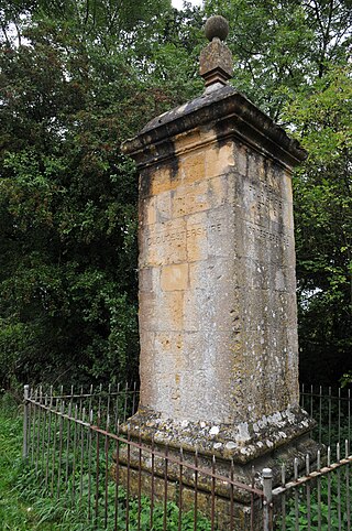
The Four Shire Stone is a boundary marker that marks the point where the English counties of Warwickshire, Oxfordshire, Gloucestershire, and Worcestershire once met. Since 1931, when the Worcestershire exclave of Evenlode was transferred to Gloucestershire, only three counties have met at the stone.

Evenlode is a village and civil parish in the Cotswold District of eastern Gloucestershire in England.

Todenham is a village and civil parish in the Cotswold district of Gloucestershire, England. The village is significant for its Grade I listed 14th-century parish church.

The Anglican Church of St Leonard at Lower Lemington in the parish of Batsford in the Cotswold District of Gloucestershire, England was built in the 12th century. It is a grade I listed building.

Dorn is a hamlet in the Cotswold district of Gloucestershire, England. It is about 1 mile north of Moreton-in-Marsh.
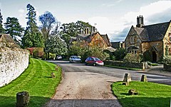
Lower Lemington is a small village and former civil parish, now in the parish of Batsford, in the Cotswold district of Gloucestershire, England. The village is about 2 miles (3 km) north-east of Moreton-in-Marsh.