
Lower Dir District is a district in the Khyber Pakhtunkhwa province of Pakistan. Timergara city is the district's headquarter. This district was formed in 1996, when Dir District was divided into Upper Dir and Lower Dir districts. Recently, On 22 January 2023, both Lower Dir and Upper Dir districts further bifurcated to create a new Central Dir District.

Bajaur District is a district in the Malakand Division of Khyber Pakhtunkhwa province of Pakistan. Until 2018, it was an agency of the Federally Administered Tribal Areas. in 2018, it was merged with Khyber Pakhtunkhwa, after the announcement of annexing FATA with KPK. According to the 2017 census report, the population of the district was 1,093,684. It shares a 52 km border with Afghanistan's Kunar Province. The town of Khar is its district headquarter.

Mohmand District is a district in Peshawar Division of Khyber Pakhtunkhwa province in Pakistan. Until 2018, it was an agency of Federally Administered Tribal Areas, with merger of FATA with Khyber Pakhtunkhwa, it became a district. It was created as an agency in 1951. Mohmand is bordered by Bajaur District to the north, Khyber District to the south, Malakand and Charsadda districts to the east and Peshawar district to the southeast.
Inayat Killi is a town in Khar Bajaur Tehsil, Bajaur Agency, Federally Administered Tribal Areas, Pakistan. The population is 10,717 according to the 2017 census.

Bar Chamer Kand Tehsil is a subdivision located in Bajaur District, Khyber Pakhtunkhwa, Pakistan.
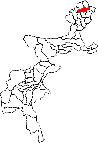
Barang Tehsil is a subdivision located in Bajaur District, Khyber Pakhtunkhwa, Pakistan.

Mamund Tehsil is a subdivision located in Bajaur District, Khyber Pakhtunkhwa, Pakistan. Mamund is the largest tehsil of district Bajaur.
Utman Khel Subdivision is a subdivision located in Bajaur District, Khyber Pakhtunkhwa, Pakistan. The population is 107,356 according to the 2017 census.
Khar Bajaur Tehsil is a subdivision located in Bajaur District, Khyber Pakhtunkhwa, Pakistan. It starts in Jar to Zorbandar (east–west) and Tangai to Inzari (northwest–southwest) and A Inayat kali to Mandalu (northeast–southeast).
Kitkot or Katkot is a village located in Mamund Tehsil, Bajaur District, Khyber Pakhtunkhwa, Pakistan. The population is 7,398 according to the 2017 census.
Bar Kamar is an area of Mamund Tehsil, Bajaur Agency, Federally Administered Tribal Areas, Pakistan. The population is 1,787 according to the 2017 census.
Pashat is the main town in Salarzai Tehsil, Bajaur District, in the Khyber Pakhtunkhwa province of Pakistan. The population is 5,111 according to the 2017 census.
Chachagai is a village in Salarzai Tehsil, Bajaur Agency, Federally Administered Tribal Areas, Pakistan. The population is 956 according to the 2017 census.
Begal is an area within the Salarzai Tehsil of the Bajaur District in Khyber Pakhtunkhwa, Pakistan. The population was 1,314 in the 2017 national census.
Lora Miana, or Lwara Myana is an area of Mula Gori Tehsil, Khyber Agency, Federally Administered Tribal Areas, Pakistan. The population is 7,466 according to the 2017 census.
Maimoola or Memola is an area serving as the headquarters of Barang Tehsil, Bajaur Agency, Federally Administered Tribal Areas, Pakistan. As of 2017, the population is 530.
Sadiq Abad is a town in Khar Bajaur Tehsil, Bajur, Khyber Pakhtunkhwa, Pakistan. The population is 10,060 according to the 2017 census.
Lagharai is a town in Mamund Tehsil, Bajaur Agency, Federally Administered Tribal Areas, Pakistan. The population is 592 according to the 2017 census.
Utmankhel Tehsil is a subdivision located in Bajaur District, Khyber Pakhtunkhwa, Pakistan. The population is 107,356 according to the 2017 census.
