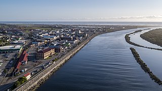
Demographics
Bayview covers 3.04 km2 (1.17 sq mi) [1] and had an estimated population of 9,650 as of June 2024, [2] with a population density of 3,174 people per km2.
Historical population| Year | | |
|---|
| 2006 | 7,869 | — |
|---|
| 2013 | 8,409 | +0.95% |
|---|
| 2018 | 9,057 | +1.50% |
|---|
| 2023 | 9,030 | −0.06% |
|---|
| Source: [3] [4] |
Bayview had a population of 9,030 in the 2023 New Zealand census, a decrease of 27 people (−0.3%) since the 2018 census, and an increase of 621 people (7.4%) since the 2013 census. There were 4,515 males, 4,479 females and 39 people of other genders in 2,910 dwellings. [5] 4.4% of people identified as LGBTIQ+. The median age was 34.7 years (compared with 38.1 years nationally). There were 1,764 people (19.5%) aged under 15 years, 1,848 (20.5%) aged 15 to 29, 4,590 (50.8%) aged 30 to 64, and 828 (9.2%) aged 65 or older. [4]
People could identify as more than one ethnicity. The results were 49.5% European (Pākehā); 9.3% Māori; 7.2% Pasifika; 40.6% Asian; 3.8% Middle Eastern, Latin American and African New Zealanders (MELAA); and 2.9% other, which includes people giving their ethnicity as "New Zealander". English was spoken by 92.6%, Māori language by 1.6%, Samoan by 1.2%, and other languages by 34.8%. No language could be spoken by 2.7% (e.g. too young to talk). New Zealand Sign Language was known by 0.3%. The percentage of people born overseas was 49.8, compared with 28.8% nationally.
Religious affiliations were 34.2% Christian, 4.2% Hindu, 2.3% Islam, 0.3% Māori religious beliefs, 2.2% Buddhist, 0.4% New Age, 0.2% Jewish, and 1.8% other religions. People who answered that they had no religion were 48.2%, and 6.5% of people did not answer the census question.
Individual statistical areas| Name | Area
(km2) | Population | Density
(per km2) | Dwellings | Median age | Median
income |
|---|
| Bayview East | 1.37 | 3,732 | 2,724 | 1,170 | 34.1 years | $50,600 [6] |
| Bayview West | 0.73 | 2,364 | 3,238 | 765 | 34.9 years | $50,800 [7] |
| Bayview South | 0.93 | 2,931 | 3,152 | 975 | 35.3 years | $52,100 [8] |
| New Zealand | | | | | 38.1 years | $41,500 |
|---|
Of those at least 15 years old, 2,034 (28.0%) people had a bachelor's or higher degree, 3,033 (41.7%) had a post-high school certificate or diploma, and 1,692 (23.3%) people exclusively held high school qualifications. The median income was $51,100, compared with $41,500 nationally. 924 people (12.7%) earned over $100,000 compared to 12.1% nationally. The employment status of those at least 15 was that 4,404 (60.6%) people were employed full-time, 945 (13.0%) were part-time, and 168 (2.3%) were unemployed. [4]

The South Wairarapa District is a district at the south-east tip of the North Island of New Zealand, governed by the South Wairarapa District Council. The district comprises the southernmost part of the Wairarapa, and is part of the Wellington Region.

Horowhenua District is a territorial authority district on the west coast of the North Island of New Zealand, administered by Horowhenua District Council. Located north of Wellington and Kāpiti, it stretches from slightly north of the town of Ōtaki in the south to just south of Himatangi in the north, and from the coast to the top of the Tararua Range. It is in the Manawatū-Whanganui local government region. The name Horowhenua is Māori for landslide.

The Thames-Coromandel District is a territorial authority district in the North Island of New Zealand, covering all the Coromandel Peninsula and extending south to Hikutaia.

Hauraki District is a territorial authority governed by the Hauraki District Council within the Waikato region of New Zealand. The seat of the council is at Paeroa.

Central Otago District is local government district in New Zealand. It is administered by the Central Otago District Council, and it is in the Otago region, the top tier of local government in New Zealand. The major towns in the district are Alexandra, Cromwell, Roxburgh, Clyde and Ranfurly. The district covers 9,968 km2 (3,849 sq mi), making it the fourth-largest district in New Zealand by area, and is home to 26,500 people as of June 2024.

Westland District is a territorial authority district on the West Coast of New Zealand's South Island. It is administered by the Westland District Council. The district's population is 9,430.
Grey District is a district in the West Coast Region of New Zealand that covers Greymouth, Runanga, Blackball, Cobden, and settlements along the Grey River. It has a land area of 3,474.31 square kilometres (1,341.44 sq mi). The seat of the Grey District Council, the local government authority that administers the district, is at Greymouth, where 58.4% of the district's population live.

Clutha District is a local government district of southern New Zealand, with its headquarters in the Otago town of Balclutha. Clutha District has a land area of 6,334.47 km2 (2,445.75 sq mi) and an estimated population of 19,300 as of June 2024. Clutha District occupies the majority of the geographical area known as South Otago.
South Taranaki is a territorial authority on the west coast of New Zealand's North Island that contains the towns of Hāwera, Manaia, Ōpunake, Patea, Eltham, and Waverley. The District has a land area of 3,575.46 km2 and a population of 30,400. It is part of the greater Taranaki Region.
West Harbour is a suburb of Auckland, located to the west of the Auckland isthmus and CBD. It is named for its location on the western side of the Waitematā Harbour. West Harbour is under the governance of Auckland Council after the amalgamation of district councils in 2010.

Massey is a northern suburb in West Auckland, New Zealand. It was formerly a northern suburb of Waitakere City, which existed from 1989 to 2010 before the city was amalgamated into Auckland Council. The suburb was named after former Prime Minister of New Zealand William Massey. Massey is a relatively large suburb and can be divided into three reasonably distinctive areas, Massey West, Massey East and Massey North. Parts of Massey East are also known as 'Royal Heights', which is home to the Royal Heights shopping centre.
Gulf Harbour is a suburb development some 4 km from the end of the Whangaparāoa Peninsula, and 7 km from Whangaparaoa Town Centre, towards the northern end of Auckland, New Zealand. It has one of the country's largest marinas, and had, until 2023, one of the country's top golf courses, and used to be regarded as a retreat for Auckland's well-off. The site is sometimes also known as Hobbs Bay and was sold in the early seventies by landowners, the Hobbs family, who still retain some of the coastal area including the Hobbs Bay beach.

Taupō District is a territorial authority district in New Zealand. It covers 6,333 km² of land, and a further 610 km² of lake area, including Lake Taupō, New Zealand's largest lake, and Lake Rotoaira. The district stretches from the small town of Mangakino in the northwest to the Tongariro National Park in the south, and east into the Kaingaroa Forest. The district's population is largely located in the two main centres, Taupō and Tūrangi.

Pinehill is a small suburb in the East Coast Bays area of Auckland, New Zealand. The suburb has only recently grown because of the housing estates being built in the area for the rapidly growing Albany area. Pinehill is regularly serviced by buses which go to Takapuna and the Auckland city centre. The Auckland Northern Motorway passes to the west of the suburb.

Whangarei District is a territorial authority district in the Northland Region of New Zealand that is governed by the Whangarei District Council. The district is made up in area largely by rural land, and includes a fifth of the Northland Region. It extends southwards to the southern end of Bream Bay, northwards to Whangaruru and almost to the Bay of Islands, and westwards up the Mangakahia River valley past Pakotai and almost to Waipoua Forest. It includes the Hen and Chicken Islands and the Poor Knights Islands.
Stanmore Bay is a suburb and beach located on the Whangaparaoa Peninsula, in the Auckland Region of New Zealand. The beach is on the northern side of the peninsula.
Unsworth Heights is a suburb of North Shore in the Auckland metropolitan area in northern New Zealand. New Zealand State Highway 18 passes to the north of the suburb, and the Albany Highway to the south. The two routes intersect just to the west of Unsworth Heights. Unsworth Reserve is to the east.

Ashburton District is a territorial authority district in the Canterbury Region of the South Island of New Zealand. It encompasses the town of Ashburton, a number of small towns and settlements and the surrounding rural area, roughly coterminous with Mid Canterbury. The district had a population of 38,400 as of June 2024.

Waimate District is a territorial authority district located in the Canterbury Region of the South Island of New Zealand. The main town is Waimate, while there are many smaller rural communities dispersed throughout the area. Its boundary to the south is the Waitaki River, to the west Lake Benmore and to the north-east the Pareora River.
Rānui is a suburb of West Auckland, New Zealand, which is under the local governance of Auckland Council. The area is densely populated but close to the western fringe of the Auckland urban area.

