Birkdale, New Zealand

Last updated

Birkdale
Salisbury Road, Birkdale, 2016.jpg
Looking north from Salisbury Road, Birkdale
Birkdale, New Zealand
Coordinates: 36°48′02″S174°42′15″E / 36.8006°S 174.7042°E / -36.8006; 174.7042
CountryNew Zealand
City Auckland
Local authority Auckland Council
Electoral ward North Shore Ward
Local board Kaipātiki Local Board
Area
[1]
  Land290 ha (720 acres)
Population
 (June 2023) [2]
  Total9,460
Postcode(s)
4159
Beach Haven Beach Haven Glenfield
(Waitematā Harbour)
Pfeil oben.svg
Pfeil links.svgBirkdalePfeil rechts.svg
Pfeil unten.svg
Birkenhead
(Waitematā Harbour) Chatswood Birkenhead

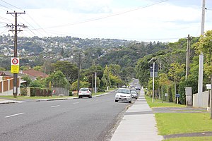
Birkdale is a suburb of the contiguous Auckland metropolitan area located in New Zealand. Originally called Parkview, comprising the area from Balmain Rd to the Birkdale (now Beach Haven) wharf, it was renamed Birkdale at a meeting of the Birkenhead Borough Council in 1889 [3] It now comprises statistical area units such as 'Birkdale North' and 'Birkdale South'. The suburb is located in the North Shore, and is under the governance of Auckland Council.

Contents

Demographics

Birkdale covers 2.90 km2 (1.12 sq mi) [1] and had an estimated population of 9,460 as of June 2023, [2] with a population density of 3,262 people per km2.

Historical population
YearPop.±% p.a.
20067,896    
20138,337+0.78%
20188,898+1.31%
Source: [4]

Before the 2023 census, Birkdale had a smaller boundary, covering 2.80 km2 (1.08 sq mi). [1] Using that boundary, Birkdale had a population of 8,898 at the 2018 New Zealand census, an increase of 561 people (6.7%) since the 2013 census, and an increase of 1,002 people (12.7%) since the 2006 census. There were 2,856 households, comprising 4,392 males and 4,506 females, giving a sex ratio of 0.97 males per female, with 1,932 people (21.7%) aged under 15 years, 1,956 (22.0%) aged 15 to 29, 4,242 (47.7%) aged 30 to 64, and 771 (8.7%) aged 65 or older.

Ethnicities were 65.2% European/Pākehā, 13.1% Māori, 9.7% Pacific peoples, 22.2% Asian, and 5.0% other ethnicities. People may identify with more than one ethnicity.

The percentage of people born overseas was 39.3, compared with 27.1% nationally.

Although some people chose not to answer the census's question about religious affiliation, 49.4% had no religion, 36.9% were Christian, 0.5% had Māori religious beliefs, 2.5% were Hindu, 2.0% were Muslim, 1.3% were Buddhist and 2.3% had other religions.

Of those at least 15 years old, 2,202 (31.6%) people had a bachelor's or higher degree, and 828 (11.9%) people had no formal qualifications. 1,455 people (20.9%) earned over $70,000 compared to 17.2% nationally. The employment status of those at least 15 was that 4,143 (59.5%) people were employed full-time, 906 (13.0%) were part-time, and 237 (3.4%) were unemployed. [4]

Individual statistical areas in 2018
NameArea (km2)PopulationDensity (per km2)HouseholdsMedian ageMedian income
Birkdale North1.394,1733,0021,29933.0 years$37,600 [5]
Birkdale South1.414,7253,3511,55733.2 years$42,000 [6]
New Zealand37.4 years$31,800

Education

Birkenhead College is a secondary (Years 9–13) school with a roll of 465 students. [7] The school began as Birkdale College, opening in 1972. [8] The name of the college was changed in 1988. The college has a proud history of producing educators, engineers, scientists and creative artists. [9] Notable alumni include All Whites Duncan Cole and Bill Tuiloma, round-the-world sailor Don Wright, singer Kim Willoughby, gymnast Tania Jack, children's author Sally Sutton and comedian Melanie Bracewell. [10] [11] In 2020, Birkenhead College was named a top-10 school for Art by Metro magazine. Due to Covid disruptions, the Golden Jubilee celebrations were delayed, and took place in 2023.

Birkdale Intermediate is an intermediate (years 7–8) school with a roll of 429 as of July 2022. [12] Contributing local primary schools are Beach Haven, Birkdale, Birkdale North, Kauri Park and Verran.

Birkdale North School and Birkdale Primary School are primary (years 1–6) schools with rolls of 135 [13] and 191, [14] respectively.

Birkdale Primary was established in 1894. [15] In 1892, Birkdale parents asked for a school for their 49 children. The Northcote and Mayfield School Committee denied their request. As a result, 20 school age children in the Birkdale area were not receiving an education. In 1894, the Loan and Mortgage Company offered the school site to the Education Board. Local residents prepared the site and a single classroom was built, at the cost of 109 pounds, opening on October 1. The roll was 32 pupils and 1 teacher, a Miss Rosanna Brown. With a growing roll, another room was added to the classroom building in 1895. In 1897, a large house was transported from Matakana to the school site as accommodation for the first principal, Mr Julian Brook. The school badge/logo has had a strawberry leaf in it since it first opened, reflecting the role students played as strawberry pickers for local growers. [16] Today, Birkdale Primary has both English and Maori immersion units. [17] The Maori immersion unit,Te Puāwaitanga, was established in 1986. It was the first such unit on the North Shore.The oldest building on the site is Durham Hall, which was originally a classroom built in 1940. It was named in honour of life-long Salisbury Rd resident Glady Durham, a past-pupil of the school, long serving board member, and occasional driver of buses taking Birkdale Primary students to camps or day events. The hall was given historical protection by the North Shore City Council.

Kauri Park School was originally called Birkdale West School. [18] Verran Primary was first mooted as Birkdale East School.

All of these schools are coeducational. All rolls except for Birkdale Intermediate are as of February 2024. [19]

Notes

  1. 1 2 3 "ArcGIS Web Application". statsnz.maps.arcgis.com. Retrieved 25 March 2024.
  2. 1 2 "Population estimate tables - NZ.Stat". Statistics New Zealand . Retrieved 25 October 2023.
  3. McClure, Margaret (1987). The Story of Birkenhead, Birkenhead City Council
  4. 1 2 "Statistical area 1 dataset for 2018 Census". Statistics New Zealand. March 2020. Birkdale North (122800) and Birkdale South (124400).
  5. 2018 Census place summary: Birkdale North
  6. 2018 Census place summary: Birkdale South
  7. Education Counts: Birkenhead College
  8. "History". Birkenhead College. Archived from the original on 14 October 2008.
  9. Birkdale/Birkenhead College yearbooks
  10. "Coming-of-age comedy show from North Shore's Melanie Bracewell". Stuff. 28 April 2017.
  11. "Melanie's a crack-up". www.northsidelive.co.nz.
  12. Education Counts: Birkdale Intermediate
  13. Education Counts: Birkdale North School
  14. Education Counts: Birkdale Primary School
  15. "About Us". Birkdale Primary School. Retrieved 11 January 2009.
  16. Birkdale Primary School, Centennial Magazine 1894-1994
  17. http://www.birkdaleprimary.school.nz
  18. Kauri Park School, Silver Jubilee 1969-1994 booklet
  19. "New Zealand Schools Directory". New Zealand Ministry of Education. Retrieved 14 March 2024.

Related Research Articles

<span class="mw-page-title-main">Takanini</span> Suburb in Auckland, New Zealand

Takanini is a southern suburb of Auckland, New Zealand. It is located on the shores of the Pahurehure Inlet, 28 kilometres southeast of the Auckland CBD.

<span class="mw-page-title-main">Henderson, New Zealand</span> Suburb in Auckland, New Zealand

Henderson is a major suburb of West Auckland, in the North Island of New Zealand. It is 13 kilometres (8.1 mi) west of Auckland city centre, and two kilometres (1.2 mi) west of the Whau River, a southwestern arm of the Waitematā Harbour. The suburb is located within the Henderson-Massey Local Board of the Waitākere Ward, one of the thirteen administrative divisions of Auckland Council.

<span class="mw-page-title-main">Northcote, Auckland</span> Suburb in Auckland, New Zealand

Northcote is a suburb of Auckland in northern New Zealand. It is situated on the North Shore, on the northern shores of Waitematā Harbour, 4 kilometres (2.5 mi) northwest of the Auckland City Centre. The suburb includes the peninsula of Northcote Point where the northern approaches to the Auckland Harbour Bridge are located, and Northcote Central, the commercial centre of Northcote. Northcote features two volcanic maars.

<span class="mw-page-title-main">Birkenhead, New Zealand</span> Suburb in Auckland, New Zealand

Birkenhead is a suburb of Auckland, in northern New Zealand. It is located on the North Shore of the Waitematā Harbour, 4 kilometres (2.5 mi) northwest of the Auckland City Centre. The area has been settled by Tāmaki Māori since at least the 14th century, and is the location of Te Matarae ō Mana, a fortified pā for Te Kawerau ā Maki that overlooked an important seasonal shark fishery. European settlement in Birkenhead began in late the 1840s, and by the late 19th century the area became renowned for strawberry crops. In 1884, the Chelsea Sugar Refinery was constructed in Birkenhead, becoming a major source of income for Birkenhead. The increased population growth led to Birkenhead becoming one of the first boroughs of Auckland in 1888. Birkenhead transitioned from a semi-rural community to suburban Auckland after the opening of the Auckland Harbour Bridge in 1959, becoming a city in 1978. In 1989, Birkenhead City was amalgamated with North Shore City.

<span class="mw-page-title-main">Takapuna</span> Suburb in Auckland, New Zealand

Takapuna is a suburb located on the North Shore of Auckland, New Zealand. The suburb is an isthmus between Shoal Bay, arm of the Waitematā Harbour, and the Hauraki Gulf. Lake Pupuke, a volcanic maar and one of the oldest features of the Auckland volcanic field, is a freshwater lake located in the suburb.

<span class="mw-page-title-main">Glenfield, New Zealand</span> Suburb in Auckland, New Zealand

Glenfield is a suburb of Auckland, New Zealand, located on the North Shore. Established as a rural community in the 1850s, the area developed as a suburban part of Auckland after the completion of the Auckland Harbour Bridge in 1959.

<span class="mw-page-title-main">Albany, New Zealand</span> Suburb in Auckland, New Zealand

Albany is one of the northernmost suburbs of the contiguous Auckland metropolitan area in New Zealand. It is located on the North Shore, 15 kilometres (9 mi) northwest of the Auckland city centre. Albany is found at the headlands of Lucas Creek, and was the location of a portage used by Tāmaki Māori, where waka could be taken between the Upper Waitematā Harbour and the Okura River/Hauraki Gulf. During the 1840s, early European settlers established the village of Lucas Creek, which became by the 1880s had become a major fruit growing centre in Auckland. The town voted to change the name from Lucas Creek to Albany in 1890.

<span class="mw-page-title-main">Milford, New Zealand</span> Suburb in Auckland, New Zealand

Milford is a suburb located on the North Shore, Auckland. It is located on northern side of Lake Pupuke. It also has a popular swimming beach, which runs some two kilometres from Black Rock in the south to Castor Bay in the north. The Wairau Creek reaches the sea at the Hauraki Gulf at the northern end of Milford Beach, and its lower tidal reaches host the Milford Marina.

<span class="mw-page-title-main">Kelston, New Zealand</span> Suburb in Auckland, New Zealand

Kelston is a residential suburb of West Auckland, New Zealand. Originally a ceramics manufacturing centre, the area is now mostly residential, including a number of schools. Kelston is located in, and its name has been given to, the Kelston parliamentary electorate.

<span class="mw-page-title-main">Mairangi Bay</span> Suburb in Auckland, New Zealand

Mairangi Bay is a coastal suburb of North Shore, Auckland, located in the northern North Island of New Zealand, on the south-east-facing peninsula forming the northern side of the Waitematā Harbour. Mairangi Bay came under the local governance of the North Shore City Council until subsumed into the Auckland Council in 2010.

<span class="mw-page-title-main">Beach Haven, New Zealand</span> Suburb in Auckland, New Zealand

Beach Haven is a northwestern suburb of the North Shore, located in Auckland, New Zealand. It was originally a small area of holiday baches in the larger suburb of Birkdale. The area has gentrified rapidly over recent years as young professionals moved into the area.

<span class="mw-page-title-main">Chatswood, New Zealand</span> Suburb in Auckland, New Zealand

Chatswood is a suburb in the city of Auckland, New Zealand, in the middle-eastern side of North Shore. It contains a primary school and many parks. To the south of Chatswood is Kendall's Bay, a small bay of the Waitematā Harbour. The suburb is under the governance of Auckland Council. The Royal New Zealand Navy's Kauri Point Armament Depot is located in Chatswood. Chelsea Sugar Refinery is located in Chatswood.

<span class="mw-page-title-main">Hillcrest, Auckland</span> Suburb in Auckland, New Zealand

Hillcrest is a suburb of the contiguous Auckland metropolitan area located in New Zealand. Since 2010, it has been under the jurisdiction of the Auckland Council, and is located in the North Shore, surrounded by Glenfield, Wairau Valley, Northcote and Birkenhead. The Auckland Northern Motorway passes to the east.

<span class="mw-page-title-main">Belmont, Auckland</span> Suburb in Auckland, New Zealand

Belmont is a suburb of Auckland, New Zealand, located on the North Shore. The suburb is in the North Shore ward, one of the thirteen administrative divisions of Auckland Council.

<span class="mw-page-title-main">Castor Bay</span> Suburb in Auckland, New Zealand

Castor Bay is a bay and suburb of the North Shore, located in Auckland which is in the North Island of New Zealand. Located between Milford and Campbells Bay, it is part of the East Coast Bays. To the east lies the islands of Rangitoto and Motutapu, which are easily visible from land. The suburb is in the North Shore ward, one of the thirteen administrative divisions of Auckland Council.

<span class="mw-page-title-main">Murrays Bay</span> Suburb in Auckland, New Zealand

Murrays Bay is a small suburb in the East Coast Bays region, located in the North Shore of Auckland. The suburb is roughly the same size as Rothesay Bay, the suburb to the immediate north. It is primarily a residential area but does have a community centre, restaurant and café. Murrays Bay is regularly serviced by buses which go to Takapuna and the Auckland city centre.

<span class="mw-page-title-main">Sunnynook, New Zealand</span> Suburb in Auckland, New Zealand

Sunnynook is a suburb on the North Shore in the Auckland metropolitan area in New Zealand. It is currently under the governance of Auckland Council.

<span class="mw-page-title-main">Bayview, New Zealand</span> Suburb in Auckland, New Zealand

Bayview is a suburb of Auckland in New Zealand. The area was included into the North Shore ward in 2010, one of the new thirteen administrative areas of the new Auckland Council.

<span class="mw-page-title-main">Long Bay, New Zealand</span> Suburb in Auckland, New Zealand

Long Bay is one of the northernmost suburbs of the North Shore, part of the contiguous Auckland metropolitan area located in New Zealand.

<span class="mw-page-title-main">Campbells Bay</span> Suburb in Auckland, New Zealand

Campbells Bay is a suburb of the North Shore located in Auckland, New Zealand. Centennial Park is a popular recreational space that has walking tracks and stunning harbour views.