Beach Haven is a northwestern suburb of the North Shore, located in Auckland, New Zealand. It was originally a small area of holiday baches in the larger suburb of Birkdale. The area has gentrified rapidly over recent years as young professionals moved into the area.[3]
Beach Haven is located on the western North Shore, on the eastern shores of the Upper Waitematā Harbour. Southern Beach Haven is a suburban area known as Kauri Park.
History
Prior to European settlement, the Beach Haven area was covered to the water’s edge by thick bush, pōhutukawa, ferns and giant kauri trees. Maori tribes inhabited the area, but were decimated by wars and finally succumbed to the newly acquired guns of Hongi Hika. In 1844 the area was sold to the Government and became deserted. One of the first settlers in the district established an orchard near Soldier’s Bay and as the kauri trees were gradually removed from the land, it was found to be an ideal place for fruit growing, especially grapes and strawberries. Most of the kauri trees taken out were used by boat builders for masts and spurs.[4]
The first European settlers arrived in the 1860s and by the 1880s the area was a popular summer resort, with many city dwellers making the trip across the harbour to Island Bay for excursions and holidays.[4]
Historically Beach Haven, along with neighbouring Birkdale served as a market garden for Auckland. Beach Haven also had sawmills and baches.[5]
In 1923, the Birkdale Land Company bought and surveyed the land around where the wharf is now and it was then marketed as the Beach Haven Estate, "the Gem of the Waitemata."[6]
After the construction of the Harbour Bridge in 1959, housing subdivisions completed the transformation into an urban area.[citation needed]
Demographics
Beach Haven covers 3.67km2 (1.42sqmi)[1] and had an estimated population of 11,000 as of June 2024,[2] with a population density of 2,997 people per km2.
Beach Haven had a population of 10,845 in the 2023 New Zealand census, an increase of 282 people (2.7%) since the 2018 census, and an increase of 711 people (7.0%) since the 2013 census. There were 5,310 males, 5,484 females and 48 people of other genders in 3,738 dwellings.[9] 3.8% of people identified as LGBTIQ+. The median age was 35.4 years (compared with 38.1 years nationally). There were 2,403 people (22.2%) aged under 15 years, 1,971 (18.2%) aged 15 to 29, 5,274 (48.6%) aged 30 to 64, and 1,194 (11.0%) aged 65 or older.[8]
People could identify as more than one ethnicity. The results were 71.3% European (Pākehā); 15.8% Māori; 12.4% Pasifika; 15.0% Asian; 2.9% Middle Eastern, Latin American and African New Zealanders (MELAA); and 2.1% other, which includes people giving their ethnicity as "New Zealander". English was spoken by 94.4%, Māori language by 3.5%, Samoan by 2.5%, and other languages by 19.6%. No language could be spoken by 3.3% (e.g. too young to talk). New Zealand Sign Language was known by 0.4%. The percentage of people born overseas was 33.1, compared with 28.8% nationally.
Of those at least 15 years old, 2,853 (33.8%) people had a bachelor's or higher degree, 3,822 (45.3%) had a post-high school certificate or diploma, and 1,767 (20.9%) people exclusively held high school qualifications. The median income was $51,100, compared with $41,500 nationally. 1,611 people (19.1%) earned over $100,000 compared to 12.1% nationally. The employment status of those at least 15 was that 4,845 (57.4%) people were employed full-time, 1,038 (12.3%) were part-time, and 282 (3.3%) were unemployed.[8]
Beach Haven forms part of the North Shore ward and Kaipatiki Local Board under the Auckland Council. Prior to 2010, the area had been administered as part of the Birkenhead Borough Council and then as part of North Shore City Council.
Under the voting district for elections to the Parliament of New Zealand it forms part of the Northcote electorate.
Facilities, services and amenities
Beach Haven has one main shopping area with a variety of shops, including a French cafe, two bakeries, a post office, a gym and a police community constable office. There are several preschools and one primary school that serve the area. Churches in the area include the Anglican, Catholic, Orthodox, Mormon and Assembly Of God.
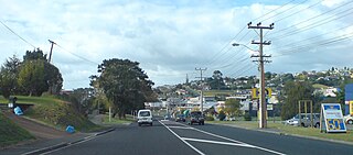
Beach Haven is surrounded by many beaches which are suitable for swimming, including Charcoal Bay which is considered one of the most beautiful bays in the Waitematā Harbour.[13] The area also has a wharf which is a very popular feature of Beach Haven. The first wharf was built in 1887. It was known for decades as the Birkdale wharf and occasionally the Hellyers' Creek wharf. The biggest park in Beach Haven is Shepherds Park which has a 1.6km walk through native bush beside Oruamo or Hellyers Creek, as well as squash, bowling and tennis facilities. It also has rugby and soccer grounds and is home to Birkenhead United AFC.
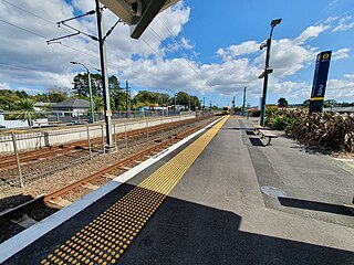
Beach Haven is well serviced by bus connections to Takapuna and the CBD. In August 2012 after years of delays, Auckland Transport announced that it would spend NZ$1.35m to upgrade the wharf at Beach Haven, allowing a ferry service to the city to begin at the start of 2013 to coincide with a new service to Hobsonville. It was expected that this new service will ease traffic congestion on Onewa Road and service the wider areas of Glenfield and Birkdale.[14] The ferry service opened with five sailings a day in February 2013. Beach Haven and Hobsonville wharves are the first new ferry services to be built in Auckland in 50 years.[15]
Beach Haven is known for House of Chocolate (formerly La Maison du Chocolat), a working chocolate factory that was established in 1999.[16][17]
Culture & community
A garden project (funded by local council) began construction in April 2015 and was completed by the end of the year.[18]
In 2013, the community learned that the Beach Haven Methodist Church – which sits on a prominent site in the village – was to be demolished by the Lifewise trust to make way for accessible housing units. The church was built by the community in one day in 1939 using donated timber. "We are dismayed at the prospect of losing the old church building which was built in 1939 in one day by the Beach Haven community," said Lisbeth Alley of the Heart of Beach Haven group. The group and the trust have committed to working together to find a way of keeping the church.[19]
Methodist Mission Northern's property development arm, Airedale Property Trust, spent years discussing the church's future with the community. Bruce Stone, chief executive, said APT was approached by the church to put the land to better use for the community. "There is a shortage of purpose-built housing for people with disabilities," Stone said. "This [development] allows the church to use land in a new way. If [the church] could have been retained on site and used as a part of development, it would have been."[20]
In 2013, the Kaipatiki Community Policing Project won a national award.[21] Kainga Ora have been building high density social housing complexes in the area since 2016.
The hip hop artist Sir T. grew up in Beach Haven and often raps about the area.[22]
Housing
In October 2012, Metro magazine reported Beach Haven had shown one of the biggest increases in property prices in the city over the previous 10 years (admittedly off a lower base than other areas) and named it "One to watch". The magazine was particularly enthusiastic about Island Bay Road.[23][verification needed] In 2014, Metro named Beach Haven one of Auckland's hottest suburbs, noting: "A new ferry service, a meandering coastline offering all sorts of delights and a growing sense of community make Beach Haven one of the new hot spots. Still pretty cheap, but we doubt it will stay that way."[24][promotion?]
Houses are a mix of original character baches, 1950s and 1960s bungalows, apartments as well as architecturally designed homes near the water. Many houses have waterfront access and jetties.[5]
Education
Beach Haven School is a coeducational contributing primary (years 1-6) school with a roll of 499.[25] Kauri Park School is a coeducational primary with a roll of 397.[26] Rolls are as of November 2024.[27] Both schools pride themselves on their multi-cultural make-up.
The local college is Birkenhead College, situated between Beach Haven and Birkdale.
Related Research Articles
Greater Wellington, also known as the Wellington Region, is a non-unitary region of New Zealand that occupies the southernmost part of the North Island. The region covers an area of 8,049 square kilometres (3,108 sq mi), and has a population of 550,600.
The North Shore is one of the major geographical regions of Auckland, the largest city in New Zealand. The area is defined as the northern shores of the Waitematā Harbour as far north as the Ōkura River.
The South Wairarapa District is a district at the south-east tip of the North Island of New Zealand, governed by the South Wairarapa District Council. The district comprises the southernmost part of the Wairarapa, and is part of the Wellington Region.
Waikato District is a territorial authority of New Zealand, in the northern part of Waikato region, North Island. Waikato District is administered by the Waikato District Council, with headquarters in Ngāruawāhia.
Orewa is a settlement in the northern Auckland Region of New Zealand. It is a suburb of the Hibiscus Coast, just north of the base of the Whangaparāoa Peninsula and 40 kilometres (25 mi) north of central Auckland. The Northern Motorway, part of State Highway 1, passes just inland of Orewa and extends through the twin Johnston Hill tunnels to near Puhoi.
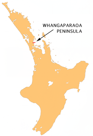
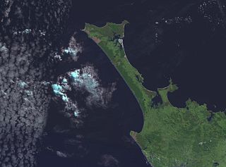
The Whangaparāoa Peninsula is a suburban area about 30–50 km north of Auckland, New Zealand. It had 39,140 residents in June 2024. It stretches from Red Beach, where it connects to Kingsway, Orewa and Silverdale, and extends to Army Bay in the Hauraki Gulf. It is part of the Hibiscus Coast. The area is populated by residents who work on the peninsula, or commute from the area to other parts of the Hibiscus Coast, the North Shore, Rodney district, Auckland CBD and beyond for work. They travel by vehicle, or via the Gulf Harbour ferry at Gulf Harbour Marina, or the Hibiscus Coast Bus Station at Silverdale. There is one main road along its entire length, which is accessible from State Highway 1 via Hibiscus Coast Highway at Silverdale, or from Hibiscus Coast Highway at Orewa via Red Beach. It is popular as a tourist destination for catching a ferry to Tiritiri Matangi Island, and for visiting Shakespear Regional Park. It has one open (Whangaparāoa Golf Club) and one closed golf club (Gulf Harbour Country Club), beaches, sporting and recreation facilities, a library, shops, businesses and public and private primary and secondary schools. The median age of the population is in the 30s-40s.
Glenfield is a suburb of Auckland, New Zealand, located on the North Shore. Established as a rural community in the 1850s, the area developed as a suburban part of Auckland after the completion of the Auckland Harbour Bridge in 1959.
The Aupōuri Peninsula is a tombolo at the northern tip of the North Island of New Zealand. It projects between the Tasman Sea to the west and the Pacific Ocean to the east. It constitutes the northern part of the Far North District, incorporating North Cape, Houhora and the northern half of Awanui.
Pāremoremo is a rural settlement and its mostly rural surrounds about 8 km southwest of Albany on the northern fringe of Auckland, New Zealand. Coatesville is about 7 km to the north, and Riverhead is about 8 km to the west. Pāremoremo is home to New Zealand's only maximum security prison.
Westland District is a territorial authority district on the West Coast of New Zealand's South Island. It is administered by the Westland District Council. The district's population is 9,430.
Dairy Flat is a northern rural district located 8 km south of Orewa in the North Island of New Zealand and 28 km north of central Auckland. Until the early 1990s most of the district was in dairy farms of 40 to 60 hectares, but with the growth of Auckland and the extension of the Northern Motorway into the area, these are being gradually overtime subdivided into lifestyle blocks of around 2 to 5 hectares, many of which are grazing sheep, horses, beef cattle or deer. Although it still retains a rural character, it is counted as part of the Auckland urban area in official statistics.
Forrest Hill is a suburb located on the North Shore of Auckland, New Zealand.
Torbay is a northern suburb of Auckland, New Zealand. It is located in the upper East Coast Bays of the city's North Shore, and is governed by Auckland Council.
Birkdale is a suburb of the contiguous Auckland metropolitan area located in New Zealand. Originally called Parkview, comprising the area from Balmain Rd to the Birkdale wharf, it was renamed Birkdale at a meeting of the Birkenhead Borough Council in 1889, after the suburb of Birkenhead in England of the same name. It now comprises statistical area units such as 'Birkdale North' and 'Birkdale South'. The suburb is located in the North Shore, and is under the governance of Auckland Council.
West Harbour is a suburb of Auckland, located to the west of the Auckland isthmus and CBD. It is named for its location on the western side of the Waitematā Harbour. West Harbour is under the governance of Auckland Council after the amalgamation of district councils in 2010.
Massey is a northern suburb in West Auckland, New Zealand. It was formerly a northern suburb of Waitakere City, which existed from 1989 to 2010 before the city was amalgamated into Auckland Council. The suburb was named after former Prime Minister of New Zealand William Massey. Massey is a relatively large suburb and can be divided into three reasonably distinctive areas, Massey West, Massey East and Massey North. Parts of Massey East are also known as 'Royal Heights', which is home to the Royal Heights shopping centre.
Red Beach is a suburb surrounding the beach of the same name on the Hibiscus Coast, Auckland, New Zealand, at the base of the Whangaparaoa Peninsula. The suburb of Silverdale is to the south-west, and Orewa to the north.
Stanmore Bay is a suburb and beach located on the Whangaparaoa Peninsula, in the Auckland Region of New Zealand. The beach is on the northern side of the peninsula.
Bayview is a suburb of Auckland in New Zealand. The area was included into the North Shore ward in 2010, one of the new thirteen administrative areas of the new Auckland Council.
Rānui is a suburb of West Auckland, New Zealand, which is under the local governance of Auckland Council. The area is densely populated but close to the western fringe of the Auckland urban area.
↑ Community Facilities Trust Birkenhead/Northcote (2006). Harbourside Explorer: A Guide to Exploring What's In and Around Birkenhead and Northcote (2nded.). North Shore City. pp.4–5.
↑ "Our Story". House of Chocolate. Retrieved 1 December 2023.
This page is based on this Wikipedia article Text is available under the CC BY-SA 4.0 license; additional terms may apply. Images, videos and audio are available under their respective licenses.