Hillcrest | |
---|---|
![]() View of Archers Road looking towards McFetridge Park in the 1980s | |
![]() | |
Coordinates: 36°47′38″S174°44′06″E / 36.794°S 174.735°E | |
Country | New Zealand |
City | Auckland |
Local authority | Auckland Council |
Electoral ward | North Shore Ward |
Local board | Kaipātiki Local Board |
Area | |
• Land | 293 ha (724 acres) |
Population (June 2024) [2] | |
• Total | 11,490 |
Postcode(s) | 0627 |
Glenfield | Wairau Valley | Milford |
Birkenhead | ![]() ![]() ![]() ![]() | Takapuna |
Birkenhead | Northcote | Northcote |
Hillcrest is a suburb of the contiguous Auckland metropolitan area located in New Zealand. Since 2010, it has been under the jurisdiction of the Auckland Council, and is located in the North Shore, surrounded by Glenfield, Wairau Valley, Northcote and Birkenhead. [3] The Auckland Northern Motorway passes to the east. [4]
The name Hillcrest was given to the suburb by developer Ewen Allison. [5] Prior to this, the area was referred to by the name Sunnybrae, [5] which refers to Mr. Nicholson's farm in western Northcote. [6]
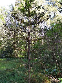
The Hillcrest area is primarily uplifted Waitemata Group sandstone, that was deposited on the sea floor during the Early Miocene, between 22 and 16 million years ago. [7] Prior to human settlement, the inland North Shore was a mixed podocarp-broadleaf forest dominated by kauri. [7]
Hillcrest Creek is a stream that flows east through the suburb, entering the Waitematā Harbour at Shoal Bay, east of the Auckland Northern Motorway. [8] Until the 1970s, the upper reaches of the creek were primarily swampland. [5] A traditional recorded name for Hillcrest Creek is Wakatatere "The Drifting Canoe", a name which recalls an incident where a tapu drifted into the stream at high tide. [9] [10]
Hillcrest is bordered by Sunnybrae Road and Ocean View Road in the east, Archers Road and Glenfield Road in the west, and Pupuke Road in the south. The highest point in the suburb is the hill at Speedy Crescent, which is 98 metres (322 ft) above sea-level. [5] The second highest point is an 88 metres (289 ft) hill to the south on Pupuke Road, [5] referred informally by residents in the early 20th century as Clay Hill. [11] The hill is the location of the Pupuke Road Reservoir and Pump Station. [12]
Tāmaki Māori settlement of the Auckland Region began around the 13th or 14th centuries. [13] [14] While poor clay soils of the inland forest of the North Shore hindered Māori settlement, [15] inland areas were used for harvesting resources from the forests. [16]
Hillcrest was a part of the Mahurangi Block, an area purchased by the Crown on 13 April 1841. [17] Land speculators made purchases in the area in 1843. [18] In 1867 Alexander Wilson, bought 100 acres (40 ha) of land near modern-day Moore Street, cultivating the land for fruit growing. Wilson called his farmhouse Betsland. [19] Wilson was joined by Mr. Nicholson, who established a 128 acres (52 ha) property in western Northcote that he called Sunnybrae. [6]
In 1942 during World War II, a camp was established at Hillcrest to house the First Auckland Battalion of the New Zealand Army, later becoming Camp Hillcrest, a base for the United States Army. [7] The suburb began developing as a suburb of Auckland in the 1960s and 1970s, after the construction of the Auckland Harbour Bridge. [11] Sunnybrae Normal School was opened in 1966 as a school to support teachers training at nearby North Shore Teachers College (now the site of AUT North Campus). [20] This was followed by Willow Park School, established in 1967. [21]
Hillcrest covers 2.93 km2 (1.13 sq mi) [1] and had an estimated population of 11,490 as of June 2024, [2] with a population density of 3,922 people per km2.
Year | Pop. | ±% p.a. |
---|---|---|
2006 | 9,522 | — |
2013 | 9,819 | +0.44% |
2018 | 10,551 | +1.45% |
2023 | 10,635 | +0.16% |
Source: [22] [23] |
Hillcrest (Auckland) had a population of 10,635 in the 2023 New Zealand census, an increase of 84 people (0.8%) since the 2018 census, and an increase of 816 people (8.3%) since the 2013 census. There were 5,250 males, 5,343 females and 39 people of other genders in 3,546 dwellings. [24] 4.2% of people identified as LGBTIQ+. The median age was 36.3 years (compared with 38.1 years nationally). There were 1,824 people (17.2%) aged under 15 years, 2,286 (21.5%) aged 15 to 29, 5,172 (48.6%) aged 30 to 64, and 1,356 (12.8%) aged 65 or older. [23]
People could identify as more than one ethnicity. The results were 52.2% European (Pākehā); 7.4% Māori; 3.5% Pasifika; 42.9% Asian; 2.9% Middle Eastern, Latin American and African New Zealanders (MELAA); and 1.7% other, which includes people giving their ethnicity as "New Zealander". English was spoken by 90.5%, Māori language by 1.2%, Samoan by 0.4%, and other languages by 37.3%. No language could be spoken by 2.3% (e.g. too young to talk). New Zealand Sign Language was known by 0.3%. The percentage of people born overseas was 48.7, compared with 28.8% nationally.
Religious affiliations were 29.4% Christian, 3.3% Hindu, 1.4% Islam, 0.2% Māori religious beliefs, 2.6% Buddhist, 0.2% New Age, 0.1% Jewish, and 1.5% other religions. People who answered that they had no religion were 56.4%, and 5.0% of people did not answer the census question.
Of those at least 15 years old, 3,591 (40.8%) people had a bachelor's or higher degree, 3,324 (37.7%) had a post-high school certificate or diploma, and 1,893 (21.5%) people exclusively held high school qualifications. The median income was $50,100, compared with $41,500 nationally. 1,425 people (16.2%) earned over $100,000 compared to 12.1% nationally. The employment status of those at least 15 was that 5,043 (57.2%) people were employed full-time, 1,116 (12.7%) were part-time, and 213 (2.4%) were unemployed. [23]
Name | Area (km2) | Population | Density (per km2) | Dwellings | Median age | Median income |
---|---|---|---|---|---|---|
Hillcrest North | 0.98 | 3,465 | 3,536 | 1,155 | 36.8 years | $44,300 [25] |
Hillcrest West | 0.89 | 3,276 | 3,681 | 1,077 | 35.7 years | $53,200 [26] |
Hillcrest East | 1.06 | 3,900 | 3,679 | 1,314 | 36.3 years | $51,700 [27] |
New Zealand | 38.1 years | $41,500 |
Sunnybrae Normal School and Willow Park School are coeducational contributing primary (years 1–6) schools with rolls of 390 and 665 respectively, as of November 2024. [28] [29] [30]
Climate data for Hillcrest, North Shore (1991–2020) | |||||||||||||
---|---|---|---|---|---|---|---|---|---|---|---|---|---|
Month | Jan | Feb | Mar | Apr | May | Jun | Jul | Aug | Sep | Oct | Nov | Dec | Year |
Mean daily maximum °C (°F) | 23.7 (74.7) | 24.1 (75.4) | 22.7 (72.9) | 20.6 (69.1) | 18.3 (64.9) | 16.2 (61.2) | 15.3 (59.5) | 15.6 (60.1) | 16.8 (62.2) | 18.4 (65.1) | 20.0 (68.0) | 22.0 (71.6) | 19.5 (67.1) |
Daily mean °C (°F) | 20.1 (68.2) | 20.6 (69.1) | 19.1 (66.4) | 16.9 (62.4) | 14.8 (58.6) | 12.7 (54.9) | 11.7 (53.1) | 12.1 (53.8) | 13.2 (55.8) | 14.6 (58.3) | 16.3 (61.3) | 18.4 (65.1) | 15.9 (60.6) |
Mean daily minimum °C (°F) | 16.5 (61.7) | 17.0 (62.6) | 15.5 (59.9) | 13.3 (55.9) | 11.3 (52.3) | 9.3 (48.7) | 8.0 (46.4) | 8.6 (47.5) | 9.7 (49.5) | 10.9 (51.6) | 12.6 (54.7) | 14.9 (58.8) | 12.3 (54.1) |
Source: NIWA [33] |
The North Shore is one of the major geographical regions of Auckland, the largest city in New Zealand. The area is defined as the northern shores of the Waitematā Harbour as far north as the Ōkura River.
Mount Wellington is a suburb in East Auckland, New Zealand, located 10 km (6.2 mi) southeast of the city centre. It is surrounded by the suburbs of Stonefields, Tamaki, Panmure, Penrose, and Ellerslie, and by the Tāmaki River. The suburb is named after the volcanic peak of Maungarei / Mount Wellington. Sylvia Park is a large business park and shopping centre located in the suburb.
Northcote is a suburb of Auckland in northern New Zealand. It is situated on the North Shore, on the northern shores of Waitematā Harbour, 4 kilometres (2.5 mi) northwest of the Auckland City Centre. The suburb includes the peninsula of Northcote Point where the northern approaches to the Auckland Harbour Bridge are located, and Northcote Central, the commercial centre of Northcote. Northcote features two volcanic maars.
Takapuna is a suburb located on the North Shore of Auckland, New Zealand. The suburb is an isthmus between Shoal Bay, arm of the Waitematā Harbour, and the Hauraki Gulf. Lake Pupuke, a volcanic maar and one of the oldest features of the Auckland volcanic field, is a freshwater lake located in the suburb.
Glenfield is a suburb of Auckland, New Zealand, located on the North Shore. Established as a rural community in the 1850s, the area developed as a suburban part of Auckland after the completion of the Auckland Harbour Bridge in 1959.
Dairy Flat is a northern rural district located 8 km south of Orewa in the North Island of New Zealand and 28 km north of central Auckland. Until the early 1990s most of the district was in dairy farms of 40 to 60 hectares, but with the growth of Auckland and the extension of the Northern Motorway into the area, these are being gradually overtime subdivided into lifestyle blocks of around 2 to 5 hectares, many of which are grazing sheep, horses, beef cattle or deer. Although it still retains a rural character, it is counted as part of the Auckland urban area in official statistics.
Kelston is a residential suburb of West Auckland, New Zealand. Originally a ceramics manufacturing centre, the area is now mostly residential, including a number of schools. Kelston is located in, and its name has been given to, the Kelston parliamentary electorate.
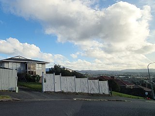
New Windsor, founded in 1865, is a suburb of Auckland, New Zealand. It is located 10 kilometres (6.2 mi) from the Auckland city centre, between Mount Albert, Blockhouse Bay, Mt Roskill and Avondale.
Forrest Hill is a suburb located on the North Shore of Auckland, New Zealand.
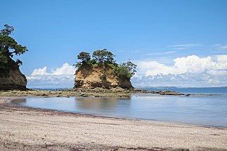
Torbay is a northern suburb of Auckland, New Zealand. It is located in the upper East Coast Bays of the city's North Shore, and is governed by Auckland Council.
Birkdale is a suburb of the contiguous Auckland metropolitan area located in New Zealand. Originally called Parkview, comprising the area from Balmain Rd to the Birkdale wharf, it was renamed Birkdale at a meeting of the Birkenhead Borough Council in 1889, after the suburb of Birkenhead in England of the same name. It now comprises statistical area units such as 'Birkdale North' and 'Birkdale South'. The suburb is located in the North Shore, and is under the governance of Auckland Council.
St Johns is a suburb in Auckland, New Zealand.
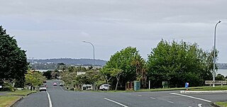
West Harbour is a suburb of Auckland, located to the west of the Auckland isthmus and CBD. It is named for its location on the western side of the Waitematā Harbour. West Harbour is under the governance of Auckland Council after the amalgamation of district councils in 2010.
Western Heights is a neighbourhood of Henderson, in West Auckland, New Zealand. Western Heights School and the nearby shops are the centre of the community. Western Heights is a "frontier suburb", separating suburban Auckland from lifestyle farming blocks, orchards and the Waitākere Ranges.
Massey is a northern suburb in West Auckland, New Zealand. It was formerly a northern suburb of Waitakere City, which existed from 1989 to 2010 before the city was amalgamated into Auckland Council. The suburb was named after former Prime Minister of New Zealand William Massey. Massey is a relatively large suburb and can be divided into three reasonably distinctive areas, Massey West, Massey East and Massey North. Parts of Massey East are also known as 'Royal Heights', which is home to the Royal Heights shopping centre.
Glendene is a suburb of West Auckland, in New Zealand. It is under the local governance of the Auckland Council.
Lincoln is a suburb in West Auckland, New Zealand. It is also the filming location of Shortland Street. The suburb is sometimes called Lincoln North or treated as part of Henderson North to avoid confusion with Lincoln in Canterbury.
Bayview is a suburb of Auckland in New Zealand. The area was included into the North Shore ward in 2010, one of the new thirteen administrative areas of the new Auckland Council.
Rānui is a suburb of West Auckland, New Zealand, which is under the local governance of Auckland Council. The area is densely populated but close to the western fringe of the Auckland urban area.
Tōtara Vale is a suburb located on the North Shore of Auckland, New Zealand. It is under the local governance of Auckland Council.