
Darwin is the capital city of the Northern Territory, Australia. With a 2019 estimated population of 147,255, it has more residents than the rest of the sparsely populated Northern Territory. It is the smallest, wettest, and most northerly of the Australian capital cities and serves as the Top End's regional centre.

HMS Beagle was a Cherokee-class 10-gun brig-sloop of the Royal Navy, one of more than 100 ships of this class. The vessel, constructed at a cost of £7,803, was launched on 11 May 1820 from the Woolwich Dockyard on the River Thames. Later reports say the ship took part in celebrations of the coronation of King George IV of the United Kingdom, passing through the old London Bridge, and was the first rigged man-of-war afloat upriver of the bridge. There was no immediate need for Beagle so she "lay in ordinary", moored afloat but without masts or rigging. She was then adapted as a survey barque and took part in three survey expeditions.
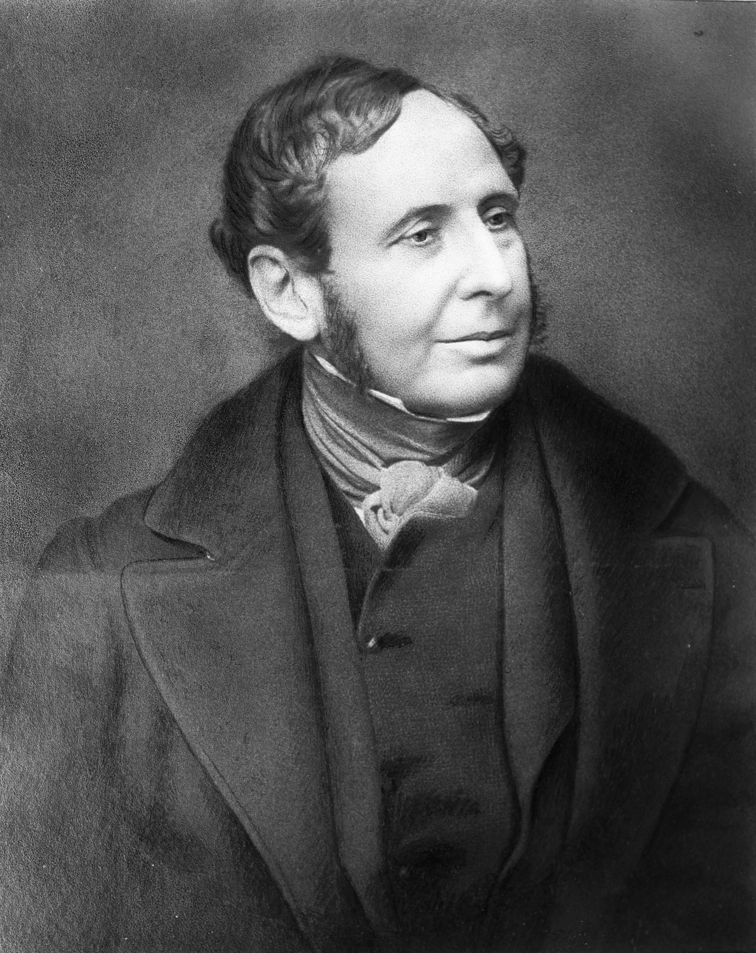
Vice-Admiral Robert FitzRoy was an English officer of the Royal Navy and a scientist. He achieved lasting fame as the captain of HMS Beagle during Charles Darwin's famous voyage, FitzRoy's second expedition to Tierra del Fuego and the Southern Cone.

Darwin Harbour is the body of water close to Darwin in the Northern Territory of Australia. It opens to the north at a line from Charles Point in the west to Lee Point in the east into the Beagle Gulf and connects via the Clarence Strait with the Van Diemen Gulf. It contains Port Darwin, which is flanked by Frances Bay to the east and Cullen Bay to the west.

Nightcliff is a northern suburb of the city of Darwin, Northern Territory, Australia.
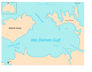
Van Diemen Gulf is a gulf in the Northern Territory of Australia. It connects to the Timor Sea in the north via Dundas Strait. Most of its area is also gazetted as a locality with the name Van Diemen Gulf.
Clarence Strait in northern Australia separates Melville Island from the mainland of Australia. It also connects the Beagle Gulf in the west to the Van Diemen Gulf in the east. It is approximately 50 km (31 mi) north of the city of Darwin.

John Clements Wickham was a Scottish explorer, naval officer, magistrate and administrator. He was first officer on HMS Beagle during its second survey mission, 1831–1836, under captain Robert FitzRoy. The young naturalist and geologist Charles Darwin was a supernumerary on the ship, and his journal was published as The Voyage of the Beagle. After that expedition, Wickham was promoted to Commander and made captain of the Beagle on its third voyage, from 1837 and conducted various maritime expeditions and hydrographic surveys along the Australian coastline.

The Victoria River is a river in the Victoria Bonaparte bioregion of the Northern Territory, Australia.

The second voyage of HMS Beagle, from 27 December 1831 to 2 October 1836, was the second survey expedition of HMS Beagle, under captain Robert FitzRoy who had taken over command of the ship on its first voyage after the previous captain, Pringle Stokes, committed suicide. FitzRoy had thought of the advantages of having someone onboard who could investigate geology, and sought a naturalist to accompany them as a supernumerary. At the age of 22, the graduate Charles Darwin hoped to see the tropics before becoming a parson and accepted the opportunity. He was greatly influenced by reading Charles Lyell's Principles of Geology during the voyage. By the end of the expedition, Darwin had made his name as a geologist and fossil collector and the publication of his journal gave him wide renown as a writer.

Darwin City (referred to as Darwin city centre or The CBD is a suburb in metropolitan Darwin which comprises the original settlement, the central business district, parkland and other built-up areas. It is the oldest part of Darwin and includes many of the city's important institutions and landmarks, such as Parliament, Government House, the Northern Territory Supreme Court, Bicentennial Park and the George Brown Darwin Botanic Gardens. The city centre is located in the local government areas of the City of Darwin and the Darwin Waterfront Precinct.

A nautical chronometer made by Thomas Earnshaw (1749–1828), and once part of the equipment of HMS Beagle, the ship that carried Charles Darwin on his voyage around the world, is held in the British Museum. The chronometer was the subject of one episode of the BBC's series A History of the World in 100 Objects.

Quail Island is an island in the Northern Territory of Australia in the Beagle Gulf about 40 kilometres (25 mi) from the territory capital of Darwin.

Shoal Bay is a locality in the Northern Territory of Australia located about 20 kilometres (12 mi) east of the territory capital of Darwin.
Hotham is a locality in the Northern Territory of Australia located about 62 kilometres (39 mi) east of the territorial capital of Darwin.
Vernon Islands is a locality in the Northern Territory of Australia located over land and water in the Clarence Strait including the Vernon Islands and which is located about 55 kilometres (34 mi) north-east of the territory capital of Darwin.
Vernon Islands Conservation Reserve is a protected area in the Northern Territory of Australia located in the locality of Vernon Islands about 50 kilometres (31 mi) north-east of the territory capital of Darwin.
Bynoe Harbour is a locality in the Northern Territory of Australia located about 41 kilometres (25 mi) south-west of the territory capital of Darwin.
Glyde Point is a locality in the Northern Territory of Australia located about 37 kilometres (23 mi) north-east of the territory capital of Darwin.

Vernon Islands, also known as the Potinga Islands, is an island group in the Northern Territory of Australia located in the Clarence Strait about 55 kilometres (34 mi) north-east of the territory capital of Darwin. The group consists of three islands which were first sighted in 1818 by Europeans on a British navy ship under the command of Phillip Parker King. The group were part of the subject of a successful aboriginal land claim which was resolved after 40 years in 2018 when the Tiwi people received title. All three islands host navigation aids which assist vessels passing through the Clarence Strait. It and some adjoining seabed have had protected area status since 1974 and which has been known as the Vernon Islands Conservation Reserve since 1979. Since 2007, the island group have been located in the locality of Vernon Islands.

