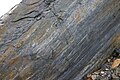
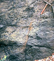
In structural geology, a syncline is a fold with younger layers closer to the center of the structure, whereas an anticline is the inverse of a syncline. A synclinorium is a large syncline with superimposed smaller folds. Synclines are typically a downward fold (synform), termed a synformal syncline, but synclines that point upwards can be found when strata have been overturned and folded.

Reading Anthracite Company is a coal mining company based in Pottsville, Pennsylvania in the United States. It mainly mines anthracite coal in the Coal Region of eastern Pennsylvania.

Shamokin Creek is a tributary of the Susquehanna River in Northumberland County, Pennsylvania, in the United States. It is approximately 32.4 miles (52.1 km) long and flows through Mount Carmel, Mount Carmel Township, Coal Township, Shamokin, Ralpho Township, Shamokin Township, Snydertown, Upper Augusta Township, and Sunbury. The watershed of the creek has an area of 137 square miles (350 km2). It experiences significant impacts by abandoned mine drainage and many abandoned mine drainage discharges are in its watershed. Various other impairments also affect parts of the creek's watershed. Shamokin Creek is in the Appalachian Mountains section of the Ridge and Valley physiographic province. Rock formations consisting of sandstone, shale, and anthracite deposits occur in the watershed.

The geology of Wales is complex and varied; its study has been of considerable historical significance in the development of geology as a science. All geological periods from the Cryogenian to the Jurassic are represented at outcrop, whilst younger sedimentary rocks occur beneath the seas immediately off the Welsh coast. The effects of two mountain-building episodes have left their mark in the faulting and folding of much of the Palaeozoic rock sequence. Superficial deposits and landforms created during the present Quaternary period by water and ice are also plentiful and contribute to a remarkably diverse landscape of mountains, hills and coastal plains.

The Geology of Pennsylvania consists of six distinct physiographic provinces, three of which are subdivided into different sections. Each province has its own economic advantages and geologic hazards and plays an important role in shaping everyday life in the state. From the southeast corner to the northwest corner of the state, the include: the Atlantic Plain Province province, the Piedmont Province, the New England Province, the Ridge and Valley Province, the Appalachain Province, and the Central Lowlands Province.
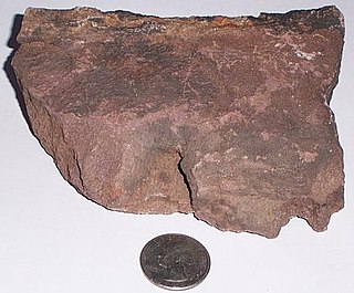
The Silurian Bloomsburg Formation is a mapped bedrock unit in Pennsylvania, New Jersey, New York and Maryland. It is named for the town of Bloomsburg, Pennsylvania in which it was first described. The Bloomsburg marked the first occurrence of red sedimentary rocks in the Appalachian Basin.

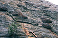
The Llewellyn Formation is a mapped bedrock unit in eastern Pennsylvania. It was previously known as the "coal measures" and the post-Pottsville rocks. The formation is named for the community of Llewellyn in Schuylkill County.

Mahanoy Creek is a 51.6-mile-long (83.0 km) tributary of the Susquehanna River in Northumberland and Schuylkill counties, Pennsylvania. There are at least 35 sources of acid mine drainage in the creek's watershed. Anthracite was mined in the upper part of the Mahanoy Creek watershed in the 19th and 20th centuries. Mahanoy Creek's tributaries include Schwaben Creek, Zerbe Run, Little Mahanoy Creek, Shenandoah Creek, and North Mahanoy Creek. Little Mahanoy Creek and Schwaben Creek are two streams in the watershed that are unaffected by acid mine drainage. Schwaben Creek has a higher number and diversity of fish species than the main stem.
The Mississippian Mauch Chunk Formation is a mapped bedrock unit in Pennsylvania, Maryland, and West Virginia. It is named for the township of Mauch Chunk, now known as borough of Jim Thorpe, Pennsylvania and for nearby Mauch Chunk Ridge where the formation crops out.

The Pennsylvanian Pottsville Formation is a mapped bedrock unit in Pennsylvania, western Maryland, West Virginia, Ohio, and Alabama. It is a major ridge-former in the Ridge-and-Valley Appalachians of the eastern United States. The Pottsville Formation is conspicuous at many sites along the Allegheny Front, the eastern escarpment of the Allegheny or Appalachian Plateau.

The geology of Tasmania is complex, with the world's biggest exposure of diabase, or dolerite. The rock record contains representatives of each period of the Neoproterozoic, Paleozoic, Mesozoic and Cenozoic eras. It is one of the few southern hemisphere areas that were glaciated during the Pleistocene with glacial landforms in the higher parts. The west coast region hosts significant mineralisation and numerous active and historic mines.

The geology of Massachusetts includes numerous units of volcanic, intrusive igneous, metamorphic and sedimentary rocks formed within the last 1.2 billion years. The oldest formations are gneiss rocks in the Berkshires, which were metamorphosed from older rocks during the Proterozoic Grenville orogeny as the proto-North American continent Laurentia collided against proto-South America. Throughout the Paleozoic, overlapping the rapid diversification of multi-cellular life, a series of six island arcs collided with the Laurentian continental margin. Also termed continental terranes, these sections of continental rock typically formed offshore or onshore of the proto-African continent Gondwana and in many cases had experienced volcanic events and faulting before joining the Laurentian continent. These sequential collisions metamorphosed new rocks from sediments, created uplands and faults and resulted in widespread volcanic activity. Simultaneously, the collisions raised the Appalachian Mountains to the height of the current day Himalayas.
The geology of Merseyside in northwest England largely consists of a faulted sequence of Carboniferous Coal Measures rocks overlain in the west by younger Triassic and Permian age sandstones and mudstones. Glaciation during the present Quaternary Period has left widespread glacial till as well as erosional landforms. Other post-glacial superficial deposits such as river and estuarine alluvium, peat and blown sand are abundant.
The geology of Malawi formed on extremely ancient crystalline basement rock, which was metamorphosed and intruded by igneous rocks during several orogeny mountain building events in the past one billion years. The rocks of the Karoo Supergroup and newer sedimentary units deposited across much of Malawi in the last 251 million years, in connection with a large rift basin on the supercontinent Gondwana and the more recent rifting that has created the East African Rift, which holds Lake Malawi. The country has extensive mineral reserves, many of them poorly understood or not exploited, including coal, vermiculite, rare earth elements and bauxite.
The geology of Ohio formed beginning more than one billion years ago in the Proterozoic eon of the Precambrian. The igneous and metamorphic crystalline basement rock is poorly understood except through deep boreholes and does not outcrop at the surface. The basement rock is divided between the Grenville Province and Superior Province. When the Grenville Province crust collided with Proto-North America, it launched the Grenville orogeny, a major mountain building event. The Grenville mountains eroded, filling in rift basins and Ohio was flooded and periodically exposed as dry land throughout the Paleozoic. In addition to marine carbonates such as limestone and dolomite, large deposits of shale and sandstone formed as subsequent mountain building events such as the Taconic orogeny and Acadian orogeny led to additional sediment deposition. Ohio transitioned to dryland conditions in the Pennsylvanian, forming large coal swamps and the region has been dryland ever since. Until the Pleistocene glaciations erased these features, the landscape was cut with deep stream valleys, which scoured away hundreds of meters of rock leaving little trace of geologic history in the Mesozoic and Cenozoic.
The geology of South Dakota began to form more than 2.5 billion years ago in the Archean eon of the Precambrian. Igneous crystalline basement rock continued to emplace through the Proterozoic, interspersed with sediments and volcanic materials. Large limestone and shale deposits formed during the Paleozoic, during prevalent shallow marine conditions, followed by red beds during terrestrial conditions in the Triassic. The Western Interior Seaway flooded the region, creating vast shale, chalk and coal beds in the Cretaceous as the Laramide orogeny began to form the Rocky Mountains. The Black Hills were uplifted in the early Cenozoic, followed by long-running periods of erosion, sediment deposition and volcanic ash fall, forming the Badlands and storing marine and mammal fossils. Much of the state's landscape was reworked during several phases of glaciation in the Pleistocene. South Dakota has extensive mineral resources in the Black Hills and some oil and gas extraction in the Williston Basin. The Homestake Mine, active until 2002, was a major gold mine that reached up to 8000 feet underground and is now used for dark matter and neutrino research.
The geology of Utah, in the western United States, includes rocks formed at the edge of the proto-North American continent during the Precambrian. A shallow marine sedimentary environment covered the region for much of the Paleozoic and Mesozoic, followed by dryland conditions, volcanism, and the formation of the basin and range terrain in the Cenozoic.

The geology of Bulgaria consists of two major structural features. The Rhodope Massif in southern Bulgaria is made up of Archean, Proterozoic and Cambrian rocks and is a sub-province of the Thracian-Anatolian polymetallic province. It has dropped down, faulted basins filled with Cenozoic sediments and volcanic rocks. The Moesian Platform to the north extends into Romania and has Paleozoic rocks covered by rocks from the Mesozoic, typically buried by thick Danube River valley Quaternary sediments. In places, the Moesian Platform has small oil and gas fields. Bulgaria is a country in southeastern Europe. It is bordered by Romania to the north, Serbia and North Macedonia to the west, Greece and Turkey to the south, and the Black Sea to the east.
This article describes the geology of the Brecon Beacons National Park in mid/south Wales. The area gained national park status in 1957 with the designated area of 1,344 km2 (519 sq mi) including mountain massifs to both the east and west of the Brecon Beacons proper. The geology of the national park consists of a thick succession of sedimentary rocks laid down from the late Ordovician through the Silurian and Devonian to the late Carboniferous period. The rock sequence most closely associated with the park is the Old Red Sandstone from which most of its mountains are formed. The older parts of the succession, in the northwest, were folded and faulted during the Caledonian orogeny. Further faulting and folding, particularly in the south of the park is associated with the Variscan orogeny.
The geology of California is highly complex, with numerous mountain ranges, substantial faulting and tectonic activity, rich natural resources and a history of both ancient and comparatively recent intense geological activity. The area formed as a series of small island arcs, deep-ocean sediments and mafic oceanic crust accreted to the western edge of North America, producing a series of deep basins and high mountain ranges.