Beaver Creek | |
---|---|
Native name | Amochkhanne |
Location | |
Country | United States |
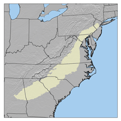
State | Pennsylvania |
County | Bucks |
Township | Tinicum, Nockamixon, Bridgeton |
Physical characteristics | |
Source | |
- coordinates | 40°32′14″N75°7′20″W / 40.53722°N 75.12222°W |
- elevation | 540 feet (160 m) |
Mouth | |
- coordinates | 40°28′50″N75°8′49″W / 40.48056°N 75.14694°W Coordinates: 40°28′50″N75°8′49″W / 40.48056°N 75.14694°W |
- elevation | 226 feet (69 m) |
Length | 4.76 miles (7.66 km) |
Basin size | 6.83 square miles (17.7 km2) |
Basin features | |
Progression | Beaver Creek → Tinicum Creek → Delaware River → Delaware Bay |
River system | Delaware River |
Bridges | Lonely Cottage Road, Lonely Cottage Road, Strocks Grove Road, Rocky Ridge Road, Byers Road, Clay Ridge Road |
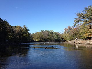
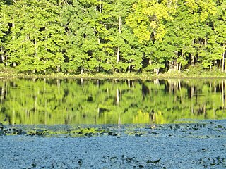
Beaver Creek (Lenape name - Amochkhanne, Amoch=beaver, khanne=creek) is a tributary of Tinicum Creek in Bridgeton, Nockamixon, and Tinicum Townships in Bucks County, Pennsylvania, in the United States. The creek is part of the Delaware River watershed. [1]
A tributary or affluent is a stream or river that flows into a larger stream or main stem river or a lake. A tributary does not flow directly into a sea or ocean. Tributaries and the main stem river drain the surrounding drainage basin of its surface water and groundwater, leading the water out into an ocean.
Tinicum Creek is a tributary of the Delaware River in Tinicum Township, Bucks County, Pennsylvania in the United States.
Bridgeton Township is a township in Bucks County, Pennsylvania, United States. The population was 1,277 at the 2010 census. The township was originally a part of adjacent Nockamixon Township, but a division was arranged and signed on May 24, 1890. This accord split an area of Nockamixon which ran west from the banks of the Delaware River to about one third the breadth of the original township. This smaller area was unsurprisingly named "Bridgeton", as it was the site of Upper Black Eddy-Milford Bridge covered wooden truss bridge built in 1842, which connected the towns of Upper Black Eddy and Milford, New Jersey. The original covered bridge was replaced by a truss bridge in 1933. The township originally contained several tiny hamlets, such as the aforementioned Upper Black Eddy, Narrowsville, and Rupletown. Upper Black's Eddy, as it was originally called, and Raubsville were named for notable landholders, while Narrowsville was named for a particularly thin portion of the Delaware River. With the construction of a centralized post office in Upper Black Eddy, the usage of separate names for the smaller towns ceased in an official capacity, and the everyday errands of residents became centered on the largest of the towns. What little commercial trade exists in the township is now centered solely in Upper Black Eddy, with any evidence of there being any distinctive, smaller villages existing only on outdated road-signs and maps. Ringing Rocks Park is located within the township, as well as state game hunting lands. Bridgeton Township is also home to the Homestead General Store, the oldest continually operating general store on the Delaware Canal.
Beaver Creek was entered into the Geographic Names Information System on 2 August 1979 as identification number 1169002, its identification number in the PA Gazetteer of Streams is 3241. [2] [3]
Beaver Creek rises in Bridgeton Township near Lonely Cottage Road at an elevation of approximately 540 feet (160 m) and runs generally southwest for 3.68 miles (5.92 km) until it meets its confluence at Tinicum Creek's 6.41 river mile at an elevation of 226 feet (69 m). During its course it receives three tributaries from the left and three from the right. The average slope is 85.3 feet per mile (15.37 meters per kilometer). [4]
In the United States, a river mile is a measure of distance in miles along a river from its mouth. River mile numbers begin at zero and increase further upstream. The corresponding metric unit using kilometers is the river kilometer. They are analogous to vehicle roadway mile markers, except that river miles are rarely marked on the physical river; instead they are marked on navigation charts, and topographic maps. Riverfront properties are sometimes partially legally described by their river mile.
Diabase or dolerite or microgabbro is a mafic, holocrystalline, subvolcanic rock equivalent to volcanic basalt or plutonic gabbro. Diabase dikes and sills are typically shallow intrusive bodies and often exhibit fine grained to aphanitic chilled margins which may contain tachylite. Diabase is the preferred name in North America, yet dolerite is the preferred name in most of the rest of the world, where sometimes the name diabase is applied to altered dolerites and basalts. Many petrologists prefer the name microgabbro to avoid this confusion.
The Appalachian Mountains, often called the Appalachians, are a system of mountains in eastern North America. The Appalachians first formed roughly 480 million years ago during the Ordovician Period. They once reached elevations similar to those of the Alps and the Rocky Mountains before experiencing natural erosion. The Appalachian chain is a barrier to east–west travel, as it forms a series of alternating ridgelines and valleys oriented in opposition to most highways and railroads running east–west.
The Piedmont is a plateau region located in the Eastern United States. It sits between the Atlantic coastal plain and the main Appalachian Mountains, stretching from New Jersey in the north to central Alabama in the south. The Piedmont Province is a physiographic province of the larger Appalachian division which consists of the Gettysburg-Newark Lowlands, the Piedmont Upland and the Piedmont Lowlands sections.
The Geology of Pennsylvania consists of six distinct physiographic provinces, three of which are subdivided into different sections. Each province has its own economic advantages and geologic hazards and plays an important role in shaping everyday life in the state. They are: the Atlantic Coastal Plain Province, the Piedmont Province, the New England Province, the Ridge and Valley Province, the Appalachian Plateau Province, and the Central Lowlands Province.
Beaver Creek's course is located in a region of diabase rock which intruded into the local sedimentary layers of the Brunswick and Lockatong Formations during the Jurassic and the Triassic, then the remaining course flows over the Brunswick Formation. Diabase is a dark gray to black, fine grained and very dense, consisting of primarily labradorite and augite. [5]
The Jurassic was a geologic period and system that spanned 56 million years from the end of the Triassic Period 201.3 million years ago (Mya) to the beginning of the Cretaceous Period 145 Mya. The Jurassic constitutes the middle period of the Mesozoic Era, also known as the Age of Reptiles. The start of the period was marked by the major Triassic–Jurassic extinction event. Two other extinction events occurred during the period: the Pliensbachian-Toarcian extinction in the Early Jurassic, and the Tithonian event at the end; however, neither event ranks among the "Big Five" mass extinctions.
The Triassic is a geologic period and system which spans 50.6 million years from the end of the Permian Period 251.9 million years ago (Mya), to the beginning of the Jurassic Period 201.3 Mya. The Triassic is the first period of the Mesozoic Era. Both the start and end of the period are marked by major extinction events.
Labradorite ((Ca, Na)(Al, Si)4O8), a feldspar mineral, is an intermediate to calcic member of the plagioclase series. It has an anorthite percentage (%An) of between 50 and 70. The specific gravity ranges from 2.68 to 2.72. The streak is white, like most silicates. The refractive index ranges from 1.559 to 1.573 and twinning is common. As with all plagioclase members, the crystal system is triclinic, and three directions of cleavage are present, two of which are nearly at right angles and are more obvious, being of good to perfect quality. (The third direction is poor.) It occurs as clear, white to gray, blocky to lath shaped grains in common mafic igneous rocks such as basalt and gabbro, as well as in anorthosites.
Crossing | NBI Number | Length | Lanes | Spans | Material/Design | Built | Reconstructed | Latitude | Longitude |
---|---|---|---|---|---|---|---|---|---|
Lonely Cottage Road | - | - | - | - | - | - | - | - | - |
Lonely Cottage Road | 7624 | 7 metres (23 ft) | 2 | 1 | Steel stringer/multi-beam or girder | 1961 | - | 40°32'5.1"N | 75°7'38.2"W |
Strocks Grove Road | 7571 | 7 metres (23 ft) | 1 | 1 | Concrete tee-beam | 1920 | - | 40°31'11"N | 75°8'4"W |
Rocky Ridge Road | 7623 | 7 metres (23 ft) | 2 | 1 | Steel stringer/multi-beam or girder | 1980 | - | 40°30'55.3"N | 75°8'18.1"W |
Byers Road | 7569 | 14 metres (46 ft) | 1 | 2 | Concrete tee-beam | 1912 | 1980 | 40°30'18.4"N | 75°8'23.1"W |
Beaver Run Road | - | - | - | - | - | - | - | - | - |
Clay Ridge Road | 7566 | 12 metres (39 ft) | 1 | 1 | Concrete arch-deck | 1909 | - | 40°29'3.6"N | 75°8'38.75"W |
Tohickon Creek is a 29.5-mile-long (47.5 km) tributary of the Delaware River. Located entirely in Bucks County, in southeastern Pennsylvania, it rises in Springfield Township and has its confluence with the Delaware at Point Pleasant. It is dammed to form Lake Nockamixon.
Neshaminy Creek is a 40.7-mile-long (65.5 km) stream that runs entirely through Bucks County, Pennsylvania, rising south of the borough of Chalfont, where its north and west branches join. Neshaminy Creek flows southeast toward Bristol Township and Bensalem Township to its confluence with the Delaware River. The name "Neshaminy" originates with the Lenni Lenape and is thought to mean "place where we drink twice". This phenomenon refers to a section of the creek known as the Neshaminy Palisades, where the course of the water slows and changes direction at almost a right angle, nearly forcing the water back upon itself. These palisades are located in Dark Hollow Park, operated by the county, and are flanked by Warwick Township to the south and Buckingham Township to the north.
Houghs Creek is a tributary of the Delaware River in Bucks County, Pennsylvania, contained wholly within Upper Makefield Township.
Paunnacussing Creek is a tributary of the Delaware River contained wholly within Bucks County, Pennsylvania in the United States. It rises from a pond north of Mechanicsville, in Buckingham Township and drains into the Delaware at Bull Island just upstream of Lumberville in Solebury Township.
Hickory Creek is a tributary of the Delaware River in Plumstead Township, Bucks County, Pennsylvania, in the United States.
Deep Run is a tributary of Tohickon Creek in Bedminster Township, Bucks County, Pennsylvania, in the United States.
Deep Run is a tributary of the Tohickon Creek in Bedminster Township, Bucks County, Pennsylvania in the United States.
Deer Run is a tributary of the Tohickon Creek in Bedminster Township, Bucks County, Pennsylvania in the United States.
Mink Run is a tributary of the Tohickon Creek in Bedminster Township, Bucks County, Pennsylvania in the United States.
Haycock Creek is a tributary of the Tohickon Creek in Bucks County, Pennsylvania in the United States and is part of the Delaware River watershed.
Threemile Run is a tributary of the Tohickon Creek in Bucks County, Pennsylvania in the United States and is part of the Delaware River watershed.
Dimple Creek is a tributary of the Tohickon Creek in Haycock Township, Bucks County, Pennsylvania in the United States. It is part of the Delaware River watershed.
Morgan Creek is a tributary of the Tohickon Creek in Bucks County, Pennsylvania in the United States, rising in Milford Township and empties into the Tohickon in Richland Township east of Quakertown.
Beaver Run is a tributary of the Tohickon Creek in Milford Township and Richland Township, Bucks County, Pennsylvania in the United States and is part of the Delaware River watershed.
Smithtown Creek is a tributary of the Delaware River in Tinicum Township, Bucks County, Pennsylvania in the United States.
Rapp Creek is a tributary of Tinicum Creek in Nockamixon Township, Bucks County, Pennsylvania in the United States. Rapp Creek is part of the Delaware River watershed.
Swamp Creek is a tributary of the Delaware River in Tinicum Township, Bucks County, Pennsylvania in the United States.
Falls Creek is a tributary of the Delaware River wholly contained in Bridgeton Township, Bucks County, Pennsylvania in the United States. The creek boasts the highest falls in Bucks County.
Gallows Run is a tributary of the Delaware River in Springfield and Nockamixon Townships, in Bucks County, Pennsylvania in the United States.