Tinicum Creek | |
---|---|
Location | |
Country | United States |
State | Pennsylvania |
County | Bucks |
Township | Tinicum |
Physical characteristics | |
Source | Rapp Creek, Beaver Creek |
⁃ coordinates | 40°27′22.06″N75°19′30.64″W / 40.4561278°N 75.3251778°W |
⁃ elevation | 240 feet (73 m) |
Mouth | |
⁃ coordinates | 40°29′12″N75°4′4″W / 40.48667°N 75.06778°W Coordinates: 40°29′12″N75°4′4″W / 40.48667°N 75.06778°W |
⁃ elevation | 100 feet (30 m) |
Length | 6.44 miles (10.36 km) |
Basin features | |
River system | Delaware River |
Landmarks | Van Sant Airport |
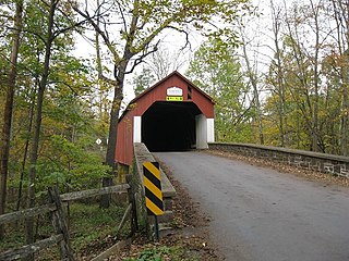
Bridges | Geigel Hill Road, Sheep Hole Road, Sheep Hole Road, Headquarters Road, Municipal Road, Cafferty Road, Pennsylvania Route 32 (River Road) |
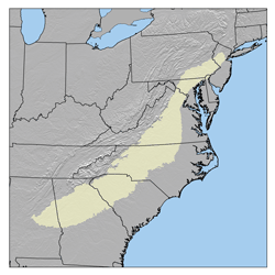
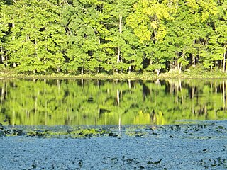
Tinicum Creek is a tributary of the Delaware River in Tinicum Township, Bucks County, Pennsylvania in the United States.
A tributary or affluent is a stream or river that flows into a larger stream or main stem river or a lake. A tributary does not flow directly into a sea or ocean. Tributaries and the main stem river drain the surrounding drainage basin of its surface water and groundwater, leading the water out into an ocean.
The Delaware River is a major river on the Atlantic coast of the United States. It drains an area of 14,119 square miles (36,570 km2) in five U.S. states: Delaware, Maryland, New Jersey, New York, Pennsylvania. Rising in two branches in New York state's Catskill Mountains, the river flows 419 miles (674 km) into Delaware Bay where its waters enter the Atlantic Ocean near Cape May in New Jersey and Cape Henlopen in Delaware. Not including Delaware Bay, the river's length including its two branches is 388 miles (624 km). The Delaware River is one of nineteen "Great Waters" recognized by the America's Great Waters Coalition.
Tinicum Township is a township in Bucks County, Pennsylvania, United States. The population was 3,995 at the 2010 census.
Tinicum Creek was added to the Geographical Names Information System of the U.S. Geological Survey on 8 September 1979 as identification number 1209346. It is listed in the PA Gazetteer of Streams as identification number 03218. As the largest stream in the northeast corner of Bucks County north of the Tohickon Creek, it boasts a watershed of 24 square miles (62 km2) and meets its confluence at the Delaware River's 161.60 river mile. [1] [2]
Tohickon Creek is a 29.5-mile-long (47.5 km) tributary of the Delaware River. Located entirely in Bucks County, in southeastern Pennsylvania, it rises in Springfield Township and has its confluence with the Delaware at Point Pleasant. It is dammed to form Lake Nockamixon.
A drainage basin is any area of land where precipitation collects and drains off into a common outlet, such as into a river, bay, or other body of water. The drainage basin includes all the surface water from rain runoff, snowmelt, and nearby streams that run downslope towards the shared outlet, as well as the groundwater underneath the earth's surface. Drainage basins connect into other drainage basins at lower elevations in a hierarchical pattern, with smaller sub-drainage basins, which in turn drain into another common outlet.
In the United States, a river mile is a measure of distance in miles along a river from its mouth. River mile numbers begin at zero and increase further upstream. The corresponding metric unit using kilometers is the river kilometer. They are analogous to vehicle roadway mile markers, except that river miles are rarely marked on the physical river; instead they are marked on navigation charts, and topographic maps. Riverfront properties are sometimes partially legally described by their river mile.
Tinicum Creek rises near Cauffman Hill at the merger of Beaver Creek and Rapp Creek, and meanders, but generally flows southeast for about 1.73 miles (2.78 km), receiving two unnamed tributaries from the left, and one from the right. It, then, abruptly turns to the northwest at the point it receives another tributary from the southeast. Then the creek meanders generally to the northeast for approximately 4.75 miles (7.64 km) until it meets its confluence with the Delaware. The stream has a total length of 6.40 miles (10.30 km), the headwaters rises at an elevation of 240 feet (73 m), and its mouth is at an elevation of 100 feet (30 m), which is a drop of 140 feet (43 m). This results in an average slope of 21.875 feet per mile (3.93 meters per kilometer). [3]
Beaver Creek is a tributary of Tinicum Creek in Bridgeton, Nockamixon, and Tinicum Townships in Bucks County, Pennsylvania, in the United States. The creek is part of the Delaware River watershed.
Rapp Creek is a tributary of Tinicum Creek in Nockamixon Township, Bucks County, Pennsylvania in the United States. Rapp Creek is part of the Delaware River watershed.
Diabase or dolerite or microgabbro is a mafic, holocrystalline, subvolcanic rock equivalent to volcanic basalt or plutonic gabbro. Diabase dikes and sills are typically shallow intrusive bodies and often exhibit fine grained to aphanitic chilled margins which may contain tachylite. Diabase is the preferred name in North America, while dolerite is the preferred name in the rest of English-speaking world, where sometimes the name diabase is applied to altered dolerites and basalts. Some geologists prefer the name microgabbro to avoid this confusion.
The Appalachian Mountains, often called the Appalachians, are a system of mountains in eastern North America. The Appalachians first formed roughly 480 million years ago during the Ordovician Period. They once reached elevations similar to those of the Alps and the Rocky Mountains before experiencing natural erosion. The Appalachian chain is a barrier to east–west travel, as it forms a series of alternating ridgelines and valleys oriented in opposition to most highways and railroads running east–west.
The Piedmont is a plateau region located in the Eastern United States. It sits between the Atlantic coastal plain and the main Appalachian Mountains, stretching from New York in the north to central Alabama in the south. The Piedmont Province is a physiographic province of the larger Appalachian division which consists of the Gettysburg-Newark Lowlands, the Piedmont Upland and the Piedmont Lowlands sections.
The Geology of Pennsylvania consists of six distinct physiographic provinces, three of which are subdivided into different sections. Each province has its own economic advantages and geologic hazards and plays an important role in shaping everyday life in the state. They are: the Atlantic Coastal Plain Province, the Piedmont Province, the New England Province, the Ridge and Valley Province, the Appalachian Plateau Province, and the Central Lowlands Province.
The Brunswick Formation is a sedimentary layer of rock consisting of mudstone, siltstone, and beds of green, brown, and red-brown shale. Mineralogy consists of argillite and hornfels. About 200 million years ago, magma intruded into the Brunswick and cooled quickly forming a fine grained diabase consisting of primarily labradorite and augite. [4]
Crossing | NBI Number | Length | Lanes | Spans | Material/Design | Built | Reconstructed | Latitude | Longitude |
---|---|---|---|---|---|---|---|---|---|
Geigel Hill Road | 47016 | 18 metres (59 ft) | 1 | 1 | Steel girder and floorbeam system | 2011 | - | 40°28'48"N | 75°8'54"W |
Sheep Hole Road | 7644 | 20 metres (66 ft) | 2 | 1 | Steel truss-thru | 1932 | 1950 | 40°28'35.3"N | 75°8'44.9"W |
Sheep Hole Road | 7561 | 19 metres (62 ft) | 1 | 1 | Steel truss-thru | 1985 | - | 40°28'26"N | 75°8'35"W |
Headquarters Road | 7128 | 24 metres (79 ft) | 1 | 3 | Continuous concrete stringer/multi-beam or grider | 1919 | - | 40°28'14.6"N | 75°8'11.96"W |
Municipal Road | - | - | - | - | No bridge, road passes through creek bed | - | - | - | - |
Cafferty Road | 7568 | 37 metres (121 ft) | 1 | 2 | Steel stringer/multi-beam or girder | - | 1978 | 40°28'32.3"N | 75°5'58.7"W |
Pennsylvania Route 32 (River Road) | 6811 | 52 metres (171 ft) | 2 | 4 | Steel stringer/multi-beam or girder | 1932 | 1985 | 40°29'8.2"N | 75°4'9.46"W |
Martins Creek is a tributary of the Delaware River in Bucks County, Pennsylvania meeting its confluence at the Delaware River 122 river mile.
Buck Creek is a tributary of the Delaware River, rising in Lower Makefield Township, Bucks County, Pennsylvania and meeting its confluence at the Delaware River's 138.00 river mile.
Hickory Creek is a tributary of the Delaware River in Plumstead Township, Bucks County, Pennsylvania, in the United States.
Deep Run is a tributary of Tohickon Creek in Bedminster Township, Bucks County, Pennsylvania, in the United States.
Deep Run is a tributary of the Tohickon Creek in Bedminster Township, Bucks County, Pennsylvania in the United States.
Deer Run is a tributary of the Tohickon Creek in Bedminster Township, Bucks County, Pennsylvania in the United States.
Mink Run is a tributary of the Tohickon Creek in Bedminster Township, Bucks County, Pennsylvania in the United States.
Haycock Creek is a tributary of the Tohickon Creek in Bucks County, Pennsylvania in the United States and is part of the Delaware River watershed.
Threemile Run is a tributary of the Tohickon Creek in Bucks County, Pennsylvania in the United States and is part of the Delaware River watershed.
Dimple Creek is a tributary of the Tohickon Creek in Haycock Township, Bucks County, Pennsylvania in the United States. It is part of the Delaware River watershed.
Morgan Creek is a tributary of the Tohickon Creek in Bucks County, Pennsylvania in the United States, rising in Milford Township and empties into the Tohickon in Richland Township east of Quakertown.
Beaver Run is a tributary of the Tohickon Creek in Milford Township and Richland Township, Bucks County, Pennsylvania in the United States and is part of the Delaware River watershed.
Smithtown Creek is a tributary of the Delaware River in Tinicum Township, Bucks County, Pennsylvania in the United States.
Swamp Creek is a tributary of the Delaware River in Tinicum Township, Bucks County, Pennsylvania in the United States.
Falls Creek is a tributary of the Delaware River wholly contained in Bridgeton Township, Bucks County, Pennsylvania in the United States. The creek boasts the highest falls in Bucks County.
Gallows Run is a tributary of the Delaware River in Springfield and Nockamixon Townships, in Bucks County, Pennsylvania in the United States.
Cooks Creek is a tributary of the Delaware River in Bucks County, Pennsylvania, in the United States, rising in Springfield Township and passing through Durham Township before emptying into the Pennsylvania Canal and the Delaware.