
Pine Manor is a census-designated place (CDP) located off U.S. Route 41 and Summerlin Road in Lee County, Florida, United States. The population was 4,122 at the 2020 census, up from 3,428 at the 2010 census. It is part of the Cape Coral-Fort Myers, Florida Metropolitan Statistical Area.

Silver Springs is a census-designated place (CDP) in Lyon County, Nevada, United States at the intersection of US 50 and US 95A. The population was 5,296 at the 2010 census. Lahontan Reservoir, Lahontan State Recreation Area and historic Fort Churchill State Historic Park are all located nearby. The area is served by the Silver Springs Airport.

Smith Valley is a census-designated place (CDP) in Lyon County, Nevada, United States. The population was 1,603 at the 2010 census.
Spanish Springs is a census-designated place (CDP) in Washoe County, Nevada, United States. It is located in the northeastern part of the Reno–Sparks Metropolitan Statistical Area. The population was 15,064 at the 2010 Census.
Pleasant Hill is an unincorporated community and census-designated place (CDP) in Lebanon County, Pennsylvania, United States. The population was 2,643 at the 2010 census, up from 2,301 at the 2000 census.

Mountville is an unincorporated community and census-designated place (CDP) in Laurens County, South Carolina, United States. The population was 108 at the 2010 census, down from 130 at the 2000 census. It is part of the Greenville–Mauldin–Easley Metropolitan Statistical Area.
Lemmon Valley is a census-designated place (CDP) in Washoe County, Nevada, United States. The population was 5,040 at the 2010 census. It is a northern suburb of the city of Reno and is part of the Reno–Sparks Metropolitan Statistical Area. Prior to 2010 it was listed by the U.S. Census Bureau as part of the Lemmon Valley–Golden Valley CDP.
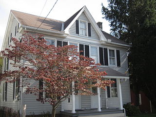
East Earl is an unincorporated community and census-designated place (CDP) in East Earl Township, Lancaster County, Pennsylvania, United States. As of the 2010 census, it had a population of 1,144.

Crystal Bay is a census-designated place (CDP) on the north shore of Lake Tahoe in Washoe County, Nevada, United States. The population was 305 at the 2010 census. It is part of the Reno−Sparks Metropolitan Statistical Area. Prior to 2010, it was listed by the U.S. Census Bureau within the Incline Village–Crystal Bay CDP.

Broadlands is a census-designated place (CDP) in Loudoun County, Virginia, United States. It is a 1,500-acre (610 ha) master-planned community started and developed by Van Metre Homes in the 1990s. It is built on wetlands and is certified as a Community Wildlife Habitat by the National Wildlife Federation.
Falmouth is an unincorporated community and census-designated place (CDP) in Conoy Township, Lancaster County, Pennsylvania, United States. As of the 2010 census the population was 420, but the 2020 census shows that the population has decreased to 397.
Penryn is an unincorporated community and census-designated place (CDP) in Penn Township, Lancaster County, Pennsylvania, United States. As of the 2010 census the population was 1,024.
Topaz Lake is a census-designated place (CDP) in Douglas County, Nevada, United States. The population was 157 at the 2010 census.

Beaver Dam Lake is a census-designated place (CDP) in the towns of New Windsor, Blooming Grove, and Cornwall in Orange County, New York, United States. As of the 2020 census, it had a population of 2,609.
Lakeridge is a census-designated place (CDP) in Douglas County, Nevada, United States. The population was 371 at the 2010 census.
Logan Creek is a census-designated place (CDP) on the east shore of Lake Tahoe in Douglas County, Nevada, United States. The population was 26 at the 2010 census.
Bennett Springs is a census-designated place in Lincoln County, Nevada, United States. As of the 2010 census it had a population of 132.
Del Muerto is a census-designated place (CDP) in Apache County, Arizona, United States. The population was 329 at the 2010 census.
Cross Keys is an unincorporated community and census-designated place (CDP) in Blair County, Pennsylvania, United States. It was first listed as a CDP prior to the 2020 census.
Fort Fetter is a neighborhood and census-designated place (CDP) in Blair County, Pennsylvania, United States. It was first listed as a CDP prior to the 2020 census.


