Beinn a' Chaorainn (Cairngorms)

Last updated

Beinn a' Chaorainn
Beinn a'Chaorainn from Derry Cairngorm.jpg
Looking up Glen Derry from the slopes of Derry Cairngorm with Beinn a' Chaorainn (right) and Beinn Mheadhoin (left).
Highest point
Elevation 1,083 m (3,553 ft) [1]
Prominence 245 m (804 ft)
Parent peak Beinn a' Bhuird
Listing Munro, Marilyn
Naming
English translationMountain of the Rowan Tree
Language of name Gaelic
PronunciationScottish Gaelic:  [ˈpeiɲ ə ˈxɯːɾɛɲ]
Geography
Scotland relief location map.jpg
Red triangle with thick white border.svg
Beinn a' Chaorainn
Parent range Grampians
OS grid NJ044013
Topo map OS Landranger 36, OS Explorers 404, 403
Listed summits of Beinn a' Chaorainn (Cairngorms)
NameGrid refHeightStatus
Beinn a' Chaorainn Bheag NJ057017 1017 m (3336 ft)Munro Top
Looking SW from the summit to Derry Cairngorm and Ben Macdui. Looking SW from Beinn a Chaorainn.jpg
Looking SW from the summit to Derry Cairngorm and Ben Macdui.

Beinn a' Chaorainn is a Scottish mountain in the heart of the Cairngorms range. It is quite a remote hill, being located roughly 19 kilometres south east of Aviemore and 14 kilometres north west of Braemar. The mountain stands on the border of the Moray and Aberdeenshire council areas. The hill's name used to be spelt as Beinn a' Chaoruinn, [2] but the spelling of the word caorunn (in genitive case here) was altered to caorann by the Gaelic Orthographic Convention's attempts to standardise spelling.

Contents

Overview

The mountain is a pointed hill, however it is not particularly conspicuous in views being overshadowed by the more imposing and impressive peaks of the Cairngorms which stand nearby. The hill is located at the head of Glen Derry and faces its higher and better-known neighbour Beinn Mheadhoin across the Lairig an Laoigh (The Pass of the Calves). Beinn a' Chaorainn reaches a height of 1083 metres (3553 feet) and qualifies as both a Munro and a Marilyn. The hill's name translates from the Gaelic as “Mountain of the Rowan tree” although today the hill seems bare of any trees. [3] The mountain should not be confused with another Munro also known as Beinn a' Chaorainn which is in Glen Spean above Loch Laggan.

Geography

Beinn a' Chaorainn lies on the northern part of the Moine Bhealaidh (Yellow Moss) plateau, a large area of featureless land which hardly drops below 850 metres, to the east of upper Glen Derry. The southern part of the plateau is occupied by another Munro, Beinn Bhreac, which lies 4.5 kilometres south of Beinn a' Chaorainn across boggy ground. On its western flanks Beinn a' Chaorainn falls away steeply to the Lairig an Laoigh pass on slopes that are mostly grassy but are craggy in places. To the east stands Beinn a' Chaorainn Bheag (1017 metres), a subsidiary top, which is listed in Munro's Tables. They are linked by a col with a height of 945 metres; there are several small lochans at the lowest point of the broad ridge, the largest of which is called Lochan Beinn a' Chaorainn. Further to the east (five kilometres from the summit) stands the massive mountain of Beinn a' Bhùird to which Beinn a' Chaorainn is linked by the high ground across the Moine Bhealaidh. Drainage from the mountain either goes south to the Derry Burn to eventually reach the sea at Aberdeen via the River Dee or north via Glen Avon and the River Spey to reach the Moray Firth.

Ascents

The ascent of Beinn a' Chaorainn along with the neighbouring Munro of Beinn Bhreac is a long round trip of over 28 kilometres, starting at the Linn of Dee car park ( NO065901 ), eight kilometres west of Braemar. The route follows the estate road along Glen Lui for five kilometres to Derry Lodge: bicycles can be used on this stretch of the route and secured in the woodland around Derry Lodge for collection on the return journey. The route then goes north up Glen Derry for two kilometres before ascending the western flanks of Beinn Bhreac and then continuing northwards for almost five kilometres across the Moine Bhealaidh to reach the summit of Beinn a' Chaorainn. An approach from the Aviemore side of the Cairngorms is feasible, starting at the Cairn Gorm ski centre, but this involves crossing or bypassing Cairn Gorm, Loch Avon and Beinn Mheadhoin before reaching the mountain and is a long, hard walk. The view from the summit gives a fine panorama and takes in all the Cairngorm giants. [4] In snow and cloud, the cornices on the plateau are a notorious hazard. [5]

Related Research Articles

<span class="mw-page-title-main">Cairngorms</span> Mountain range in the eastern Highlands of Scotland

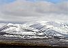
The Cairngorms are a mountain range in the eastern Highlands of Scotland closely associated with the mountain Cairn Gorm. The Cairngorms became part of Scotland's second national park on 1 September 2003. Although the Cairngorms give their name to, and are at the heart of, the Cairngorms National Park, they only form one part of the national park, alongside other hill ranges such as the Angus Glens and the Monadhliath, and lower areas like Strathspey.

<span class="mw-page-title-main">Lairig Ghru</span>

The Lairig Ghru is one of the mountain passes through the Cairngorms of Scotland. The route and mountain pass partially lies on the Mar Lodge Estate.

<span class="mw-page-title-main">Bynack More</span> Mountain in Scotland

Bynack More is a Scottish Mountain that is situated in the Cairngorms range, 16 kilometres east-south-east of the town of Aviemore in the Highland region.

<span class="mw-page-title-main">Derry Cairngorm</span>

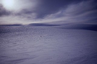
Derry Cairngorm is a Scottish mountain in the Cairngorms range, 14 kilometres (8.7 mi) north west of Braemar in the county of Aberdeenshire.

<span class="mw-page-title-main">Càrn a' Mhàim</span>

Càrn a' Mhàim is a Scottish mountain situated in the inner part of the Cairngorms range, some 15 kilometres west of Braemar in the county of Aberdeenshire.

<span class="mw-page-title-main">Stob Bàn (Grey Corries)</span>

Stob Bàn is a mountain situated in the Lochaber region of Highland, Scotland, 16 kilometres east of Fort William. It reaches a height of 977 metres (3205 feet) and lies in a group of hills known as the Grey Corries which includes three other Munros and nine Munro "Tops" along an eight kilometre ridge. The mountain's name translate as “White Peak”, while other sources give the translation as Light Coloured Peak with the hill being covered in light coloured schist scree, in contrast to the rest of the Grey Corries which are made up of grey quartzite scree. The mountain is a prominent conical shape, isolated from the rest of the group and distant from any main roads. It should not be confused with another Munro named Stob Bàn situated in the Mamores.

<span class="mw-page-title-main">Stob Coire Easain</span>

Stob Coire Easain is a Scottish Munro mountain which reaches a height of 1115 metres (3658 feet), situated 18 kilometres east of Fort William. It stands on the western side of Loch Treig, along with its "twin", the Munro Stob a' Choire Mheadhoin. Collectively the pair are called "The Easains" or the "Stob Corries" and stand just one kilometre apart connected by a high col with an approximate height of 965 metres. The fine corrie of Coire Easain Beag lies in between the two mountains facing north west. Stob Coire Easain’s name translates from the Gaelic as “Peak of the Corrie of the Little Waterfall”. This mountain should not be confused with another Stob Coire Easain, a Munro “Top” on the Munro Stob Coire an Laoigh

<span class="mw-page-title-main">Beinn Achaladair</span>

Beinn Achaladair is a Scottish mountain situated six kilometres north east of the hamlet of Bridge of Orchy. The mountain stands on the border of the Perth and Kinross and Argyll and Bute council areas.

<span class="mw-page-title-main">Meall Glas</span>

Meall Glas is a mountain situated in the southern highlands of Scotland. It stands on the northern border of the Loch Lomond and the Trossachs National Park, 8.5 kilometres north east of Crianlarich.

<span class="mw-page-title-main">Càrn Gorm</span>

Càrn Gorm is a mountain in the Breadalbane region of the Scottish Highlands, with a height of 1,029 metres (3,376 ft). It stands in a group of four Munro mountains known as the Càrn Mairg group or the Glen Lyon Horseshoe, on the north side of Glen Lyon, Perthshire.

<span class="mw-page-title-main">Càrn a' Gheòidh</span>

Càrn a' Gheòidh or Càrn Gheòidh is a mountain in the Mounth region of the Scottish Highlands. It lies 15 km south of the town of Braemar. Its summit stands on the border between the council areas of Perth and Kinross and Aberdeenshire.

<span class="mw-page-title-main">Stob Choire Claurigh</span>

Stob Choire Claurigh is a mountain in Lochaber in the Scottish Highlands, with a height of 1,177 metres (3,862 ft). It is part of the Grey Corries, near Ben Nevis, and lies about 16 km (10 mi) east of Fort William. It is described as one of the best ridge walks on the Scottish mainland.

Mar Lodge Estate is the largest remnant of the ancient Earldom of Mar in Aberdeenshire, Scotland and is now owned by the National Trust for Scotland.

<span class="mw-page-title-main">Beinn a' Chaorainn (Glen Spean)</span> Scottish mountain in the Lochaber region of the Highland Council area

Beinn a' Chaorainn is a Scottish mountain situated on the northern side of Glen Spean in the Lochaber region of the Highland Council area. The mountain which is located 30 km east-northeast of Fort William is one of several of the same name in the Scottish Highlands and should not be confused with another well known Beinn a' Chaorainn in the Cairngorms.

<span class="mw-page-title-main">Beinn Bhreac (Glen Derry)</span> Twin-peaked mountain in Scotland

Beinn Bhreac is a twin-peaked Scottish mountain located above Glen Derry in the Cairngorm Mountains approximately 11 kilometres (7 mi) north-west of Braemar.

<span class="mw-page-title-main">Loch A'an</span> A lake in the Highlands of Scotland

Loch A'an is a remote freshwater loch set deep within the central Cairngorms plateau, in the Cairngorms National Park, located in the eastern Highlands of Scotland. Loch A'an, also called Loch Avon, is the source of the River Avon. Loch A'an is oriented southwest–northeast and is bounded on three sides by precipitous mountains, cliffs and crags, with the North-East opening out to provide an outflow for the river through Glen Avon.

<span class="mw-page-title-main">Cairngorm Plateau disaster</span> Scottish mountaineering tragedy in 1971

The Cairngorm Plateau disaster, also known as the Feith Buidhe disaster, occurred in November 1971 when six fifteen-year-old Edinburgh school students and their two leaders were on a two-day navigational expedition in a remote area of the Cairngorms in the Scottish Highlands.

<span class="mw-page-title-main">Lairig an Laoigh</span> Major mountain pass in Cairngorms, Scotland

The Lairig an Laoigh is a mountain pass through the Highlands of Scotland. In speech and sometimes in writing the name is reduced to "Lairig Laoigh". It is of glacial origin, dissecting the Cairngorm plateau, and it runs roughly north–south from Speyside to Deeside at one time being used as a drove road. Between the public road in the Abernethy Forest and the one at Linn of Dee the trekking distance is 31 kilometres (19 mi).

<span class="mw-page-title-main">Beinn Mheadhoin (Cairngorms)</span> Mountain in Scotland

Beinn Mheadhoin or Beinn Meadhain is a mountain in the Highlands of Scotland. It is a Munro with a height of 1,182 metres (3,878 ft) and by some counts it is the twelfth-highest mountain of Great Britain. It lies in the very heart of the Cairngorm mountains, and is one of the most remote in the region. Beinn Mheadoin is surrounded by deep glens and mountain lakes, including Loch A'an, Loch Etchachan and the Dubh Lochan.

References

Footnotes

  1. "walkhighlands Beinn a'Chaorainn (Cairngorms)". walkhighlands.co.uk. 2013. Retrieved 21 December 2013.
  2. "Hamish's Mountain Walk" Page 136 Gives spelling as Beinn a' Chaoruinn.
  3. "The Magic of the Munros" Page 114 Gives details of translation.
  4. "The Munros" Page 121 Gives details of ascents.
  5. Corrigan, Peter. "A Lucky Break On Beinn a' Chaorainn". UKH. Retrieved 7 January 2014.

Coordinates: 57°05′38″N3°34′35″W / 57.0939°N 3.5764°W / 57.0939; -3.5764