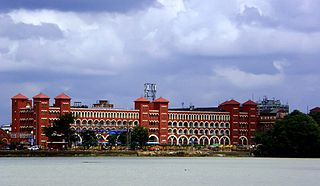
Howrah is a city in the Indian state of West Bengal. Howrah is located on the western bank of the Hooghly River, opposite its twin city of Kolkata. Administratively Howrah lies within Howrah district and is the headquarters of the Howrah Sadar subdivision; it is also part of the area covered by Kolkata Metropolitan Development Authority (KMDA). Howrah is an important industrial and transportation hub, and is also a gateway to Kolkata via Howrah railway station and Howrah Bridge.

Shibpur is a neighbourhood in Howrah of Howrah district in the Indian state of West Bengal. It is a part of the area covered by Kolkata Metropolitan Development Authority (KMDA).

Sodepur is a neighbourhood in Panihati of North 24 Parganas district in the Indian state of West Bengal. It is a part of the area covered by Kolkata Metropolitan Development Authority (KMDA).
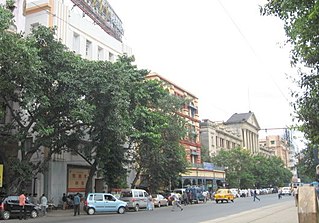
Esplanade is a neighbourhood of Central Kolkata, located at the heart of city with being the city's Central business district. This is a conventional esplanade because the Ganga river (Ganges), also known as Hooghly river, flows nearby and it is adjacent to the large fields of Maidan extending up to Fort William.
Kolkata the Capital of the Indian state of West Bengal has a good transportation system. Kolkata's transport system is diverse, with a mix of modern and traditional modes of transport catering to the city's large population.

Domjur is a census town in Domjur CD Block of Howrah Sadar subdivision in Howrah district in the Indian state of West Bengal.

Calcutta Tramways Company (CTC) was a state-run company that operated trams and buses in and around Kolkata in West Bengal, India. The Kolkata tram is the only operating tramway in India and is the oldest electric tram in India, operating since 1902.
Kantlia is a census town in Domjur CD Block of Howrah Sadar subdivision in Howrah district in the Indian state of West Bengal.
Makardah is a census town in Domjur CD Block of Howrah Sadar subdivision in Howrah district in the Indian state of West Bengal.

Nibra is a census town in Domjur CD Block of Howrah Sadar subdivision in Howrah district in the Indian state of West Bengal.

Belgharia is a neighbourhood in Kamarhati of North 24 Parganas district in the Indian state of West Bengal. It is a part of the area covered by Kolkata Metropolitan Development Authority (KMDA).

Kadamtala is a neighbourhood in Howrah of Howrah district in the Indian state of West Bengal. It is a part of the area covered by Kolkata Metropolitan Development Authority (KMDA). Kadamtala is under the jurisdiction of Bantra Police Station of Howrah City Police.

Joka is a locality in South Kolkata, West Bengal, India. It is a part of greater Behala region. This place is mostly known for Indian Institute of Management Calcutta and ESIC Medical College and Hospital.

Santragachi is a neighbourhood in Howrah of Howrah district in the Indian state of West Bengal. It is a part of the area covered by Kolkata Metropolitan Development Authority (KMDA). Santragachi Junction in Santragachi is one of the five intercity railway junctions of Howrah-Kolkata, which serves as a railway junction-cum-terminus for the South Eastern Railway. Kona Expressway in Santragachi is one of the major and fastest roads to enter Kolkata.

Ramrajatala is a neighbourhood in Howrah of Howrah district in the Indian state of West Bengal. It is a part of the area covered by Kolkata Metropolitan Development Authority (KMDA). Ramrajatala is under the jurisdiction of Chatterjeehat Police Station, Dasnagar Police Station and Jagacha Police Station of Howrah City Police.
Howrah City Police established in 2011, is a city police force with primary responsibilities in law enforcement and investigation in Howrah city and some of its adjacent areas in Howrah district. The Commissionerate is part of the West Bengal Police and is under the administrative control of Home Ministry of West Bengal. It was formed after the bifurcation of the Howrah Police District and has eighteen police stations under its jurisdiction as of now. Presently, P. K. Tripathi, IPS is appointed as the Commissioner of the Howrah Police Commissionerate.

Baghajatin is a locality of South Kolkata in the South 24 Parganas district in Indian state of West Bengal. It has been named in honour of Jatindranath Mukherjee whose nom de guerre was Bagha (Tiger) Jatin. It is located in the southern part of the city and is surrounded by Jadavpur and Santoshpur in the north, Chak Garia and Panchasayar in the east, Baishnabghata Patuli Township in the south and Bijoygarh and Regent Estate in the west. The locality is referred to as the middle-class and currently growing very well-off, upper-middle-class people's locality in South Kolkata. Though it is surrounded by its rich and famous areas, over the it still remains primarily a nice upper-middle-class neighbourhood. Apart from its critical location in south Calcutta, it is also a place inhabited by prominent people with strong social and cultural background. The two most important landmarks that signify this locality are Baghajatin railway station, Baghajatin bus terminal and EM Bypass which are the lifeline of this locality and its USP.

The Kolkata Tram System, is a LRT that serves Kolkata, the capital city of the Indian state of West Bengal, operated by West Bengal Transport Corporation (WBTC) after Calcutta Tramways Company (CTC) was merged with WBTC. Being started in 1873 Kolkata tram is the oldest operating tram network in the world. Being electrified in 1902, Calcutta became the first Asian City with electric tramway. The Kolkata Tram is the only tram system operating now in India. With the help of periodic negligence, the Government of West Bengal had formed systematic initiatives to suspend the entire tram network from the city and sell properties. However, an apolitical organization named Calcutta Tram Users Association (CTUA) was formed in 2016 to advocate in favor of Kolkata's tram system. The network initially had up to 37 lines in the 1960s, but has gradually reduced over the years with only two lines currently operating due to financial struggles, poor maintenance, low ridership, addition of road flyovers, expansion of the Kolkata Metro, slow tram speed and perceptions that the trams are outdated and occupy too much road space. Right now there are two tram routes running. They are -

Dum Dum Park is a neighbourhood in South Dumdum of North 24 Parganas district in the Indian state of West Bengal. It is a part of the area covered by Kolkata Metropolitan Development Authority (KMDA).
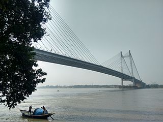
Kona Expressway is a 14.17-kilometre-long (8.80 mi) grade-separated highway in greater Kolkata, West Bengal, India. The highway have 4 general transit lanes with 2-4 service lanes while the 6 laned elevated expressway corridor is under construction. The road acts as important link to kolkata connecting National Highway 16 (India) near Nibra to Vidyasagar Setu, which leads to Kolkata. It is one of the most important entries to Kolkata. As of November 2022, the road carries more 70,000 vehicles per day.


