
Troyan is a town remembering the name of Roman Emperor Trajan, in Lovech Province in central Bulgaria with population of 21,997 inhabitants, as of December 2009. It is the administrative centre of the homonymous Troyan Municipality. The town is about 162 kilometres away from the country capital Sofia. The nearest civilian airport is Gorna Oryahovitsa, 105 kilometres away. The river of Beli Osam passes through the heart of the town. The 2011 Census indicates that the population of the Trojan was 21.194 inhabitants. The racial distribution of the inhabitants is ethnic Bulgarians (87.29%), with minorities being Roma (1.23%) and Turks (1.03%). The ethnicity for 10,21% of inhabitants is not known. Donka Mihaylova of Bulgarian Socialist Party has been the town's mayor since 2011.

The Iskar is a right tributary of the Danube. With a length of 368 km it is the longest river that runs entirely within Bulgaria. Originating as three forks in Balkan's highest mountain range Rila, it flows in northern direction until its confluence with the Danube River. As it flows northwards it fuels the largest artificial lake in the country, the Iskar Reservoir, forms the divide between the Vitosha and Plana Mountains in the west and the Sredna Gora mountain range in the east before entering the Sofia Valley, which contains the nation's capital Sofia. From there the Iskar runs through the Balkan Mountains forming the spectacular 84 km long Iskar Gorge and as it crosses the mountains its water course turns in north-eastern direction at Lakatnik. North of the Balkan Mountains the river crosses the Danubian Plain and finally flows into the Danube between the villages of Baykal and Gigen. Geologically, Iskar is the oldest river in the Balkan Peninsula.
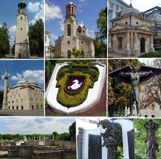
Razgrad is a city in Northeastern Bulgaria in the valley of the Beli Lom river that falls within the historical and geographical region of Ludogorie. It is an administrative center of Razgrad Province.

The Timok, sometimes also known as Great Timok, is a river in eastern Serbia, a right tributary of the Danube. For the last 15 km of its run it forms a border between eastern Serbia and western Bulgaria.

The Rusenski Lom is a river in northeastern Bulgaria, the last major right tributary of the Danube. It is formed by the rivers Beli Lom and Cherni Lom, the former taking its source south of Razgrad and the latter southeast of Popovo.

Ugarchin is a town located along the Kamenitsa river in the Lovech Province in central northern Bulgaria. It is the administrative centre of the homonymous Ugarchin Municipality. The town is about 30 kilometers away in the west from the main centre of the province - Lovech. As of December 2009, it has a population of 2,832 inhabitants.
Ribaritsa is a village in Teteven Municipality, Lovech Province. It lies at the foot of the Teteven Balkan Mountains, on the banks of the Beli Vit River, 12 kilometres from Teteven, 74 kilometres southwest of Lovech and 138 kilometres northeast of Sofia. Due to its mountainous location 701 metres above sea level, it is a popular mountain resort. As of 2015, it has a population of 1,064 and the mayor is Penka Ganeva (GERB)
Koynare is a town in northern Bulgaria, part of Cherven Bryag Municipality, Pleven Province. It lies on the left bank of the Iskar River, at one of the river's meanders. As of December 2009, the town has a population of 4,464 inhabitants.
Shtraklevo is a village in northern Bulgaria. It is located in municipality of Ivanovo in Rousse.

Vír is a village and municipality (obec) in Žďár nad Sázavou District in the Vysočina Region of the Czech Republic.
The Beli Timok is a headwater of the Timok River in Serbia. It starts at the junction of the Svrljiški Timok River and the Trgoviški Timok River, in Knjaževac. It was also known as Knjaževački Timok.
Beli Dol is a village in the municipality of Ivaylovgrad, in Haskovo Province, in southern Bulgaria.

Beli Dunav Metro Station is a station on the Sofia Metro in Bulgaria. It was put into operation on August 31, 2012. Bulgaria's PM Boyko Borisov and the President of the European Commission Jose Manuel Barroso inaugurated the new section of the Sofia Metro, which was funded with EU money.
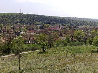
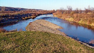
Krivnya is a village in northeastern Bulgaria, part of Vetovo Municipality, Ruse Province. Krivnya is picturesquely situated in the valley of the Beli Lom River in the western part of the Ludogorie located in the hilly Danubian Plain (Bulgaria). The village is surrounded by rock formations, among which the river meanders and divides the village into two parts. In the past the river flowed slowly making a big curve and forming a sort of peninsula. In the last century (1959) an artificial correction of the riverbed is made by using of explosions and the rock formation is "cut." Today this place is known as " Prosyakata." The altitude of the area ranges between 100 and 200 meters. Relief, except the rocky formations around the river is favorable for agriculture. The climate is continental with hot summers and cold winters. The village is located 3 km from the Ruse-Varna railway line and between the towns of Vetovo and Senovo, Ruse Province.
Beli plast is a village in Kardzhali Municipality, Kardzhali Province, southern Bulgaria.
Beli Osam is a village in Troyan Municipality, Lovech Province, northern Bulgaria.

Beli is a village in the Kočani Municipality, near the city of Kočani.


