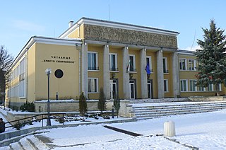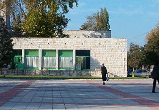
Opaka is a town in Targovishte Province in northeast Bulgaria. As of December 2009, the town had a population of 2,873 and covers an area of 57 square kilometres (22 sq mi). It is 70 kilometres (43 mi) south of the city of Rousse on the border with Romania and 250 kilometres (160 mi) northeast of the Bulgarian capital, Sofia. Archeologists have found evidence of Thracian, Roman and Slavonic settlements in the area. Near the village of Krepcha, a stone monastery is the site of the oldest known Old Bulgarian Cyrillic inscription, dated from around 920 CE. A 2nd century Thracian tumulus containing various artifacts, including six leaves of a golden wreath and bronze figurines, was excavated in 2011.

Zlatitsa is a town and the seat of the Zlatitsa Municipality in southern Bulgaria located in the Zlatitsa-Pirdop valley. It lies between Stara Planina to the north and Sredna Gora to the south at 680 metres (2,230 ft) above sea level. It is situated immediately south in the lap of the Zlatitsa -Teteven Mountain. Zlatitsa is situated 75 kilometres (47 mi) east of Sofia, 27 kilometres (17 mi) south of Etropole, 32 kilometres (20 mi) north of Panagiurishte, 2 kilometres (1.2 mi) west of Pirdop and 32 kilometres (20 mi) northwest of Koprivshtitsa. The population is 5,286.

Trastenik is a town in central northern Bulgaria, part of Dolna Mitropoliya municipality, Pleven Province. It lies 18 kilometres northwest of Pleven and 30 kilometres south of the Danube, between the Vit and Iskar rivers.

Gulyantsi is a town in central northern Bulgaria, part of Pleven Province. It is the administrative centre of Gulyantsi municipality and lies in the central north of the province, near the town of Nikopol, very close to the Danube River. As of December 2009, the town has a population of 3,432 inhabitants.

Zavet is a town in northeastern Bulgaria, part of Razgrad Province and located in the geographic region of Ludogorie. It is the administrative centre of the homonymous Zavet Municipality, which lies in the northern part of Razgrad Province. Zavet is situated in the western Ludogorie Plateau, 12 kilometres from Isperih and Kubrat and 35 kilometres from Tutrakan and Razgrad.

Slivo Pole is a town in northeastern Bulgaria, part of Rousse Province. It is the administrative centre of the homonymous Slivo Pole Municipality, which lies in the northeastern part of the Province. The town is located five kilometres from the Danube, along the main road from Rousse to Silistra. As of December 2009, it has a population of 3,169 inhabitants.

Suvorovo is a town in northeastern Bulgaria, part of Varna Province. It is the administrative centre of the homonymous Suvorovo Municipality, which lies in the northwestern part of the Province. The town is located in the southwestern part of the Dobruja plateau, 34 kilometres (21 mi) northwest of the provincial capital of Varna, 56 kilometres (35 mi) southwest of Dobrich and 59 kilometres (37 mi) east of Shumen. As of December 2009, it has a population of 4,723 inhabitants.

Dimovo is a town in northwestern Bulgaria, part of Vidin Province. It is the administrative centre of the homonymous Dimovo Municipality, which lies in the eastern part of Vidin Province, 30 kilometres from Vidin at the Danube and 50 kilometres from Bregovo at the Timok River and the Serbian border. As of December 2009, Dimovo has a population of 1,211 inhabitants.

Avramovo is a village in Ardino Municipality, Kardzhali Province, in southern-central Bulgaria. It is located 187.5 kilometres (116.5 mi) from Sofia, roughly 14 kilometres (8.7 mi) by road southwest of the city of Kardzhali, and roughly 20 kilometres (12 mi) by road east of the municipal town of Ardino.Boyno lies just to the east along the 865 road. It covers an area of 6.197 square kilometres (2.393 sq mi) and as of 2007 had a population of 6 people. Until 1934, the settlement had the name Ibrahimler.

Borovitsa is a village in Ardino Municipality, Kardzhali Province, southern-central Bulgaria. It is located 194.207 kilometres (120.675 mi) from Sofia. It covers an area of 12.667 square kilometres and as of 2007 had a population of 297 people.

Pravdolyub is a village in Ardino Municipality, Kardzhali Province, southern-central Bulgaria. It is located 205.476 kilometres (127.677 mi) southeast of Sofia. It covers an area of 4.436 square kilometres and as of 2007 it had a population of 204 people.

Sedlartsi is a village in Ardino Municipality, Kardzhali Province, southern-central Bulgaria. It is located 190.742 kilometres (118.522 mi) southeast of Sofia. It covers an area of 1.837 square kilometres and as of 2007 it had a population of 118 people.

Bosilitsa is a village in Chernoochene Municipality, in Kardzhali Province, in southern-central Bulgaria. It is located 188.843 kilometres (117.342 mi) southeast of Sofia. It covers an area of square kilometres and as of 2007 it had a population of 15 people.

Bostantsi is a village in Chernoochene Municipality, in Kardzhali Province, in southern-central Bulgaria. It is located 199.279 kilometres (123.826 mi) southeast of Sofia. It covers an area of 1.16 square kilometres and as of 2007 it had a population of 90 people.

Gabrovo is a village in Chernoochene Municipality, in Kardzhali Province, in southern-central Bulgaria. It is located 188.153 kilometres (116.913 mi) southeast of Sofia. It covers an area of 12.777 square kilometres and as of 2007 it had a population of 744 people.

Kanyak is a village in Chernoochene Municipality, in Kardzhali Province, in southern-central Bulgaria. It is located 192.274 kilometres (119.474 mi) southeast of Sofia. It covers an area of 5.697 square kilometres and as of 2007 it had a population of 205 people.

Kutsovo is a village in Chernoochene Municipality, in Kardzhali Province, in southern-central Bulgaria. It is located 186.664 kilometres (115.988 mi) southeast of Sofia. It covers an area of 3.74 square kilometres and as of 2007 it had a population of 12 people.

Lyaskovo is a village in Chernoochene Municipality, in Kardzhali Province, in southern-central Bulgaria. It is located 191.676 kilometres (119.102 mi) southeast of Sofia. It covers an area of 5.668 square kilometres and as of 2007 it had a population of 646 people.

The Bulgaria–Turkey border is a 269 km (167 mi) long international border between the Republic of Bulgaria and the Republic of Turkey. It is the third longest border of Turkey, after Syria and Iran, and the shortest border of Bulgaria.


