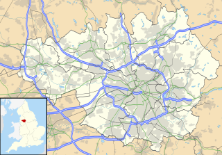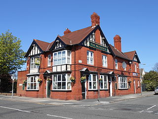
Hampton is a developing township to the south of Peterborough, Cambridgeshire in the United Kingdom.

Donabate is a small coastal town in Fingal, Ireland, about 20 kilometres north-northeast of Dublin. The town is on a peninsula on Ireland's east coast, between the Rogerstown Estuary to the north and Broadmeadow Estuary to the south. Donabate is a civil parish in the ancient barony of Nethercross.

Netherley is an area in the city of Liverpool, Merseyside, England. It is bordered by Belle Vale and situated near to Huyton, Tarbock and Halewood.

Blakenhall is a suburb and ward in Wolverhampton, England.

The Millennium Ribble Link is a Linear Water Park and new navigation which links the once-isolated Lancaster Canal in Lancashire, England to the River Ribble. It was opened in July 2002.

Edmonton is a district in North London in the London Borough of Enfield, England, 8.4 miles (13.5 km) north-northeast of Charing Cross. The population of all of Edmonton was 82,472 as of 2011.

Brinnington is a north-eastern suburb of Stockport, Greater Manchester, England, on a bluff above a bend in the Tame Valley. It was reported to have the highest prevalence of depression in England.
Manly Vale is a suburb of northern Sydney, in the state of New South Wales, Australia 17 kilometres north-east of the Sydney central business district in the local government area of Northern Beaches Council, in the Northern Beaches region.

Belle Vale is a district of south-east Liverpool, Merseyside, England and a Liverpool City Council Ward that covers both Belle Vale and Netherley.

Crumpsall Park is a small municipal park in the Crumpsall ward of Manchester, North West England.
Fryent Country Park together with Barn Hill Open Space is a large park situated in the north of the London Borough of Brent. It covers 103 hectares of rolling fields and small woods.

Drinkwater Park is situated in the Irwell Valley on the western border of Prestwich, near Manchester, bounded by the River Irwell to the west, Agecroft Road and Rainsough Brow (A6044) to the south, Butterstile Lane and Carr Clough estate to the east and Bunkers Hill to the north. The park is administered by Bury Metropolitan Borough Council and is part of Prestwich Forest Park, which also incorporates Philips Park, Mere Clough, Prestwich Clough, Forest Bank Park in Pendlebury and Waterdale Meadow.
Sele Farm is an area on the north-western edge of Hertford, Hertfordshire.

Orrell Park is a district of Liverpool, Merseyside, England. It is a small residential area of northern Liverpool between the larger neighbouring districts of Aintree and Walton-on-the-Hill. It is part of the Liverpool Walton Parliamentary constituency. The area is built upon a raised hillock.

Gateacre School is a secondary school and sixth form located in Belle Vale, Liverpool, England. The school is Coeducational with both male and female pupils from years 7 to 11 and throughout the sixth form.
The Blue Angel, also known as "The Raz" is a nightclub in Liverpool, England. It is located where Seel Street meets Berry Street in Liverpool City Centre. It is a venue in Liverpool in which the Beatles, Rolling Stones, Bob Dylan and many other bands played at in the 1960s. It was historically a jazz club, but it now plays pop music.
Belle Vale is a Liverpool City Council ward in the Garston and Halewood Parliamentary constituency. The population of the ward at the 2011 census was 15,004. It was formed for the 2004 municipal elections from the former Valley and Netherley wards.

Shorne Wood Country Park is near Gravesend, Kent, England. It was once part of a large estate and then later passed to the county council to be used as a country park.

High Town is a hilly inner-city district of Luton adjacent to Luton railway station. The area is roughly bounded by Richmond Hill and the northern edge of People's Park/Pope's Meadow to the north, the Midland Main Line to the south, the A6 to the west, and Hitchin Road to the east.


