
Covarrubias is a village and municipality in the province of Burgos in the Spanish autonomous community of Castile and León. It has 640 inhabitants, and it is near to Mecerreyes, Cubillo del Campo and Hortigüela. Covarrubias is situated in the valley of the river Arlanza, which is extensively wooded with among other species Spanish Juniper. Part of the area belonging to the municipality is included within a Special Protection Area for bird-life such as vultures.

Puente la Reina is a town and municipality located in the autonomous community of Navarre, in northern Spain.

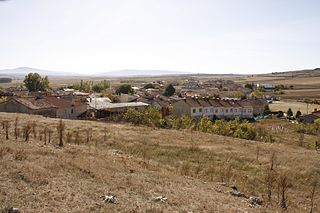
San Adrián is a town and municipality located in the province and autonomous community of Navarre, northern Spain. There was an ancient monastery dedicated to San Adrián y la Virgen de la Palma there, after which the village is named.
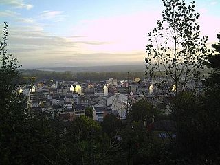
Sarria is a municipality in the province of Lugo, in the autonomous community of Galicia, northwestern Spain. It belongs to the comarca of Sarria. Sarria is the most populous town on the French Way in Galicia, with 13,700 inhabitants and the major is Carmen José Lòpez. It is head of the region and the most popular starting point for the Camino de Santiago; many pilgrims choose Sarria because the distance from this point to Santiago allows them to cover the necessary kilometers to reach the Compostela. King Alfonso IX of León died in Sarria in 1230 while making a pilgrimage to Santiago de Compostela.
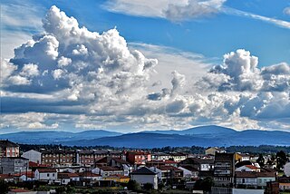
Arzúa is a municipality in the province A Coruña, in the autonomous community of Galicia, northwestern Spain. It has an area of 155.89 km2, a population of 6,315, and a population density of 40.64 people/km2. It is one of the Galician municipalities with more cows per capita rate in Galicia.
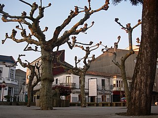
Melide is a municipality in the province of A Coruña in the autonomous region of Galicia in northwest Spain. It belongs to the comarca of Terra de Melide. It has an area of 101 km2 and a population of 9,000 inhabitants mostly spread among its 26 parishes. It has an elevation of 456 meters.

The French Way follows the GR 65 and is the most popular of the routes of the Way of St. James, the ancient pilgrimage route to Santiago de Compostela in Galicia, Spain. It runs from Saint-Jean-Pied-de-Port on the French side of the Pyrenees to Roncesvalles on the Spanish side and then another 780 km on to Santiago de Compostela through the major cities of Pamplona, Logroño, Burgos and León. A typical walk on the Camino francés takes at least four weeks, allowing for one or two rest days on the way. Some travel the Camino on bicycle or on horseback.
The municipality of Boñar is located in the province of León, Castile and León, Spain. As per the 2010 census (INE), the municipality has a population of 2,085 inhabitants with almost all of the residents living in the main town of Boñar. In addition to Boñar, the municipality includes the villages of Adrados, Barrio de las Ollas, Las Bodas, Cerecedo, Colle, Llama, Felechas, Grandoso, Orones, Oville, Poblado del Pantano, Remellán, Rucayo, Valdecastillo, Valdehuesa, La Vega de Boñar, Veneros, Vozmediano, and Voznuevo. Most surrounding villages in the municipality of Boñar have between 10 and 30 permanent residents, but some of the larger villages have up to 250 villagers.

Calzada del Coto is a municipality located in the province of León, Castile and León, Spain. According to the 2023 census (INE), the municipality has a population of 222 inhabitants.
Mansilla de las Mulas, Mansiella in Leonese language, is a municipality located in the province of León, Castile and León, Spain. According to the 2010 census (INE), the municipality has a population of 1,913 inhabitants.

Cubillo del Campo is a municipality located in the province of Burgos, Castile and León, Spain.

Rabé de las Calzadas is a municipality and town located in the province of Burgos, Castile and León, Spain. According to the 2004 census (INE), the municipality had a population of 154 inhabitants.

Redecilla del Camino is a municipality and town located in the province of Burgos, Castile and León, Spain. According to the 2004 census (INE), the municipality has a population of 148 inhabitants.
Santa Olalla de Bureba is a municipality and town located in the province of Burgos, Castile and León, Spain. According to the 2004 census (INE), the municipality has a population of 33 inhabitants.

Tosantos is a municipality and town located in the province of Burgos, Castile and León, Spain. According to the 2004 census (INE), the municipality has a population of 60 inhabitants. Tosantos is located on the Camino de Santiago de Compostela, a 1200-year-old pilgrimage route that runs through France and Northern Spain to the Spanish city of Santiago. The hamlet has a pilgrim hostel which is open from April through October and hosts up to 50 pilgrims a night.

Villamiel de la Sierra is a municipality located in the province of Burgos, Castile and León, Spain. According to the 2004 census (INE), the municipality has a population of 38 inhabitants.
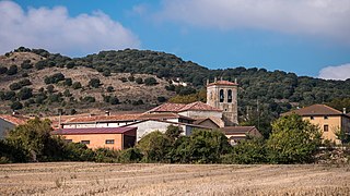
Atapuerca is a municipality and town located in the province of Burgos, Castile and León, Spain. It encompasses the Archaeological Site of Atapuerca and is famous for its prehistoric archaeological sites. The municipality is made of two villages: Atapuerca and Olmos de Atapuerca.
Puras de Villafranca, also known as Puras, is a village in the municipality of Belorado in the region of Montes de Oca, with historical links to Villafranca Montes de Oca.

Moratinos, is a town in Palencia, Spain which is located about 67 kilometers northwest of the capital of the province. It is best known to outsiders for "el castillo de Moratinos", an ages-old hill in the town center studded with family owned wine-storage caves.
The town of Villa Madero is a municipal seat in the municipality of Madero in the Mexican state of Michoacán. It was established in 1868 with the name of Cruz de Caminos. According to tradition the first inhabitant of the place was a man named Armas, he is now considered the town's founder. The land where the town currently sits belonged to La Hacienda De La Concepcion. The village is the point of intersection of the paths that lead to Acuitzio, Etucuaro, Curuchancio and Tacambaro, this is why it became known as Cruz De Caminos.


