Bentinck Island, Queensland

Last updated

Bentinck Island, Queensland
Australia Queensland location map.svg
Red pog.svg
Bentinck Island
Geography
Location Queensland
Coordinates 17°03′36″S139°30′00″E / 17.06000°S 139.50000°E / -17.06000; 139.50000 Coordinates: 17°03′36″S139°30′00″E / 17.06000°S 139.50000°E / -17.06000; 139.50000
Adjacent to Gulf of Carpentaria
Administration
State Queensland
Capital and largest city Brisbane
Area covered180 km2 (69 sq mi)
Demographics
Population0 (2016) [1]
Additional information
Time zone
  • Australian Central Standard Time (ACST)
ISO code AUS
Southern part of Bentinck Island and Albinia Island Bentinck Island 04.jpg
Southern part of Bentinck Island and Albinia Island
Bentinck Island with the Australian continent in the background Bentinck Island 01.jpg
Bentinck Island with the Australian continent in the background
Location of Bentinck Island Locator map of Bentinck Island.jpg
Location of Bentinck Island

Bentinck Island is one of the South Wellesley Islands, in Queensland's Gulf of Carpentaria. The traditional home of the Kaiadilt people, the island was the site of a brutal massacre in 1918 known as the McKenzie massacre, in which many Indigenous inhabitants died.

Contents

History

For thousands of years, the Kaiadilt tribal group of Aboriginal Australians lived in near-isolation on the island, speaking their Kayardild language. Their original name for the island is not definitely known. Explorer Matthew Flinders charted the islands in the gulf in 1802 and assigned European names to the island groups (Wellesley and South Wellesley Islands) and the largest island of the Wellesley Island group (Mornington Island) in honour of Richard Wellesley, 2nd Earl of Mornington and Governor-General of India, as well as Bentinck Island, [2] in honour of Lord William Bentinck, then Governor of Madras, India. [3] [4] In 1803, the two men had interceded on Flinders's behalf to persuade the French to release Flinders after he had been imprisoned by them on Mauritius. [5]

The people of Bentinck Island would visit Allens Island and Sweers Islands on hunting and gathering expeditions; women gathered "tjilangind" (small rock oysters), "kulpanda" (arca clams) and crabs, while the men hunted fish, turtle, sharks and dugong, using spears. They used "rafts formed from logs tied together with strings of plaited bark" for transport among the islands. [6]

In 1861, HMVS Victoria and the Firefly, carrying the William Landsborough search party for Burke and Wills, formed a land base on Sweers Island after visiting Bentinck, which was inhabited by "hostile blacks". [6]

Sometime around 1916, a man remembered only as McKenzie came to Bentinck Island and set up a sheep run, basing himself on a site at the mouth of the Kurumnbali estuary. He would ride over the island, accompanied by a pack of dogs, and shoot any Kaiadilt man who came within sight; in local memory, he murdered at least 11 people. He also kidnapped and raped native girls. He then moved to Sweers Island, and set up a lime kiln there. The Kaiadilt managed to return to Sweers only on McKenzie's departure. The massacre was only recorded by researchers in the 1980s. [7] [8]

The Kaiadilt people continued to live according to their traditional way of life until the 1940s, which included fishing for mullet and harvesting fruit from the mangroves, and obtaining fresh water by digging in swamps. In the 1940s, Presbyterian missionaries arrived and started relocating the people to their mission station on Mornington Island, the biggest island in the Wellesley Islands group. At this time there were fewer than 100 Kaiadilt people living on the island. The missionaries separated the children from their parents and placed them into separate dormitories for boys and girls, while their parents built humpies around the mission. It was ten years after the relocation, completed in 1948, before one of the removed Kaiadilt woman gave birth to a child who survived. [2] The final relocation was spurred by the pollution of the islanders' water supply by seawater. [5]

In 1960 and 1962, anthropologist Norman Tindale accompanied several Kaiadilt elders back to Bentinck Island to record genealogies and map the island, listing more than 300 place names. He recorded the name of the island as "Dulka Warngiid" (or Dulkawalnged [6] ), which he translated as "the land of all". [2] [6]

In the early 1980s, linguist Nicholas Evans visited Mornington and Bentinck Islands to document the Kayardild language, of which there were 45 fluent speakers left. [2]

In 1986, an outstation was established at Nyinyilki, on the south-eastern corner of the island. Over time, a small township, which included homes, a shop and airstrip were built, and through the 1990s a small group, mostly elders caring for young children, lived there, causing it to be nicknamed the "old ladies' camp". [2]

Today

There are no permanent inhabitants on the island. Some of the women from the "old ladies' camp", after moving to Mornington Island again in the 21st century, formed the Kaiadilt art movement, led by Sally Gabori (c.1924–2015). They mapped their traditional lands in their artwork. [2] Those who are young and fit enough to visit the island still do so. The men and boys visit in family groups to catch turtle and dugong in the waters of the island, and the state school and art centre on Mornington Island are working with Kaiadilt elders to help revive their language and culture. The people remain deeply connected to the island, although they acknowledge that there is no possibility of moving back there. [2]

Geography

The island has an area of around 180 km2 (69 sq mi), consisting of mainly arid land, with reefs off the coast. [2]

Notable people

See also

Related Research Articles

<span class="mw-page-title-main">Gulf of Carpentaria</span> Gulf of Australia

The Gulf of Carpentaria is a large, shallow sea enclosed on three sides by northern Australia and bounded on the north by the eastern Arafura Sea. The northern boundary is generally defined as a line from Slade Point, Queensland in the northeast, to Cape Arnhem on the Gove Peninsula, Northern Territory in the west.

<span class="mw-page-title-main">Mornington Island</span> Island off the coast of Australia

Mornington Island, also known as Kunhanhaa, is an island in the Gulf of Carpentaria in the Shire of Mornington, Queensland, Australia. It is the northernmost and largest of 22 islands that form the Wellesley Islands group. The largest town, Gununa, is in the south-western part of the island.

<span class="mw-page-title-main">Wellesley Islands</span> Suburb of Shire of Mornington, Queensland, Australia

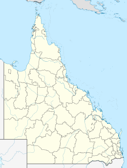
The Wellesley Islands, also known as the North Wellesley Islands, is a group of islands off the coast of Far North Queensland, Australia, in the Gulf of Carpentaria. It is a locality within the Shire of Mornington local government area. The traditional owners of the islands are the Lardil people. In the 2016 census, the Wellesley Islands had a population of 1,136 people, all living on the largest island, Mornington Island.

Nicholas "Nick" Evans is an Australian linguist and a leading expert on endangered languages. He was born in Los Angeles, USA.

<span class="mw-page-title-main">Shire of Mornington (Queensland)</span> Local government area in Queensland, Australia

The Shire of Mornington is a local government area in northwestern Queensland, Australia. The shire covers the Wellesley Islands, which includes Mornington Island; the South Wellesley Islands; Bountiful Islands; and West Wellesley / Forsyth Islands groups in the Gulf of Carpentaria.

<span class="mw-page-title-main">Lardil language</span> Australian Aboriginal language

Lardil, also spelled Leerdil or Leertil, is a moribund language spoken by the Lardil people on Mornington Island (Kunhanha), in the Wellesley Islands of Queensland in northern Australia. Lardil is unusual among Aboriginal Australian languages in that it features a ceremonial register, called Damin. Damin is regarded by Lardil-speakers as a separate language and has the only phonological system outside Africa to use click consonants.

<span class="mw-page-title-main">Kayardild language</span> Australian Aboriginal language

Kayardild is a moribund Tangkic language spoken by the Kaiadilt on the South Wellesley Islands, north west Queensland, Australia, with fewer than ten fluent speakers remaining. Other members of the family include Yangkaal, Lardil, and Yukulta (Ganggalidda). It is famous for its many unusual case phenomena, including case stacking of up to four levels, the use of clause-level case to signal interclausal relations and pragmatic factors, and another set of 'verbal case' endings which convert their hosts from nouns into verbs morphologically.

<span class="mw-page-title-main">Gulf Country</span> Region in Queensland, Australia

The Gulf Country is the region of woodland and savanna grassland surrounding the Gulf of Carpentaria in north western Queensland and eastern Northern Territory on the north coast of Australia. The region is also called the Gulf Savannah. It contains large reserves of zinc, lead and silver. The Gulf Country is crossed by the Savannah Way highway.

<span class="mw-page-title-main">South Wellesley Islands</span> Suburb of Shire of Mornington, Queensland, Australia

The South Wellesley Islands is an island group and locality in the Gulf of Carpentaria within the Shire of Mornington, Queensland, Australia. The group is separate from the Wellesley Islands.

Dick Roughsey was an Australian Aboriginal artist from the Lardil language group on Mornington Island in the south-eastern Gulf of Carpentaria, Queensland. His tribal name was Goobalathaldin, meaning “the ocean, dancing”, describing a “rough sea”. He was an active and prominent figure involved in reviving and preserving the cultural life of the Lardil people. His best known works are a series of children's picture books that retell traditional Aboriginal stories including “The Rainbow Serpent”.

Salomon Sweers was a bookkeeper and a counsel for the Dutch East India Company. His younger brother was Admiral Isaac Sweers employed by the Admiralty of Amsterdam.

<span class="mw-page-title-main">Quandamooka people</span>

The Quandamooka people are Aboriginal Australians who live around Moreton Bay in Southeastern Queensland. They are composed of three distinct tribes, the Nunukul, the Goenpul and the Ngugi, and they live primarily on Moreton and North Stradbroke Islands, that form the eastern side of the bay. Many of them were pushed out of their lands when the English colonial government established a penal colony near there in 1824. Each group has its own language. A number of local food sources are utilised by the tribes.

<span class="mw-page-title-main">Sweers Island</span>

Sweers Island is an island in the South Wellesley Islands in the Gulf of Carpentaria, Queensland, Australia. Privately owned via a perpetual lease and with the only residents being the owners and workers at the resort, the island is within the Shire of Mornington.

The Lardil people, who prefer to be known as Kunhanaamendaa, are an Aboriginal Australian people and the traditional custodians of Mornington Island in the Wellesley Islands chain in the Gulf of Carpentaria, Queensland.

The Kaiadilt are an Aboriginal Australian people of the South Wellesley group in the Gulf of Carpentaria, Queensland, Australia. They are native to Bentinck Island, but also made nomadic fishing and hunting forays to both Sweers and Allen Islands. Most Kaiadilt people now live on Mornington Island, although one group has returned to Bentinck Island.

David McKnight was a Canadian-British anthropologist and ethnographer who specialized in the anthropology of Australian Aboriginal people, with particular regard to the tribes of the Cape York Peninsula. He conducted over 20 field trips among Aboriginal people in Australia from 1965 to 1999.

<span class="mw-page-title-main">Butchulla</span>

The Butchulla, also written Butchella, Badjala, Badjula, Badjela, Bajellah, Badtjala and Budjilla are an Aboriginal Australian people of K'gari, Queensland, and a small area of the nearby mainland of southern Queensland.

Mirdidingkingathi Juwarnda Sally Gabori was an Aboriginal Australian artist who at age 81 began painting in an abstract-like style she developed to represent her Country, on the south side of Bentinck Island in Queensland, Australia.

References

  1. Australian Bureau of Statistics (27 June 2017). "South Wellesley Islands (SSC)". 2016 Census QuickStats. Retrieved 20 October 2018. OOjs UI icon edit-ltr-progressive.svg
  2. 1 2 3 4 5 6 7 8 Milton, Vanessa (19 February 2022). "Bentinck Island's 'last people' fight for their homeland after a lifetime of dispossession". ABC News (Australian Broadcasting Corporation). Retrieved 24 February 2022.
  3. "Sweers Island". State Library Of Queensland . 29 September 2014. Retrieved 26 February 2022.
  4. Cox, J. (2022). Dillon: The drove to Port Darwin: Northern Territory Australia 1872. BookPOD. p. 266. ISBN   978-1-922270-74-0 . Retrieved 26 February 2022.
  5. 1 2 "Mornington Shire". Queensland Places. Centre for the Government of Queensland, University of Queensland . Retrieved 26 February 2022.
  6. 1 2 3 4 Saenger, Peter. "Sweers Island History Article: Part I". Dropbears. Retrieved 26 February 2022.
  7. Bruce Elder (1998). Blood on the Wattle: Massacres and maltreatment of Aboriginal Australians since 1788. New Holland Publishers. p. 203-206. ISBN   1-86436-410-6.
  8. Kelly, Roma; Evans, Nicholas (1985). "The McKenzie massacre on Bentinck Island" (PDF). Aboriginal History. 9 (1). Archived (PDF) from the original on 11 February 2020. Retrieved 13 April 2020.