
Weiden an der March is a municipality in the district of Gänserndorf in Lower Austria, Austria.

Klingenbach is a town in the Eisenstadt-Umgebung district in the Austrian state of Burgenland. It is located near the border with Hungary with a border crossing into Sopron.

Kittsee is an Austrian municipality in the District of Neusiedl am See, Burgenland.

Raabs an der Thaya is a municipality with 3,114 inhabitants in Waidhofen an der Thaya (district) in the Waldviertel of Lower Austria, near the Austrian border with the Czech Republic. About 27.6 percent of the municipality is forested.

Nickelsdorf is a town in the district of Neusiedl am See in the Austrian state of Burgenland.

Schachendorf is a town in the district of Oberwart in Burgenland in southeast Austria. According to the last census, 73% of the population are members of the Burgenland Croat minority, and 5% belong to the Hungarian minority.

Berg im Drautal is a village and municipality in the district of Spittal an der Drau in the Austrian state of Carinthia.
Wolfsthal is a town in the district of Bruck an der Leitha in Lower Austria in Austria. It along with neighboring Berg were part of the municipality of Wolfsthal-Berg until 1996. It is the end of the line for S7 Vienna S-Bahn trains.

Angern an der March is a market town in the district of Gänserndorf in the Austrian state of Lower Austria. The municipality consists of the Katastralgemeinden Angern, Grub, Mannersdorf, Ollersdorf and Stillfried.

Drösing is a town in the district of Gänserndorf in the Austrian state of Lower Austria.

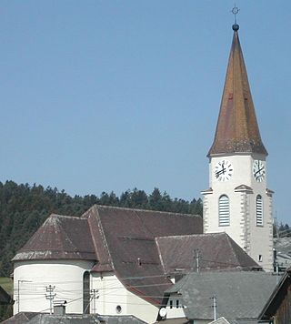
Dürnkrut is a market town in the district of Gänserndorf in the Austrian state of Lower Austria. Castle Dürnkrut (pictured) is the most famous landmark of the town. The town is agricultural with some noteworthy businesses. Crops grown in the flatter areas are canola, corn, sunflowers and sugar beets. The rolling hills are planted with wine grapes by local vintners.
Hohenau an der March is a town in the district of Gänserndorf in the Austrian state of Lower Austria, close to Vienna and the borders with the Czech Republic and Slovakia.

Marchegg is a town in the district of Gänserndorf in the Austrian state of Lower Austria at the Slovak border formed by the Morava River. The town is connected to Vysoká pri Morave via a bike bridge. The Marchegg castle is located in the town.
Ringelsdorf-Niederabsdorf is a town in the district of Gänserndorf in the Austrian state of Lower Austria.

Kals am Großglockner is a municipality in the district of Lienz in the exclave of East Tirol in the Austrian state of Tyrol.

Ulrichsberg is a municipality in the district of Rohrbach in the Austrian state of Upper Austria.

Kirchberg ob der Donau is a municipality in the district of Rohrbach in the Austrian state of Upper Austria.
Oberkappel is a municipality in the district of Rohrbach in the state of Upper Austria.
Bad Leonfelden is a municipality in the district of Urfahr-Umgebung in the Austrian state of Upper Austria. Steven Beller, author of A Concise History of Austria, who has family links to Bad Leonfelden, cites episodes from the town's history from its foundation in 1292 to the 21st century, to demonstrate the impact of historical and political events on the local life in Austria's rural provinces. The Jugendstil mosaicist Leopold Forstner was born there.

Berg im Attergau is a municipality in the district of Vöcklabruck in the Austrian state of Upper Austria.


