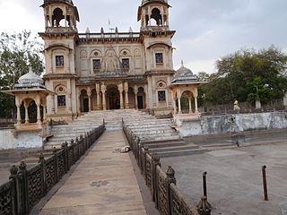
Shivpuri District is a district of Madhya Pradesh state of India. The town of Shivpuri is the district headquarters. National Highway 3 (NH-3) runs through the district.

The Gambia is subdivided into 43 districts. They are listed below by Local Government Area, each with its population at the 15 April 2013 census.

Nianija is one of the ten districts of the Central River Division of the Gambia. In the 2013 census, it had a population of 10,175.

Jarra Central is one of the six districts of the Lower River Division of the Gambia. In the 2013, it had a population of 8,437.

Jarra East is one of the six districts of the Lower River Division of the Gambia. In the 2013 census, it had a population of 16,551.

Jarra West is one of the six districts of the Lower River Division of the Gambia. In the 2013 census, it had a population of 27,205.

Kiang was a historical kingdom in what is now the West African state of The Gambia and also the name of the region it covered. The area is now the districts of Kiang Central, Kiang East, and Kiang West in the Lower River Division of the present-day country. The Kiang West National Park is also on the territory of the former empire.
Bamakuno Forest Park, or Bama Kuno, is a forest park in the Gambia. Established on January 1, 1954, it covers 1092 hectares. It is located 25 km to the south east of Brikama town in The Gambia.
Belel Forest Park is a forest park in the Gambia. Established on January 1, 1954, it covers 449.2 hectares.
Brikama Forest Park is a forest park in the Gambia. Established on January 1, 1954, it covers 357 hectares.
Furnya Forest Park is a forest park in the Gambia. Established on January 1, 1954, it covers 405 hectares.
Kabafita Forest Park is a forest park in the Gambia. Established on January 1, 1954, it covers 243 hectares.
Kaolang Forest Park is a forest park in the Gambia. Established on January 1, 1954, it covers 2379 hectares.
Kusum Forest Park is a forest park in the Gambia. Established on January 1, 1954, it covers 316 hectares.
Sabi Forest Park is a forest park in the Gambia. Established on January 1, 1954, it covers 73 hectares. It belongs to the Uper River Region (URR) and is about 5 kilometers from Basse Santa Su, which is the administrative seat of the region.
Nianimaru Forest Park is a forest park in the Gambia. Established on January 1, 1954, it covers 607 hectares.
Katilenge Forest Park is a forest park in the Gambia. It covers 324 hectares. The border with Senegal forms the southern border of the forest area.
Kenowore Forest Park is a forest park in the Gambia. It covers 67 hectares.
Kumadi Forest Park is a forest park in the Gambia. It covers 283 hectares.


