Berkhout

Last updated • 1 min readFrom Wikipedia, The Free Encyclopedia

Berkhout
Village
Kerkebuurt 172 Ned.Herv. Kerk 22-10-11 .3.JPG
Dutch Reformed church
Netherlands location map.svg
Red pog.svg
Berkhout
Location in the Netherlands
2010-NL-P07-Noord-Holland-positiekaart-gemnamen.jpg
Red pog.svg
Berkhout
Location in the province of North Holland in the Netherlands
Coordinates: 52°38′31″N4°59′49″E / 52.64194°N 4.99694°E / 52.64194; 4.99694 Coordinates: 52°38′31″N4°59′49″E / 52.64194°N 4.99694°E / 52.64194; 4.99694
Country Netherlands
Province North Holland
Municipality Koggenland
Area
[1]
  Total18.33 km2 (7.08 sq mi)
Elevation
[2]
−2.3 m (−7.5 ft)
Population
 (2021) [1]
  Total2,605
  Density140/km2 (370/sq mi)
Time zone UTC+1 (CET)
  Summer (DST) UTC+2 (CEST)
Postal code
1647 [1]
Dialing code 0229

Berkhout is a village in the northwest Netherlands. It is in the municipality of Koggenland, North Holland, about 5 km (3 mi) west of Hoorn.

Contents

History

The village was first mentioned around 1312 as Berchout, and means "deciduous forest of birch ( Betula ) trees". [3] Berkhout developed in the 13th century as a peat excavation village. [4]

The Dutch Reformed church is a T-shaped church in Renaissance Revival style built in 1884. The tower was added in 1886. [4]

Berkhout was home to 766 people in 1840. It was an independent municipality until 1979 when it was merged into Wester-Koggenland. In 2007, it became part of the municipality of Koggenland. [5]

Notable people

Climate

Climate data for Berkhout (1991−2020 normals, extremes 1999−present)
MonthJanFebMarAprMayJunJulAugSepOctNovDecYear
Record high °C (°F)13.6
(56.5)
18.0
(64.4)
22.3
(72.1)
27.1
(80.8)
29.8
(85.6)
32.5
(90.5)
35.7
(96.3)
33.0
(91.4)
29.7
(85.5)
25.0
(77.0)
19.1
(66.4)
14.4
(57.9)
35.7
(96.3)
Average high °C (°F)5.9
(42.6)
6.5
(43.7)
9.5
(49.1)
13.7
(56.7)
17.3
(63.1)
19.7
(67.5)
22.0
(71.6)
21.9
(71.4)
18.8
(65.8)
14.4
(57.9)
9.7
(49.5)
6.7
(44.1)
13.8
(56.8)
Daily mean °C (°F)3.6
(38.5)
3.7
(38.7)
6.0
(42.8)
9.1
(48.4)
12.8
(55.0)
15.4
(59.7)
17.7
(63.9)
17.6
(63.7)
14.7
(58.5)
11.0
(51.8)
7.2
(45.0)
4.4
(39.9)
10.3
(50.5)
Average low °C (°F)1.1
(34.0)
0.9
(33.6)
2.4
(36.3)
4.5
(40.1)
8.0
(46.4)
10.8
(51.4)
13.1
(55.6)
13.0
(55.4)
10.6
(51.1)
7.6
(45.7)
4.4
(39.9)
1.8
(35.2)
6.5
(43.7)
Record low °C (°F)−15.4
(4.3)
−21.9
(−7.4)
−18.7
(−1.7)
−6.5
(20.3)
−1.7
(28.9)
3.5
(38.3)
6.7
(44.1)
6.3
(43.3)
2.9
(37.2)
−4.4
(24.1)
−6.7
(19.9)
−10.0
(14.0)
−21.9
(−7.4)
Average precipitation mm (inches)73.3
(2.89)
61.1
(2.41)
51.8
(2.04)
41.3
(1.63)
52.3
(2.06)
58.3
(2.30)
73.5
(2.89)
98.1
(3.86)
84.8
(3.34)
98.6
(3.88)
84.6
(3.33)
86.5
(3.41)
864.2
(34.02)
Average relative humidity (%)88.386.683.379.778.279.679.681.484.686.589.589.683.9
Mean monthly sunshine hours 69.495.3153.1209.9236.6218.8233.6205.5155.5120.768.059.11,825.5
Percent possible sunshine 27.133.941.549.548.543.546.245.040.836.525.724.738.6
Source: Royal Netherlands Meteorological Institute [6] [7]

Related Research Articles

Hoorn City and municipality in North Holland

Hoorn is a city and municipality in the northwest of the Netherlands, in the province of North Holland. It is the largest town and the traditional capital of the region of West Friesland. Hoorn is located on the Markermeer, 20 kilometers (12 mi) east of Alkmaar and 35 kilometers (22 mi) north of Amsterdam. The municipality has just over 73,000 inhabitants and a land area of 20.38 km2 (7.87 sq mi), making it the third most densely populated municipality in North Holland after Haarlem and Amsterdam. Apart from the city of Hoorn, the municipality includes the villages of Blokker and Zwaag, as well as parts of the hamlets De Bangert, De Hulk and Munnickaij.

Obdam Village and former municipality in Netherlands, Kingdom of the Netherlands

Obdam is a village and former municipality in the Netherlands, in the province of North Holland and the region of West-Frisia. The municipality ceased to exist on 1 January 2007 when it merged with Wester-Koggenland to form the new municipality of Koggenland.

Voorschoten Municipality in South Holland, Netherlands

Voorschoten is a village and municipality in the western Netherlands, in the province of South Holland. It is a smaller town in the Randstad, enclosed by the cities of Leiden, Wassenaar and The Hague. The municipality covers an area of 11.56 km2 (4.46 sq mi) of which 0.42 km2 (0.16 sq mi) is covered by water.

Koarnjum Village in Friesland, Netherlands

Koarnjum is a village in the municipality of Leeuwarden, in the Netherlands. The village is situated between Jelsum and Britsum and a population of around 370 in January 2017.

Twisk Village in North Holland, Netherlands

Twisk is a village in the Dutch province of North Holland. It is a part of the municipality of Medemblik, and lies about 10 km north of Hoorn.

Avenhorn Village in North Holland, Netherlands

Avenhorn is a village in the Dutch province of North Holland. It is a part of the municipality of Koggenland, and lies about 9 km west of Hoorn.

Midwoud Village in North Holland, Netherlands

Midwoud is a village in the Dutch province of North Holland. It is a part of the municipality of Medemblik, and lies about 7 km north of Hoorn.

Arcen Dorp in Limburg, Netherlands

Arcen is a village in the Dutch province of Limburg. In 2010, it became part of the municipality of Venlo. Previously, it had been part of the municipality of Arcen en Velden and the seat of the town hall.

Sijbekarspel Village in North Holland, Netherlands

Sijbekarspel is a village in the Dutch province of North Holland. It is a part of the municipality of Medemblik, and lies about 10 km northwest of Hoorn.

De Goorn Village in North Holland, Netherlands

De Goorn is a village in the Dutch province of North Holland. It is a part of the municipality of Koggenland, and lies about 9 km west of Hoorn.

Zuidermeer Village in North Holland, Netherlands

Zuidermeer is a village in the Dutch province of North Holland. It is a part of the municipality of Koggenland and lies about 6 km west of Hoorn.

Grosthuizen Village in North Holland, Netherlands

Grosthuizen is a vilage in the Dutch province of North Holland. It is a part of the municipality of Koggenland, and lies about 7 km southwest of Hoorn.

Oudendijk, North Holland Village in North Holland, Netherlands

Oudendijk is a village in the Dutch province of North Holland. It is a part of the municipality of Koggenland, and lies about 9 km (5.6 mi) southwest of Hoorn.

Hensbroek Village in North Holland, Netherlands

Hensbroek is a village in the Dutch province of North Holland. It is a part of the municipality of Koggenland, and lies about 4 km east of Heerhugowaard.

Tricht Village in Gelderland, Netherlands

Tricht is a village in the Dutch province of Gelderland. It is a part of the municipality of West Betuwe, and lies about 10 km west of Tiel.

Koggenland Municipality in North Holland, Netherlands

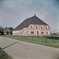
Koggenland is a municipality in North Holland province and the region of West-Frisia of the Netherlands. It came into existence on 1 January 2007 upon the merger of the two former municipalities of Obdam and Wester-Koggenland.

Winkels (Mengerskirchen) Ortsteil of Mengerskirchen in Hesse, Germany

Winkels is a village of the municipality of Mengerskirchen in the district of Limburg-Weilburg in Middle Hesse. It has 967 permanent and 38 temporary residents.

De Hulk Hamlet in North Holland, Netherlands

De Hulk is a hamlet and nature reserve in the municipalities of Koggenland and Hoorn in the Dutch province of North Holland.

Huizinge Village in Groningen, Netherlands

Huizinge is a village with a population of 100 in the municipality of Eemsdelta in the province of Groningen in the northeast of the Netherlands.

Nieuw-Beerta Village in Groningen, Netherlands

Nieuw-Beerta is a village with a population of 120 in the municipality of Oldambt in the east of the province of Groningen in the northeast of the Netherlands.

References

  1. 1 2 3 "Kerncijfers wijken en buurten 2021". Central Bureau of Statistics. Retrieved 30 April 2022.
  2. "Postcodetool for 1647AA". Actueel Hoogtebestand Nederland (in Dutch). Het Waterschapshuis. Retrieved 30 April 2022.
  3. "Berkhout - (geografische naam)". Etymologiebank (in Dutch). Retrieved 30 April 2022.
  4. 1 2 Ronald Stenvert & Saskia van Ginkel-Meester (2006). "Berkhout" (in Dutch). Zwolle: Waanders. Retrieved 29 April 2022.
  5. "Berkhout". Plaatsengids (in Dutch). Retrieved 30 April 2022.
  6. "Weerstatistieken Berkhout". Royal Netherlands Meteorological Institute . Retrieved 24 June 2022.
  7. "Klimaatviewer 1991-2020". Royal Netherlands Meteorological Institute . Retrieved 24 June 2022.