
Sandoval County is located in the U.S. state of New Mexico. As of the 2020 census, the population was 148,834, making it the fourth-most populous county in New Mexico. The county seat is Bernalillo.
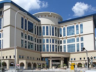
Bernalillo County is the most populous county in the U.S. state of New Mexico. As of the 2020 census, the population was 676,444. The county seat, Albuquerque, is the most populous city in New Mexico.

Isleta Village Proper is a census-designated place (CDP) in Bernalillo County, New Mexico, United States. The population was 491 at the 2010 census. It is part of the Albuquerque Metropolitan Statistical Area.

Los Ranchos de Albuquerque, known locally simply as "Los Ranchos" or "The Village," is a village in Bernalillo County, New Mexico. The population was 6,024 at the time of the 2010 Census.

South Valley is a census-designated place (CDP) and unincorporated community in Bernalillo County, New Mexico, United States. The population was 38,338 at the 2020 Census. It is part of the Albuquerque Metropolitan Statistical Area. The U.S. Postal Service uses "Albuquerque" for all South Valley addresses.
Tijeras is a village in Bernalillo County, New Mexico, United States. The population was 541 at the 2010 census. It is part of the Albuquerque metropolitan area.

Santa Clara Pueblo "Singing Water Village", also known as "Village of Wild Roses" is a census-designated place (CDP) in Rio Arriba County, New Mexico, United States and a federally recognized tribe of Native American Pueblo people.
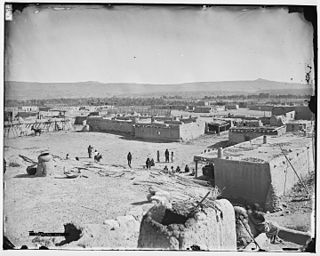
Cochiti is a census-designated place (CDP) in Sandoval County, New Mexico, United States. A historic pueblo of the Cochiti people, one of the Keresan Nations, it is part of the Albuquerque Metropolitan Statistical Area. The population was 528 at the 2010 census. Located 22 miles (35 km) southwest of Santa Fe, the community is listed as a historic district on the National Register of Historic Places.

Peña Blanca is a census-designated place (CDP) in Sandoval County, New Mexico. As of the 2000 census, the CDP population was 661. It is part of the Albuquerque Metropolitan Statistical Area.

Placitas is a census-designated place (CDP) in Sandoval County, New Mexico, United States. As of the 2010 census, its population was 4,977. It is part of the Albuquerque Metropolitan Statistical Area.
Pueblo of Sandia Village is a census-designated place (CDP) in Sandoval County, New Mexico, United States. The population was 344 at the 2000 census. It is part of the Albuquerque Metropolitan Statistical Area.

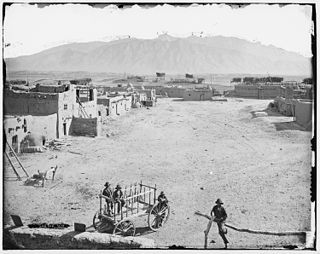
San Felipe Pueblo is a census-designated place (CDP) in Sandoval County, New Mexico, United States, and is located 10 miles (16 km) north of Bernalillo. As of the 2000 census, the CDP population was 2,080. It is part of the Albuquerque Metropolitan Statistical Area.

Santa Ana Pueblo is a census-designated place (CDP) in Sandoval County, New Mexico, United States. As of the 2000 census, the CDP had a total population of 479. It is part of the Albuquerque Metropolitan Statistical Area. The Pueblo, named Tamaya in Keres, administers a total reservation land of 73,000 acres (295 km2) in the Rio Grande valley and is composed of Native Americans who speak an eastern dialect of the Keresan languages.

Kewa Pueblo is a federally-recognized tribe of Native American Pueblo people in northern New Mexico, in Sandoval County southwest of Santa Fe. The pueblo is recorded as the Santo Domingo Pueblo census-designated place by the U.S. Census Bureau, with a population of 2,456 at the 2010 census.

Corrales is a village in southern Sandoval County, New Mexico, United States. First farmed by Tiquex Pueblo people, chosen due to its proximity to the Rio Grande, as documented by Hispano farmers of Nuevo México in the late 1500s. Despite being a part of the Albuquerque metropolitan area, the village maintains its rural character, while also being surrounded by the cities of Albuquerque and Rio Rancho. The population of Corrales was 8,329 at the 2010 Census.

New Mexico's 1st congressional district of the United States House of Representatives serves the central area of New Mexico, including most of Bernalillo County, all of Torrance County, and parts of Sandoval, Santa Fe and Valencia counties. It includes almost three-fourths of Albuquerque. The district has a notable Native American presence, encompassing several pueblos including the Pueblo of Laguna and Sandia Pueblo, and the Tohajiilee Navajo Reservation outside Albuquerque. The seat is currently represented by Democrat Melanie Stansbury. With a Cook Partisan Voting Index rating of D+5, it is the most Democratic district in New Mexico, a state with an all-Democratic congressional delegation.

Sandia Pueblo is a federally recognized tribe of Native American Pueblo people inhabiting a 101-square-kilometre (40 sq mi) reservation of the same name in the eastern Rio Grande Rift of central New Mexico. It is one of 19 of New Mexico's Native American pueblos, considered one of the state's Eastern Pueblos. The population was 427 as of the 2010 census. The people are traditionally Tiwa speakers, a language of the Tanoan group, although retention of the traditional language has waned with later generations. They have a tribal government that operates Sandia Casino, Bien Mur Indian Market Center, and Sandia Lakes Recreation Area, as well as representing the will of the Pueblo in business and political matters.

Southwestern Indian Polytechnic Institute (SIPI) is a public tribal land-grant community college in unincorporated Bernalillo County, New Mexico, with an Albuquerque postal address. It is federally operated by the Bureau of Indian Affairs and funded through the Bureau of Indian Education, both agencies within the United States Department of the Interior. More than 120 different Indian Tribes are represented in SIPI's student body.

Cochiti Lake is a census-designated place in Sandoval County, New Mexico, United States. Its population was 569 as of the 2010 census.
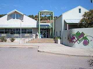
Bernalillo Public Schools is a school district headquartered in Bernalillo, New Mexico.

