
Southern California is a geographic and cultural region that generally comprises the southern portion of the U.S. state of California. It includes the Los Angeles metropolitan area as well as the Inland Empire. The region generally contains ten of California's 58 counties: Los Angeles, San Diego, Orange, Riverside, San Bernardino, Kern, Ventura, Santa Barbara, San Luis Obispo, and Imperial counties.

Lake Elsinore is a city in western Riverside County, California, United States. Established as a city in 1888, it is on the shore of Lake Elsinore, a natural freshwater lake about 3,000 acres (1,200 ha) in size. The city has grown from a small resort town in the late 19th and early 20th centuries to a suburban city with over 70,000 residents.

Moreno Valley is a city in Riverside County, California, United States, and is part of the Riverside–San Bernardino–Ontario metropolitan area. It is the second-largest city in Riverside County by population and one of the Inland Empire's population centers. The city's population was 208,634 at the 2020 census. Moreno Valley is also part of the greater Los Angeles area.
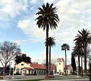
Perris is an old railway city in Riverside County, California, United States, located 71 miles (114 km) east-southeast of Los Angeles and 81 miles (130 km) north of San Diego. It is known for Lake Perris, an artificial lake, skydiving, Southern California Railway Museum, and its sunny dry climate. Perris is within the Inland Empire metropolitan area of Southern California. Perris had a population of 78,700 as of the 2020 census.

Riverside is a city in and the county seat of Riverside County, California, United States, in the Inland Empire metropolitan area. It is named for its location beside the Santa Ana River. It is the most populous city in the Inland Empire and in Riverside County, and is about 50 miles (80 km) southeast of downtown Los Angeles. It is also part of the Greater Los Angeles area. Riverside is the 59th-most-populous city in the United States and the 12th-most-populous city in California. As of the 2020 census, it had a population of 314,998. Along with San Bernardino, Riverside is a principal city in the nation's 13th-largest Metropolitan Statistical Area (MSA); the Riverside-San Bernardino-Ontario MSA ranks in population just below San Francisco (4,749,008) and above Detroit (4,392,041).

Chino Hills State Park is a state park of California, in the United States. It is located in the Chino Hills, foothills of the Santa Ana Mountains. It is a critical link in the Chino–Puente Hills wildlife corridor, and a major botanical habitat reserve for resident and migrating wildlife.

The Santa Ana River is the largest river entirely within Southern California in the United States. It rises in the San Bernardino Mountains and flows for most of its length through San Bernardino and Riverside counties, before cutting through the northern Santa Ana Mountains via Santa Ana Canyon and flowing southwest through urban Orange County to drain into the Pacific Ocean. The Santa Ana River is 96 miles (154 km) long, and its drainage basin is 2,650 square miles (6,900 km2) in size.

The San Bernardino Mountains are a high and rugged mountain range in Southern California in the United States. Situated north and northeast of San Bernardino and spanning two California counties, the range tops out at 11,503 feet (3,506 m) at San Gorgonio Mountain – the tallest peak in Southern California. The San Bernardinos form a significant region of wilderness and are popular for hiking and skiing.

Eastern California is a region defined as either the strip to the east of the crest of the Sierra Nevada or as the easternmost counties of California.

The Diablo Range is a mountain range in the California Coast Ranges subdivision of the Pacific Coast Ranges in northern California, United States. It stretches from the eastern San Francisco Bay Area at its northern end to the Salinas Valley area at its southern end.

The San Gorgonio Pass, or Banning Pass, is a 2,600 ft (790 m) elevation gap on the rim of the Great Basin between the San Bernardino Mountains to the north and the San Jacinto Mountains to the south. The pass was formed by the San Andreas Fault, a major transform fault between the Pacific plate and the North American plate that is slipping at a rate of 7.2 ±2.8 mm/year. The tall mountain ranges on either side of the pass result in the pass being a transitional zone from a Mediterranean climate west of the pass, to a Desert climate east of the pass. This also makes the pass area one of the windiest places in the United States, and why it is home to the San Gorgonio Pass wind farm.

The California Southern Railroad was a subsidiary railroad of the Atchison, Topeka and Santa Fe Railway in Southern California. It was organized July 10, 1880, and chartered on October 23, 1880, to build a rail connection between what has become the city of Barstow and San Diego, California.
Fred Thomas Perris was Chief Engineer of the Atchison, Topeka, and Santa Fe Railway, who oversaw the construction of the last leg of the 2nd Transcontinental Railroad from Barstow, California through Cajon Pass and down to San Bernardino and Los Angeles, a task that employed six thousand laborers and is still in use by BNSF Railway and Union Pacific Railroad He also laid track from Riverside, California to San Diego, California, laying out a series to town sites along the track, one of which, Perris, California was named in his honor. The city of Perris, California, a station on the California Southern Railroad, was named in his honor.(Its Cajon Pass. Not El Cajon Pass according to Chard Walkers "Cajon. Rail Passage To The Pacific")

Lake Perris is an artificial lake completed in 1973. It is the southern terminus of the California State Water Project, situated in a mountain-rimmed valley between Moreno Valley and Perris, in what is now the Lake Perris State Recreation Area. The park offers a variety of recreational activities. Because of this and the lake's proximity to major population centers, it is very crowded during the summer months.

Menifee is a city in Riverside County, California, United States, and is part of the Inland Empire. Named after a local miner, Luther Menifee Wilson, it was settled in the 19th century, and established as an independent city in 2008. Since then, Menifee has become one of the fastest growing cities in California and the United States.

Mount Rubidoux is a mountain just west of downtown in the city of Riverside, California, United States, that has been designated a city park and landmark. The mountain was once a popular Southern California tourist destination and is still the site of the oldest outdoor non-denominational Easter Sunrise service in the United States. Many historic markers and memorials have been placed on the mountain, the most prominent being the cross at the summit dedicated to Father Junípero Serra. A majority of Mt. Rubidoux is owned by the City of Riverside, while 0.43 acres at the peak is owned by Rivers & Lands Conservancy after the cross attracted a potential lawsuit and the city decided to sell it at auction it to a private organization.
The Motte Rimrock Reserve, a unit of the University of California Natural Reserve System affiliated with the University of California, Riverside, is an ecological reserve and biological field station located on a small plateau overlooking the Perris Valley in west-central Riverside County, California, United States.

Riverside County is a county located in the southern portion of the U.S. state of California. As of the 2020 census, the population was 2,418,185, making it the fourth-most populous county in California and the 10th-most populous in the United States. The name was derived from the city of Riverside, which is the county seat.
The Perris Block is the central block of three major fault-bounded blocks of the northern part of the Peninsular Ranges. The Perris Block lies between the Santa Ana Block to the west and the San Jacinto Block to the east. The Perris Block, was named by Walter A. English in 1925 for the city of Perris, located near the center of the block.

