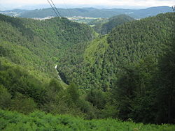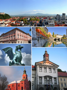
The Savinja is a river in northeast Slovenia which flows mostly in the Upper and Lower Savinja Valley and through the cities of Celje and Laško. The Savinja is the main river of the Savinja Alps. It flows into the Sava River at the town of Zidani Most. It has often flooded, such as in the 1960s, 1990, and 1995. The Savinja has a length of 101.75 kilometres (63.22 mi) and a catchment area of 1,847.7 km2 (713.4 sq mi).

Dol pri Ljubljani is a settlement in central Slovenia. It is the seat of the Municipality of Dol pri Ljubljani. It is part of the traditional region of Upper Carniola and is now included in the Central Slovenia Statistical Region.
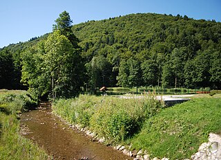
The Mirna is a river in southeastern Slovenia. The river, in which the marathon swimmer Martin Strel first learned to swim, is a right tributary of the Sava River in the province of Lower Carniola. It is 44 kilometers (27 mi) long, starts below the settlement of Velika Preska, flows through the Mirna Valley and joins the Sava at Dolenji Boštanj, opposite Sevnica. The largest settlement on the river is Mirna. The river is traversed by the Sevnica–Trebnje Railway. The river was mentioned for the first time in 1028 in relation to a 1016 document by Henry II, Holy Roman Emperor.

Podgrad is a settlement east of the capital Ljubljana in central Slovenia. It belongs to the City Municipality of Ljubljana. It lies on the right bank of the Ljubljanica River at the entrance into the Besnica Valley. The Ljubljanica in turn flows into the Sava immediately northeast of the settlement core. The railway line from Ljubljana to Zidani Most runs through the settlement. The area was part of the traditional region of Lower Carniola and is now included with the rest of the municipality in the Central Slovenia Statistical Region.

Spodnje Gameljne is a village on the right bank of the Sava River north of the capital Ljubljana in central Slovenia. It belongs to the City Municipality of Ljubljana. It was part of the traditional region of Upper Carniola and is now included with the rest of the municipality in the Central Slovenia Statistical Region.
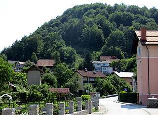
Jevnica is a settlement on the right bank of the Sava River in the Municipality of Litija in central Slovenia. The railway line from Ljubljana to Zidani Most runs through the settlement. Traditionally the area was part of Lower Carniola and is now included with the rest of the municipality in the Central Sava Statistical Region; until January 2014 the municipality was part of the Central Slovenia Statistical Region.

Spodnji Kašelj is a formerly independent settlement in the eastern part of the capital Ljubljana in central Slovenia. It is a compact settlement above the left bank of the Ljubljanica River between Zgornji Kašelj and Zalog. It was part of the traditional region of Upper Carniola and is now included with the rest of the municipality in the Central Slovenia Statistical Region.

Zalog is a formerly independent settlement in the eastern part of the capital Ljubljana in central Slovenia. It stands above the left bank of the Ljubljanica River near its confluence with the Sava. It was part of the traditional region of Upper Carniola and is now included with the rest of the municipality in the Central Slovenia Statistical Region. The former village includes the hamlets of Stari Zalog, which is the old village core on a terrace between the railroad line and a bridge across the Sava, Novi Zalog to the south, Brinje north of the railroad toward the Sava River, Prod to the east on the spit between the Ljubljanica and the Sava, Gradišče on the left bank of the Ljubljanica, and Vabrje on a small rise between the two rivers.

Vevče is a formerly independent settlement in the eastern part of the capital Ljubljana in central Slovenia. It was part of the traditional region of Upper Carniola and is now included with the rest of the municipality in the Central Slovenia Statistical Region.

Spodnja Hrušica is a formerly independent settlement southeast of the capital Ljubljana in central Slovenia. It belongs to the City Municipality of Ljubljana. It was part of the traditional region of Lower Carniola and is now included with the rest of the municipality in the Central Slovenia Statistical Region.

Zgornja Hrušica is a formerly independent settlement southeast of the capital Ljubljana in central Slovenia. It belongs to the City Municipality of Ljubljana. It was part of the traditional region of Lower Carniola and is now included with the rest of the municipality in the Central Slovenia Statistical Region.

Studenec is a formerly independent settlement in the southeast part of the capital Ljubljana in central Slovenia. It belongs to the City Municipality of Ljubljana. It was part of the traditional region of Upper Carniola and is now included with the rest of the municipality in the Central Slovenia Statistical Region.

Slape is a formerly independent settlement in the eastern part of the capital Ljubljana in central Slovenia. It was part of the traditional region of Upper Carniola and is now included with the rest of the municipality in the Central Slovenia Statistical Region.
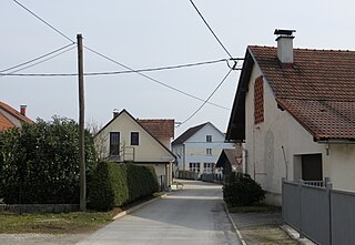
Šentjakob ob Savi is a formerly independent settlement in the northeastern part of the capital Ljubljana in central Slovenia. It was part of the traditional region of Upper Carniola and is now included with the rest of the municipality in the Central Slovenia Statistical Region. It includes the hamlets of Pečnik and Soteska.

Brod is a formerly independent settlement in the northern part of the capital Ljubljana in central Slovenia. It was part of the traditional region of Upper Carniola and is now included with the rest of the municipality in the Central Slovenia Statistical Region.

Obrh Creek is a losing stream that originates and terminates in the Lož Karst Field in the Municipality of Loška Dolina. It is a watercourse in the Ljubljanica watershed. It is created by the confluence of Little Obrh Creek and Big Obrh Creek ; the latter is fed by two tributaries: Brežiček Creek and Viševek Brežiček Creek. The confluence, at which point it is simply named Obrh, lies west of the village of Pudob. In the northwest, limestone part of the karst field, Obrh Creek starts to drain into many sinkholes, and higher water flows into 850-meter (2,790 ft) Golobina Cave. The stream re-emerges at the spring of the Stržen River 2 kilometers (1.2 mi) to the northwest on the southeast edge of the Cerknica Karst Field.
Aslivka is a left tributary of Besnica Creek, which flows through the Besnica Valley east of Ljubljana and joins the Ljubljanica at Podgrad as its last right tributary just before it joins the Sava River.
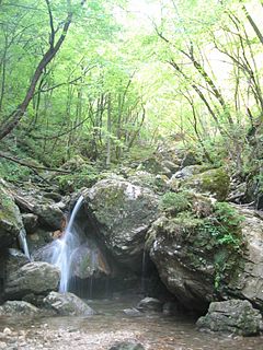
Borovniščica is a stream that originates in the hills west of Gorenje Otave and flows to the north through Hell Gorge, creating a series of waterfalls, and then through the village of Borovnica. It then flows across the Ljubljana Marsh, where it joins the Ljubljanica River as a right tributary. The upper course of the creek separates the Rakitna Plateau from the Logatec Plateau.
