Tuhinj Valley

Last updated
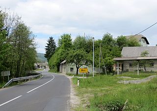
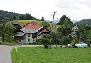
Motnik, a village in the Tuhinj Valley Motnik1.JPG
Motnik, a village in the Tuhinj Valley

The Tuhinj Valley (pronounced  [tuˈxiːn] ; Slovene : Tuhinjska dolina) is a valley in Slovenia linking the Celje Basin with the Ljubljana Basin in an east-west direction along the courses of the Nevljica and Motnišnica rivers.
Slovene language language spoken in Slovenia

Slovene or Slovenian belongs to the group of South Slavic languages. It is spoken by approximately 2.5 million speakers worldwide, the majority of whom live in Slovenia. It is the first language of about 2.1 million Slovenian people and is one of the 24 official and working languages of the European Union.

Slovenia republic in Central Europe

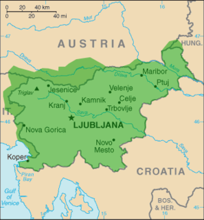
Slovenia, officially the Republic of Slovenia, is a sovereign state located in southern Central Europe at a crossroads of important European cultural and trade routes. It is bordered by Italy to the west, Austria to the north, Hungary to the northeast, Croatia to the southeast, and the Adriatic Sea to the southwest. It covers 20,273 square kilometers (7,827 sq mi) and has a population of 2.07 million. One of the successor states of the former Yugoslavia, Slovenia is a parliamentary republic and a member of the United Nations, of the European Union, and of NATO. The capital and largest city is Ljubljana.

Celje Place in Slovenia

Celje is the third-largest town in Slovenia. It is a regional center of the traditional Slovenian region of Styria and the administrative seat of the City Municipality of Celje. The town of Celje is located below Upper Celje Castle at the confluence of the Savinja, Hudinja, Ložnica, and Voglajna rivers in the lower Savinja Valley, and at the crossing of the roads connecting Ljubljana, Maribor, Velenje, and the Central Sava Valley. It lies 238 m (781 ft) above mean sea level (MSL).

Contents

Geography

The western part of the valley was formed by the watershed of the Nevljica, flowing into the Kamnik Bistrica, and the narrower, eastern part by the Motnišnica, a tributary of the Savinja River. Their drainage divide is at the Kozjak Pass at an elevation of 655 m between Cirkuše v Tuhinju and Špitalič. The largest settlements in the valley include Laze v Tuhinju, Šmartno v Tuhinju, and Motnik. The large number of old settlements points to the fact that the valley was an important thoroughfare in the Middle Ages and later as a passage between Lower Styria and Upper Carniola.

Drainage basin Area of land where precipitation collects and drains off into a common outlet

A drainage basin is any area of land where precipitation collects and drains off into a common outlet, such as into a river, bay, or other body of water. The drainage basin includes all the surface water from rain runoff, snowmelt, and nearby streams that run downslope towards the shared outlet, as well as the groundwater underneath the earth's surface. Drainage basins connect into other drainage basins at lower elevations in a hierarchical pattern, with smaller sub-drainage basins, which in turn drain into another common outlet.

The Nevljica is a river in the Municipality of Kamnik, Slovenia. It comes out below Kozjak Hill and flows through the Tuhinj Valley. It also flows through the settlements of Nevlje and Mekinje. It is a left tributary of the Kamnik Bistrica.

Kamnik Bistrica river in Slovenia

The Kamnik Bistrica is an Alpine river in northern Slovenia, a left tributary of the Sava River. It springs from the Kamnik Alps near the border with Austria. It is 33 km (21 mi) long. The Kamnik Bistrica flows through the town of Kamnik, where it is fed by the Nevljica River. It flows into the Sava south of Videm, about 10 km east of Ljubljana.

Name

The Tuhinj region was mentioned in written sources circa 1400 as Tuchein, Tuchen, and Tucheiner alben. The name was originally *Tuxyn′ь, derived from the hypocorism *Tuxynъ (based on the Slavic personal name *Tuxъ or *Tuxa). This root is also the source of similar names such as Tuhinje in Herzegovina, Tuin in Macedonia, Tukhin in Russia, and Tuchyňa in Slovakia. [1]

A hypocorism, also called a hypocoristicon, is a diminutive form of a name. Hypocorisms include pet names or calling names, often a diminutive or augmentative form of a word or given name when used as a nickname or term of endearment.

Tukhin is a village in Kalininsky District of Tver Oblast, Russia.

Tuchyňa municipality of Slovakia

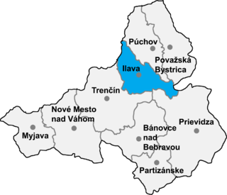
Tuchyňa is a village and municipality in Ilava District in the Trenčín Region of north-western Slovakia.

Industry

Until the mid-20th century brown coal was mined in the valley near Motnik. Tourism has only recently started to develop with the building of the Snovik Spa. [2]

Lignite A soft, brown, combustible, sedimentary rock

Lignite, often referred to as brown coal, is a soft, brown, combustible, sedimentary rock formed from naturally compressed peat. It is considered the lowest rank of coal due to its relatively low heat content. It has a carbon content around 60–70 percent. It is mined all around the world, is used almost exclusively as a fuel for steam-electric power generation, and is the coal which is most harmful to health.

Motnik Place in Upper Carniola, Slovenia

Motnik is a village in the Tuhinj Valley in the Municipality of Kamnik in the Upper Carniola region of Slovenia.

Related Research Articles

Buč Place in Upper Carniola, Slovenia

Buč is a small settlement on the Nevljica River in the Tuhinj Valley in the Municipality of Kamnik in the Upper Carniola region of Slovenia. It includes the hamlets of Brezovica, Vetrnik, and Smrtna Vas.

Cirkuše v Tuhinju Place in Upper Carniola, Slovenia

Cirkuše v Tuhinju is a small settlement in the Tuhinj Valley in the Municipality of Kamnik in the Upper Carniola region of Slovenia.

Češnjice v Tuhinju Place in Upper Carniola, Slovenia

Češnjice v Tuhinju is a village in the Tuhinj Valley in the Municipality of Kamnik in the Upper Carniola region of Slovenia.

Črni Vrh v Tuhinju Place in Upper Carniola, Slovenia

Črni Vrh v Tuhinju is a small settlement in the Tuhinj Valley in the Municipality of Kamnik in the Upper Carniola region of Slovenia.

Gradišče v Tuhinju Place in Upper Carniola, Slovenia

Gradišče v Tuhinju is a small settlement in the Tuhinj Valley in the Municipality of Kamnik in the Upper Carniola region of Slovenia. It includes the hamlet of Hom.

Laze v Tuhinju Village in Upper Carniola, Slovenia

Laze v Tuhinju is a village in the Tuhinj Valley in the Municipality of Kamnik in the Upper Carniola region of Slovenia.

Loke v Tuhinju Place in Upper Carniola, Slovenia

Loke v Tuhinju is a village in the Tuhinj Valley in the Municipality of Kamnik in the Upper Carniola region of Slovenia.

Podhruška Place in Upper Carniola, Slovenia

Podhruška is a settlement on the Nevljica River at the Kamnik end of the Tuhinj Valley in the Upper Carniola region of Slovenia.

Potok, Kamnik Place in Upper Carniola, Slovenia

Potok is a small village in the Municipality of Kamnik in the Upper Carniola region of Slovenia. It lies on the Nevljica River in the Tuhinj Valley.

Praproče v Tuhinju Place in Upper Carniola, Slovenia

Praproče v Tuhinju is a small settlement above the Tuhinj Valley in the Municipality of Kamnik in the Upper Carniola region of Slovenia.

Rožično Place in Upper Carniola, Slovenia

Rožično is a small dispersed settlement in the Tuhinj Valley in the Municipality of Kamnik in the Upper Carniola region of Slovenia. It lies along the side valley of Rožičnica Creek, a tributary of the Nevljica River.

Sidol Place in Upper Carniola, Slovenia

Sidol is a small settlement in the Tuhinj Valley in the Municipality of Kamnik in the Upper Carniola region of Slovenia. It lies in a small enclosed valley in the hills above Šmartno v Tuhinju.

Soteska, Kamnik Place in Upper Carniola, Slovenia

Soteska is a village in the Municipality of Kamnik in the Upper Carniola region of Slovenia. It lies in a side valley at the point where the Nevljica River exits the Tuhinj Valley through a gorge, from which it also gets its name. The main road from Kamnik into the Tuhinj Valley runs through the settlement.

Srednja Vas pri Kamniku Place in Upper Carniola, Slovenia

Srednja Vas pri Kamniku is settlement on the right bank of the Nevljica River at the Kamnik end of the Tuhinj Valley in the Upper Carniola region of Slovenia.

Veliki Hrib Place in Upper Carniola, Slovenia

Veliki Hrib is a dispersed settlement on an elevation on the left bank of the Nevljica River in the Tuhinj Valley in the Upper Carniola region of Slovenia.

Vir pri Nevljah Place in Upper Carniola, Slovenia

Vir pri Nevljah is a small settlement on the Nevljica River in the Municipality of Kamnik in the Upper Carniola region of Slovenia. It is a few houses on the road through the Tuhinj Valley between the settlements of Podhruška and Soteska.

Zgornji Motnik Place in Upper Carniola, Slovenia

Zgornji Motnik is a dispersed settlement in the hills north of Motnik in the Tuhinj Valley in the Municipality of Kamnik in the Upper Carniola region of Slovenia. It includes the hamlets of Bela, Koprivše, Srobotno, Vrh, and Brezovica.

Menina Pasture Plateau

The Menina Pasture Plateau is a pre-Alpine karst plateau in Slovenia.

References

  1. Snoj, Marko. 2009. Etimološki slovar slovenskih zemljepisnih imen. Ljubljana: Modrijan and Založba ZRC, pp. 441–442.
  2. Slovenian Tourist Board site

Coordinates: 46°13′17.09″N14°46′33.33″E / 46.2214139°N 14.7759250°E / 46.2214139; 14.7759250

Geographic coordinate system Coordinate system

A geographic coordinate system is a coordinate system that enables every location on Earth to be specified by a set of numbers, letters or symbols. The coordinates are often chosen such that one of the numbers represents a vertical position and two or three of the numbers represent a horizontal position; alternatively, a geographic position may be expressed in a combined three-dimensional Cartesian vector. A common choice of coordinates is latitude, longitude and elevation. To specify a location on a plane requires a map projection.