Bestwig

Last updated
Bestwig
Bestwig 2010.jpg
General view of Bestwig
Gemeindewappen der Gemeinde Bestwig.svg
Location of Bestwig within Hochsauerlandkreis district
Bestwig in HSK.svgOlsberg
Germany adm location map.svg
Red pog.svg
Bestwig
North Rhine-Westphalia location map 01.svg
Red pog.svg
Bestwig
Coordinates: 51°22′N08°24′E / 51.367°N 8.400°E / 51.367; 8.400
Country Germany
State North Rhine-Westphalia
Admin. region Arnsberg
District Hochsauerlandkreis
Subdivisions6, containing of 17 Ortsteile (villages)
Government
   Mayor (202025) Ralf Péus [1] (CDU)
Area
  Total69.36 km2 (26.78 sq mi)
Highest elevation
750 m (2,460 ft)
Lowest elevation
280 m (920 ft)
Population
 (2022-12-31) [2]
  Total10,695
  Density150/km2 (400/sq mi)
Time zone UTC+01:00 (CET)
  Summer (DST) UTC+02:00 (CEST)
Postal codes
59909
Dialling codes 02904, 02905
Vehicle registration HSK
Website www.bestwig.de

Bestwig is a municipality in the Hochsauerland district, in North Rhine-Westphalia, Germany.

Contents

Geography

Bestwig is situated on the river Ruhr, approx. 10 km east of Meschede. It lies on the German Autobahn A 46. Bestwig has a railway station, connecting the town through local trains to Dortmund Hauptbahnhof, Winterberg and Hagen Hauptbahnhof.

Neighbouring municipalities

Subdivisions

Since 2009, the municipality is officially divided into 6 so-called Ortschaften, each containing of one to five villages (Ortsteile).

OrtschaftOrtsteilePopulation [3]
VelmedeVelmede, Bestwig, Föckinghausen, Nierbachtal, Halbeswig4.595 (3.140, 1.391, 29, 28, 7)
NuttlarNuttlar, Grimlinghausen1.586 (1.556, 30)
OstwigOstwig, Alfert, Borghausen1.691 (973, 58, 660)
HeringhausenHeringhausen793
RamsbeckRamsbeck, Berlar, Valme1.827 (1.608, 146, 73)
AndreasbergAndreasberg, Dörnberg, Wasserfall609 (482, 76, 51)

Economy

Bestwig, surrounded by many acres of pine tree forests, is a centre of Christmas tree production.

Tourism, however, is the most important source of income. The Sauerland forests are popular among hikers and, in winter, skiing is possible.

Twin towns

Bestwig has no official partnership with another town, but has close to ties to Niederorschel (Thuringia, Germany) and Niederwiesa (Saxony, Germany).

Coat of arms

The coat of arms shows a silver Saint Andrew's Cross on blue ground. The Saint Andrew's Cross is a reference to the patron of the parish church in Velmede, Saint Andrew. The colors silver and blue show the allegiance to the former county of Arnsberg.

Notable natives

Notable places in Bestwig

Related Research Articles

<span class="mw-page-title-main">North Rhine-Westphalia</span> State in Germany

North Rhine-Westphalia or North-Rhine/Westphalia, commonly shortened to NRW, is a state (Land) in Western Germany. With more than 18 million inhabitants, it is the most populous state in Germany. Apart from the city-states, it is also the most densely populated state in Germany. Covering an area of 34,084 square kilometres (13,160 sq mi), it is the fourth-largest German state by size.

Hochsauerlandkreis is a Kreis (district) in the east of North Rhine-Westphalia, Germany. Neighboring districts are Soest, Paderborn, Höxter, Waldeck-Frankenberg, Siegen-Wittgenstein, Olpe, Märkischer Kreis.
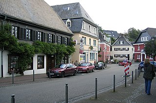
<span class="mw-page-title-main">Meinerzhagen</span> Town in North Rhine-Westphalia, Germany

Meinerzhagen is a town in the Märkischer Kreis, North Rhine-Westphalia, Germany.

<span class="mw-page-title-main">Eschweiler</span> Town in North Rhine-Westphalia, Germany

Eschweiler is a municipality in the district of Aachen in North Rhine-Westphalia in Germany on the river Inde, near the German-Belgian-Dutch border, and about 15 kilometres (9 mi) east of Aachen and 50 kilometres (31 mi) west of Cologne.
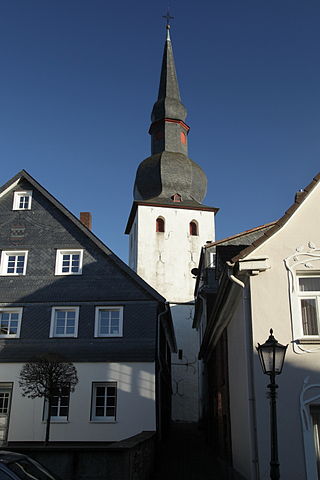
<span class="mw-page-title-main">Bergneustadt</span> Town in North Rhine-Westphalia, Germany

Bergneustadt is a municipality in the eastern part of the Oberbergischer Kreis (district), in North Rhine-Westphalia, Germany. It is located 50 km east of Cologne. It is part of the Berg region.
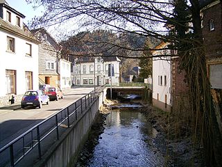
<span class="mw-page-title-main">Morsbach</span> Municipality in North Rhine-Westphalia, Germany

Morsbach is a municipality in Oberbergischer Kreis, a district in North Rhine-Westphalia near the border of Rhineland-Palatinate in Germany. In 2015, Morsbach's population was 10,600. The central village, also named Morsbach, has a population of 3,400. With a number of buildings dating back to the 12th century, it is a popular spot for hikers and other nature lovers.

<span class="mw-page-title-main">Meschede</span> Town in North Rhine-Westphalia, Germany

Meschede is a town in the Hochsauerland district, in North Rhine-Westphalia, Germany. It is the capital of the district Hochsauerlandkreis.

<span class="mw-page-title-main">Nottuln</span> Municipality in North Rhine-Westphalia, Germany

Nottuln is a municipality in the district of Coesfeld in the state of North Rhine-Westphalia, Germany.

<span class="mw-page-title-main">Wermelskirchen</span> Town in North Rhine-Westphalia, Germany

Wermelskirchen is a town in the Rheinisch-Bergischer Kreis, in North Rhine-Westphalia, Germany, southeast of Remscheid. It is home to one of Europe's biggest live Christmas trees.

<span class="mw-page-title-main">Warstein</span> Town in North Rhine-Westphalia, Germany

Warstein ( ) is a municipality with town status in the district of Soest, in North Rhine-Westphalia, Germany. It is located at the north end of Sauerland.

<span class="mw-page-title-main">Greven</span> Town in North Rhine-Westphalia, Germany

Greven is a medium-sized town in the district of Steinfurt, in Germany's most populous state of North Rhine-Westphalia and close to the city of Münster.
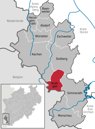
<span class="mw-page-title-main">Roetgen</span> Municipality in North Rhine-Westphalia, Germany

Roetgen is a municipality in the district of Aachen, in North Rhine-Westphalia, Germany.

<span class="mw-page-title-main">Rhede</span> Town in North Rhine-Westphalia, Germany

Rhede is a municipality in the district of Borken in the state of North Rhine-Westphalia, Germany. It is located near the border with the Netherlands, approximately 5 km (3.1 mi) east of Bocholt.

<span class="mw-page-title-main">Heek, Germany</span> Municipality in North Rhine-Westphalia, Germany

Heek is a municipality in the district of Borken, in North Rhine-Westphalia, Germany. It is located near the border with the Netherlands, approx. 20 km south-east of Enschede. Heek consists of two villages, Heek and Nienborg.

<span class="mw-page-title-main">Schöppingen</span> Municipality in North Rhine-Westphalia, Germany

Schöppingen is a municipality in the district of Borken in the state of North Rhine-Westphalia, Germany. It is located approximately 10 km (6.2 mi) south-west of Steinfurt.

<span class="mw-page-title-main">Hürtgenwald</span> Municipality in North Rhine-Westphalia, Germany

Hürtgenwald is a municipality in the district of Düren in the federal state of North Rhine-Westphalia, Germany. It is located in the Eifel hills, approx. 15 km south-west of Düren. Much of the area is covered by forest.

<span class="mw-page-title-main">Olsberg, Germany</span> Town in North Rhine-Westphalia, Germany

Olsberg is a town in the Hochsauerland district, in North Rhine-Westphalia, Germany.
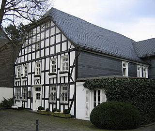
<span class="mw-page-title-main">Eslohe</span> Municipality in North Rhine-Westphalia, Germany

Eslohe is a municipality in the Hochsauerland district, in North Rhine-Westphalia, Germany.
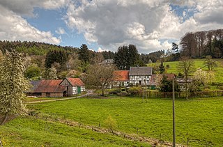
<span class="mw-page-title-main">Odenthal</span> Municipality in North Rhine-Westphalia, Germany

Odenthal is a municipality in the Rheinisch-Bergischer Kreis, in North Rhine-Westphalia, Germany.

<span class="mw-page-title-main">Hörstel</span> Town in North Rhine-Westphalia, Germany

is a town in the district of Steinfurt, in North Rhine-Westphalia, Germany. It is situated near the junction of the Mittellandkanal and the Dortmund-Ems Canal, approx. 10 km east of Rheine.

References

  1. Wahlergebnisse in NRW Kommunalwahlen 2020, Land Nordrhein-Westfalen, accessed 21 June 2021.
  2. "Bevölkerung der Gemeinden Nordrhein-Westfalens am 31. Dezember 2022 – Fortschreibung des Bevölkerungsstandes auf Basis des Zensus vom 9. Mai 2011" (in German). Landesbetrieb Information und Technik NRW . Retrieved 20 June 2023.
  3. Source: municipal website, Archived 2022-05-21 at the Wayback Machine click left under to: Informationen zu den Gemeindeteilen. First figure: population entire Ortschaft, followed by the population of its Ortsteile.