Winterberg

Last updated
Winterberg
Winterberg imwinter.jpg
Winter view of Winterberg in 2006
Flagge Winterberg.svg
Stadtwappen Winterberg.svg
Location of Winterberg within Hochsauerlandkreis district
Winterberg in HSK.svgOlsberg
Germany adm location map.svg
Red pog.svg
Winterberg
North Rhine-Westphalia location map 01.svg
Red pog.svg
Winterberg
Coordinates: 51°12′N08°31′E / 51.200°N 8.517°E / 51.200; 8.517
Country Germany
State North Rhine-Westphalia
Admin. region Arnsberg
District Hochsauerlandkreis
Subdivisions14
Government
   Mayor (202025) Michael Beckmann [1] (CDU)
Area
  Total147.86 km2 (57.09 sq mi)
Highest elevation
600 m (2,000 ft)
Lowest elevation
450 m (1,480 ft)
Population
 (2021-12-31) [2]
  Total12,427
  Density84/km2 (220/sq mi)
Time zone UTC+01:00 (CET)
  Summer (DST) UTC+02:00 (CEST)
Postal codes
59955
Dialling codes 02981
Vehicle registration HSK
Website www.winterberg.de
Winterberg Winterberg Sauerland Ost 118 pk.jpg
Winterberg

Winterberg (Westphalian: Winnenmerg) is a town in the Hochsauerland district of North Rhine-Westphalia, central Germany and a major winter sport resort of the Wintersport Arena [3] Sauerland.

Contents

Geography

Winterberg is located in the middle of the Sauerland, at the source of the Ruhr and Lenne rivers.

Neighbouring municipalities

Division of the town

After the local government reforms of 1975 Winterberg consists of 15 districts:

  • Altastenberg
  • Altenfeld
  • Elkeringhausen
  • Grönebach
  • Hildfeld
  • Hoheleye
  • Langewiese
  • Lenneplätze
  • Mollseifen
  • Neuastenberg
  • Niedersfeld
  • Siedlinghausen
  • Silbach
  • Winterberg
  • Züschen

Climate

Winterberg experiences a humid continental climate (Köppen Dfb) like most of Germany, however also bordering on subarctic climate (Dfc), thanks to its altitude, with only having an average temperature above 10 °C and September only being barely above it. The summers are short and cool, while the winters are cold, but warmer than winters in the Alps or in the Ore Mountains. The growing season nonethless lasts for only 100 days.

Depending on the definition the climate can also described as oceanic (Cfb), bordering on a subpolar oceanic climate (Cfc).

Climate data for Winterberg, 1961–1990
MonthJanFebMarAprMayJunJulAugSepOctNovDecYear
Mean daily maximum °C (°F)0
(32)
1
(34)
3.9
(39.0)
8.4
(47.1)
13.5
(56.3)
16.5
(61.7)
18
(64)
17.9
(64.2)
14.9
(58.8)
10.5
(50.9)
4.3
(39.7)
1.3
(34.3)
9.2
(48.6)
Daily mean °C (°F)−2
(28)
−1.6
(29.1)
0.9
(33.6)
4.5
(40.1)
9.2
(48.6)
12.1
(53.8)
13.8
(56.8)
13.6
(56.5)
10.8
(51.4)
7
(45)
2
(36)
−0.9
(30.4)
5.8
(42.4)
Mean daily minimum °C (°F)−4.2
(24.4)
−4.1
(24.6)
−1.8
(28.8)
0.9
(33.6)
5.1
(41.2)
8.1
(46.6)
9.8
(49.6)
9.9
(49.8)
7.6
(45.7)
−4.4
(24.1)
−0.1
(31.8)
−3
(27)
2.8
(37.0)
Average precipitation mm (inches)140.2
(5.52)
96.1
(3.78)
115.3
(4.54)
93
(3.7)
97.6
(3.84)
114.4
(4.50)
119
(4.7)
96.2
(3.79)
96.1
(3.78)
104.7
(4.12)
136.5
(5.37)
151.2
(5.95)
1,603.3
(63.12)
[ citation needed ]

History

Town Origin

Winterberg was declared a city by Archbishop Konrad von Hochstaden (1238-’61) about 1270. The foundation of the city of Winterberg was presumably carried out together with the cloister in Küstelberg. Here indicates a document of 1276 in which the rights are regulated in the town between archbishop and cloister. In this document a church is mentioned in Winterberg whose precursor presumably goes back till the time about 1225. The city fortification seems to have granted in the 14th century first only very much restricted protection. The count von Waldeck conquered the town 1321. About 1357 Winterberg became destroyed by Gottfried IV. von Arnsberg during his war with the Cologne archbishop Wilhelm von Gennep. For the reconstruction the archbishop granted an at first ten-year-old tax freedom. This was extended in 1370 and 1374 in each case by other five years. At this time Winterberg owned the same town right like Hallenberg. Winterberg was a member of the Hanseatic League from the 13th until the 17th century. The town was in the middle of two trade roads, Heidenstrasse between Cologne and Kassel and Heerstrasse between Frankfurt am Main and Soest. The bad agricultural conditions led to the fact that trade played a central role as a life basis of the town.

Deserted Medieval Town

Between 1350 and 1500 the surrounding settlements of Wernsdorf, Merleheim, Haarfeld, Günninghausen and Elkeringhausen were abandoned by their inhabitants. They often moved to Winterberg while they maintained the possession rights on their land. The abandonment of the old settlements is likely related to the plague and also to the frequent feuds and lootings of the time, since bigger towns offered a better protection against enemy troops. Only the cities/towns of Winterberg, Hallenberg, Schmallenberg and Medebach were presumably inhabited at this time. The surrounding areas were most likely left completely deserted.

Modern times 'til the end of the Thirty Years' War (1500–1650)

By the acquisition of region "Marken" the area of Winterberg strongly extended. There were similar trends in neighbouring towns. At the beginning of the 16th century Winterberg expanded her farmland in the area of Astenberg. Thereby they got during conflict with the count of von Waldeck who owned rights in the neighbouring village Nordenau. From southwest her territorial claims overlapped with the county Wittgenstein. This quarrel stretched with both opponents up to the end of the 18th century. In a comparison with Wittgenstein 1783 the debatable area was split. During the Thirty Years' War the neighbouring town Medebach and Hallenberg were 1634 destroyed by Hessian troops. Both had to suffer very much from contributions, lootings and murders. Besides, still the plague broke out soon afterwards. Both towns thereby had to register big population losses. This destiny seems to have remained saved to the city of Winterberg to a great extent. An important clue for this is that in 1638/39 the town council could buy a new organ for 240 imperial talers. Vice versa this could be the trigger for a vain siege of the town about 1640. The Winterberger shooters repulsed therefore attacking Hessen and Sweden successfully.

Witch hunts

As in many other places in the Duchy of Westphalia, between the 16th and 18th centuries, witch trials and executions took place in Winterberg. The exact number is unknown because the source material is extremely poor. Documented witch trials took place in 1523, probably 1562, 1629 and possibly 1728. On November 19, 1993, at the site of the "Winterberger Halsgerichts" a monument was opened as a memorial to the victims of the 16th century witch hunts.

Points of interest

The second highest mountain of the Sauerland, the Kahler Asten in the Rothaargebirge, is located in the city area, which also contains the spring of the Lenne and Ruhr rivers.

Sport

The city is one of the winter sports centers of the Sauerland, best known probably for the bobsleigh, luge, and skeleton track. In 2003, there were the first official World Wok Championships, initiated by Stefan Raab.

Coat of arms

The arms show the city (the city walls only existed between 1261 and 1266) behind the patron of the city, Saint James, as Winterberg is located on one of the Ways of St. James.

International relations

Winterberg is twinned with:

Related Research Articles

<span class="mw-page-title-main">Märkischer Kreis</span> District in North Rhine-Westphalia, Germany

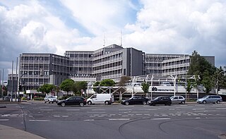
The Märkischer Kreis is a district (Kreis) in central North Rhine-Westphalia, Germany. Neighbouring districts are Unna, Soest, Hochsauerland, Olpe, Oberbergischer Kreis, Ennepe-Ruhr, and the city of Hagen.

Hochsauerlandkreis is a Kreis (district) in the east of North Rhine-Westphalia, Germany. Neighboring districts are Soest, Paderborn, Höxter, Waldeck-Frankenberg, Siegen-Wittgenstein, Olpe, Märkischer Kreis.

Olpe is a Kreis (district) in the south-east of North Rhine-Westphalia, Germany. Neighboring districts are Märkischer Kreis, Hochsauerland, Siegen-Wittgenstein, Altenkirchen, Oberbergischer Kreis.

Siegen-Wittgenstein is a Kreis (district) in the southeast of North Rhine-Westphalia, Germany. Neighboring districts are Olpe, Hochsauerlandkreis, Waldeck-Frankenberg, Marburg-Biedenkopf, Lahn-Dill, Westerwaldkreis, and Altenkirchen.

<span class="mw-page-title-main">Lenne</span> River in Germany

The Lenne is a tributary of the river Ruhr in the Sauerland hills, western Germany. It has caused flooding in recent years.

<span class="mw-page-title-main">Sauerland</span> Rural, hilly area in North Rhine-Westphalia, Germany

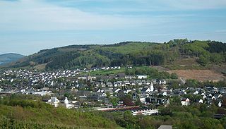
The Sauerland is a rural, hilly area spreading across most of the south-eastern part of North Rhine-Westphalia, in parts heavily forested and, apart from the major valleys, sparsely inhabited.

<span class="mw-page-title-main">Breckerfeld</span> Town in North Rhine-Westphalia, Germany

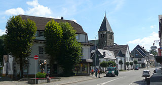
Breckerfeld is a town in the district of Ennepe-Ruhr-Kreis, in North Rhine-Westphalia, (Germany). It is located in the southeasternmost part of the Ruhr area in northern Sauerland. The town is a member of Regionalverband Ruhr (association).

<span class="mw-page-title-main">Meschede</span> Town in North Rhine-Westphalia, Germany

Meschede is a town in the Hochsauerland district, in North Rhine-Westphalia, Germany. It is the capital of the district Hochsauerlandkreis.

<span class="mw-page-title-main">Wetter (Ruhr)</span> Town in North Rhine-Westphalia, Germany

Wetter (Ruhr) is a town in western Germany, in the federal state of North Rhine-Westphalia and the district of Ennepe-Ruhr-Kreis. The river Ruhr flows through the urban area, separating the district of Alt-Wetter from the districts of Esborn, Volmarstein and Wengern. The cities of Dortmund and Bochum are within 20 minutes by road or rail.

<span class="mw-page-title-main">Hallenberg</span> Town in North Rhine-Westphalia, Germany

Hallenberg is a town in the Hochsauerland district, in North Rhine-Westphalia, Germany.

<span class="mw-page-title-main">Olsberg, Germany</span> Town in North Rhine-Westphalia, Germany

Olsberg is a town in the Hochsauerland district, in North Rhine-Westphalia, Germany.

<span class="mw-page-title-main">Schmallenberg</span> Town in North Rhine-Westphalia, Germany

Schmallenberg is a town and a climatic health resort in the High Sauerland District, Germany. By area, it is the third biggest of all cities and towns of the state of North Rhine-Westphalia and the second biggest of the region of Westphalia.

<span class="mw-page-title-main">Bestwig</span> Municipality in North Rhine-Westphalia, Germany

Bestwig is a municipality in the Hochsauerland district, in North Rhine-Westphalia, Germany.

<span class="mw-page-title-main">Lennestadt</span> Town in North Rhine-Westphalia, Germany

Lennestadt lies in the Sauerland in southeast North Rhine-Westphalia and is a community in Olpe district. It is the district's most populous municipality. Lennestadt itself is not an actual town but a community which comprises several towns and villages.

<span class="mw-page-title-main">Finnentrop</span> Town in North Rhine-Westphalia, Germany

Finnentrop is a Gemeinde (municipality) in Olpe district in North Rhine-Westphalia, Germany.

<span class="mw-page-title-main">Kirchhundem</span> Town in North Rhine-Westphalia, Germany

Kirchhundem is a German community in North Rhine-Westphalia. It belongs to the Olpe district.

<span class="mw-page-title-main">Bad Berleburg</span> Place in North Rhine-Westphalia, Germany

Bad Berleburg is a town, in the district of Siegen-Wittgenstein, in North Rhine-Westphalia, Germany. It is one of Germany's largest towns by land area. It is located approximately 30 km (19 mi) northeast of Siegen and 35 km (22 mi) northwest of Marburg an der Lahn.

<span class="mw-page-title-main">Province of Westphalia</span> Province of Prussia

The Province of Westphalia was a province of the Kingdom of Prussia and the Free State of Prussia from 1815 to 1946. In turn, Prussia was the largest component state of the German Empire from 1871 to 1918, of the Weimar Republic and from 1918 to 1933, and of Nazi Germany from 1933 until 1945.

<span class="mw-page-title-main">Altastenberg</span> Village in North Rhine-Westphalia, Germany

Altastenberg is a village in the borough of Winterberg in North Rhine-Westphalia, Germany. It is a state-recognised spa, is classed as one of the mountain villages in the borough and, at just under 800 m. above NN, is also the highest village in the Sauerland.

<span class="mw-page-title-main">Nuttlar–Frankenberg railway</span> Railway in North Rhine-Westphalia, Germany

The Nuttlar–Frankenberg railway is a 62.3 km long line from Nuttlar on the Upper Ruhr Valley Railway in the German state of North Rhine-Westphalia via Winterberg and Allendorf (Eder) to Frankenberg (Eder) in the state of Hesse.

References

  1. Wahlergebnisse in NRW Kommunalwahlen 2020, Land Nordrhein-Westfalen, accessed 21 June 2021.
  2. "Bevölkerung der Gemeinden Nordrhein-Westfalens am 31. Dezember 2021" (in German). Landesbetrieb Information und Technik NRW . Retrieved 20 June 2022.
  3. wintersport-arena.de