Leanja is a town and commune in Madagascar. It belongs to the district of Boriziny, which is a part of Sofia Region. The population of the commune was estimated to be approximately 16,000 in 2001 commune census.
Ambalabe Befanjava is a town and commune in Madagascar. It belongs to the district of Mahajanga II, which is a part of Boeny Region. The population of the commune was estimated to be approximately 4,000 in 2001 commune census.
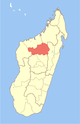
Mahatsinjo is a rural municipality in Madagascar. It belongs to the district of Maevatanana, which is a part of Betsiboka Region. The population of the municipality was 14675 in 2018.
Andranomafana is a town and commune in Madagascar. It belongs to the district of Ankazoabo, which is a part of Atsimo-Andrefana Region. The population of the commune was estimated to be approximately 6,000 in 2001 commune census.
Ambano is a town and commune in Madagascar. It belongs to the district of Antsirabe II, which is a part of Vakinankaratra Region. The population of the commune was estimated to be approximately 32,000 in the 2001 commune census.
Ambohinamboarina is a town and commune in Madagascar. It belongs to the district of Ambohimahasoa, which is a part of Haute Matsiatra Region. The population of the commune was estimated to be approximately 12,000 in 2001 commune census.
Ankerana is a town and commune in Madagascar. It belongs to the district of Ambohimahasoa, which is a part of Haute Matsiatra Region. The population of the commune was estimated to be approximately 10,000 in 2001 commune census.
Soaindrana is a town and commune in Madagascar. It belongs to the district of Fianarantsoaii, which is a part of Haute Matsiatra Region. The population of the commune was estimated to be approximately 8,000 in 2001 commune census.

Talata Ampano is a rural municipality in Madagascar. It belongs to the district of Vohibato District, which is a part of Haute Matsiatra Region. The population of the commune was estimated to be approximately 15,000 in 2001 commune census.
Ivongo is a town and commune in Madagascar. It belongs to the district of Ivohibe, which is a part of Ihorombe Region. The population of the commune was estimated to be approximately 5,000 in 2001 commune census.
Tolongoina is a town and commune in Madagascar. It belongs to the district of Ikongo, which is a part of Vatovavy-Fitovinany Region. The population of the commune was estimated to be approximately 17,000 in 2001 commune census.

Mandromodromotra is a rural municipality in Madagascar. It belongs to the district of Taolanaro, which is a part of Anosy Region. The population of the commune was estimated to be approximately 4,000 in 2001 commune census.
Amparihy Est is a town and commune in Madagascar. It belongs to the district of Vangaindrano, which is a part of Atsimo-Atsinanana Region. The population of the commune was estimated to be approximately 14,000 in 2001 commune census.
Manambondro is a rural municipality in Madagascar. It belongs to the district of Vangaindrano, which is a part of Atsimo-Atsinanana Region. The population of the commune was estimated to be approximately 15,000 in 2001 commune census.
Marokibo is a town and commune in Madagascar. It belongs to the district of Vangaindrano, which is a part of Atsimo-Atsinanana Region. The population of the commune was estimated to be approximately 3,000 in 2001 commune census.
Matanga is a town and commune in Madagascar. It belongs to the district of Vangaindrano, which is a part of Atsimo-Atsinanana Region. The population of the commune was estimated to be approximately 21,000 in 2001 commune census.
Sandravinany is a rural municipality in Madagascar. It belongs to the district of Vangaindrano, which is a part of Atsimo-Atsinanana Region. The population of the commune was estimated to be approximately 10,000 in 2001 commune census.
Vohipaho is a town and commune in Madagascar. It belongs to the district of Vangaindrano, which is a part of Atsimo-Atsinanana Region. The population of the commune was estimated to be approximately 27,000 in 2001 commune census.

Ihadilanana is a town and commune in Madagascar. It belongs to the district of Ambositra, which is a part of Amoron'i Mania Region. The population of the commune was estimated to be approximately 9,000 in 2001 commune census.
Sahatsiho Ambohimanjaka is a rural municipality in Madagascar. It belongs to the district of Ambositra, which is a part of Amoron'i Mania Region. The population of the commune was estimated to be approximately 9,000 in 2001 commune census.