Ambalajia

Last updated
Ambalajia
Madagascar location map.svg
Red pog.svg
Ambalajia
Location in Madagascar
Coordinates: 17°29′S46°7′E / 17.483°S 46.117°E / -17.483; 46.117
CountryFlag of Madagascar.svg  Madagascar
Region Betsiboka
District Maevatanana
Elevation [1] 232 m (761 ft)
Population (2001) [2]
  Total 9,000
Time zone EAT (UTC3)

Ambalajia is a town and commune (Malagasy : kaominina) in Madagascar. It belongs to the district of Maevatanana, which is a part of Betsiboka Region. The population of the commune was estimated to be approximately 9,000 in 2001 commune census. [2]

Malagasy is an Austronesian language and the national language of Madagascar. Most people in Madagascar speak it as a first language as do some people of Malagasy descent elsewhere.

Madagascar island nation off the coast of Southeast Africa, in the Indian Ocean

Madagascar, officially the Republic of Madagascar, and previously known as the Malagasy Republic, is an island country in the Indian Ocean, approximately 400 kilometres off the coast of East Africa. The nation comprises the island of Madagascar and numerous smaller peripheral islands. Following the prehistoric breakup of the supercontinent Gondwana, Madagascar split from the Indian subcontinent around 88 million years ago, allowing native plants and animals to evolve in relative isolation. Consequently, Madagascar is a biodiversity hotspot; over 90% of its wildlife is found nowhere else on Earth. The island's diverse ecosystems and unique wildlife are threatened by the encroachment of the rapidly growing human population and other environmental threats.

Districts of Madagascar

Districts are second-level administrative divisions of Madagascar below the regions. There are 114 districts in Madagascar. Districts are in their turn divided into communes; while some of the districts in urban areas and offshore islands each consist of only one commune, most of the districts are divided typically into 5–20 communes.

Only primary schooling is available. The majority 94% of the population of the commune are farmers, while an additional 4% receives their livelihood from raising livestock. The most important crops are rice and peanuts; also cowpeas are an important agricultural product. Additionally fishing employs 2% of the population. [2]

Rice cereal grain and seed of Oryza sativa

Rice is the seed of the grass species Oryza sativa or Oryza glaberrima. As a cereal grain, it is the most widely consumed staple food for a large part of the world's human population, especially in Asia. It is the agricultural commodity with the third-highest worldwide production, after sugarcane and maize.

Peanut A legume cultivated for its seeds

The peanut, also known as the groundnut, goober, or monkey nut (UK), and taxonomically classified as Arachis hypogaea, is a legume crop grown mainly for its edible seeds. It is widely grown in the tropics and subtropics, being important to both small and large commercial producers. It is classified as both a grain legume and, due to its high oil content, an oil crop. World annual production of shelled peanuts was 44 million tonnes in 2016, led by China with 38% of the world total. Atypically among crop plants, peanut pods develop underground (geocarpy) rather than aboveground. With this characteristic in mind, the botanist Linnaeus named the species hypogaea, which means "under the earth."

Cowpea species of plant, cowpea

The cowpea is an annual herbaceous legume from the genus Vigna. Due to its tolerance for sandy soil and low rainfall it is an important crop in the semi-arid regions across Africa and other countries. It requires very few inputs, as the plant's root nodules are able to fix atmospheric nitrogen, making it a valuable crop for resource-poor farmers and well-suited to intercropping with other crops. The whole plant is used as forage for animals, with its use as cattle feed likely responsible for its name.

References and notes

  1. Estimated based on DEM data from Shuttle Radar Topography Mission
  2. 1 2 3 "ILO census data". Cornell University. 2002. Retrieved 2008-03-05.

Coordinates: 17°29′S46°7′E / 17.483°S 46.117°E / -17.483; 46.117

Geographic coordinate system Coordinate system

A geographic coordinate system is a coordinate system that enables every location on Earth to be specified by a set of numbers, letters or symbols. The coordinates are often chosen such that one of the numbers represents a vertical position and two or three of the numbers represent a horizontal position; alternatively, a geographic position may be expressed in a combined three-dimensional Cartesian vector. A common choice of coordinates is latitude, longitude and elevation. To specify a location on a plane requires a map projection.


Related Research Articles

Tsarahonenana Place in Sofia, Madagascar

Tsarahonenana is a town and commune in Madagascar. It belongs to the district of Befandriana-Nord, which is a part of Sofia Region. The population of the commune was estimated to be approximately 17,000 in 2001 commune census.

Tsiningia Place in Sofia, Madagascar

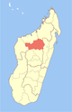
Tsiningia is a town and commune in Madagascar. It belongs to the district of Boriziny, which is a part of Sofia Region. The population of the commune was estimated to be approximately 16,000 in 2001 commune census.

Ankazomborona Place in Boeny, Madagascar

Ankazomborona is a town and commune in Madagascar. It belongs to the district of Marovoay, which is a part of Boeny Region. The population of the commune was estimated to be approximately 25,000 in 2001 commune census.

Anjiajia Place in Boeny, Madagascar

Anjiajia is a town and commune in Madagascar. It belongs to the district of Ambato-Boeni, which is a part of Boeny Region. The population of the commune was estimated to be approximately 13,000 in 2001 commune census.

Mariarano Place in Boeny, Madagascar

Mariarano is a town and commune in Madagascar. It belongs to the district of Mahajanga II, which is a part of Boeny Region. The population of the commune was estimated to be approximately 6,000 in 2001 commune census.

Ambatondrazaka Suburbaine Place in Alaotra-Mangoro, Madagascar

Ambatondrazaka Suburbaine is a town and rural commune in Madagascar. It located close to the town Ambatondrazaka and belongs to the district of Ambatondrazaka, which is a part of Alaotra-Mangoro Region. The population of the commune was estimated to be approximately 20,000 in 2001 commune census.

Mahambo Place in Analanjirofo, Madagascar

Mahambo is a town and commune in Madagascar. It belongs to the district of Fenerive Est, which is a part of Analanjirofo Region. The population of the commune was estimated to be approximately 26,000 in 2001 commune census.

Manambina Place in Menabe, Madagascar

Manambina is a town and commune in Madagascar. It belongs to the district of Miandrivazo, which is a part of Menabe Region. The population of the commune was estimated to be approximately 7,000 in 2001 commune census.

Montifeno Place in Atsimo-Andrefana, Madagascar

Montifeno or Montofeno is a town and commune in southwest Madagascar. It belongs to the district of Betioky Sud, which is a part of Atsimo-Andrefana Region. The population of the commune was estimated to be approximately 1,000 in 2001 commune census.

Mandoto Place in Vakinankaratra, Madagascar

Mandoto is a town and commune in Madagascar. It belongs to the district of Batafo, which is a part of Vakinankaratra Region. The population of the commune was estimated to be approximately 37,000 in 2001 commune census.

Ankisabe Place in Itasy, Madagascar

Ankisabe is a town and commune in Madagascar. It belongs to the district of Soavinandriana, which is a part of Itasy Region. The population of the commune was estimated to be approximately 15,000 in 2001 commune census.

Sahambano Place in Ihorombe, Madagascar

Sahambano is a town and commune in Madagascar. It belongs to the district of Ihosy, which is a part of Ihorombe Region. The population of the commune was estimated to be approximately 6,000 in 2001 commune census.

Andrainjato Centre Place in Haute Matsiatra, Madagascar

Andrainjato Centre is a town and commune in Madagascar. It belongs to the district of Fianarantsoaii, which is a part of Haute Matsiatra Region. The population of the commune was estimated to be approximately 10,000 in 2001 commune census.

Ambatolampy, Tsiroanomandidy Place in Bongolava, Madagascar

Ambatolampy is a town and commune in Madagascar. It belongs to the district of Tsiroanomandidy, which is a part of Bongolava Region. The population of the commune was estimated to be approximately 13,000 in 2001 commune census.

Ankerana Avaratra Place in Bongolava, Madagascar

Ankerana Avaratra is a town and commune in Madagascar. It belongs to the district of Tsiroanomandidy, which is a part of Bongolava Region. The population of the commune was estimated to be approximately 8,000 in 2001 commune census.

Mahasolo Place in Bongolava, Madagascar

Mahasolo is a town and commune in Madagascar. It belongs to the district of Tsiroanomandidy, which is a part of Bongolava Region. The population of the commune was estimated to be approximately 30,000 in 2001 commune census.

Ebelo Place in Anosy, Madagascar

Ebelo is a town and commune in Madagascar. It belongs to the district of Amboasary Sud, which is a part of Anosy Region. The population of the commune was estimated to be approximately 10,000 in 2001 commune census.

Ambalasoa Place in Anosy, Madagascar

Ambalasoa is a town and commune in Madagascar. It belongs to the district of Betroka, which is a part of Anosy Region. The population of the commune was estimated to be approximately 4,000 in 2001 commune census.

Andranombory Place in Anosy, Madagascar

Andranombory or Andranobory is a town and commune in Madagascar. It belongs to the district of Taolanaro, which is a part of Anosy Region. The population of the commune was estimated to be approximately 5,000 in 2001 commune census.

Bevoay Place in Anosy, Madagascar

Bevoay is a town and commune in Madagascar. It belongs to the district of Taolanaro, which is a part of Anosy Region. The population of the commune was estimated to be approximately 15,000 in 2001 commune census.