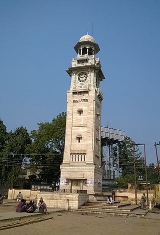
Bahraich is a city and a municipal board in Bahraich district in the state of Uttar Pradesh, India. Located on the Saryu River, a tributary of the Ghaghara river, Bahraich is 125 kilometres north-east of Lucknow, the state capital. The districts of Barabanki, Gonda, Balrampur, Lakhimpur Kheri, Shravasti and Sitapur share boundaries with Bahraich. A factor which makes this town important is the international border shared with Nepal.

Sultanpur is a city situated in the Indian state of Uttar Pradesh on the banks of the Gomti, which Hindus consider a holy river. The city is the administrative headquarters of Sultanpur district and is a part of Ayodhya division in Uttar Pradesh, India. It is situated 135 kilometers east of state capital Lucknow.

Prayagraj district, also known as Allahabad district, is the most populous district in the Indian state of Uttar Pradesh. Prayagraj city is the district headquarters of this district. The District is divided into blocks within tehsils. As of 2011, there are 20 blocks in eight tehsils. The Prayagraj division includes the districts of Pratapgarh, Fatehpur, Kaushambi and Prayagraj, with some western parts that had previously part of Allahabad District becoming part of the new Kaushambi District. The administrative divisions are Phulpur, Koraon, Meja, Sadar, Soraon, Handia, Bara, Shringverpur and Karchana.

The Pratapgarh district is one of the districts of Uttar Pradesh state of India, and Pratapgarh city is the district headquarters. Pratapgarh district is a part of Prayagraj division. The total area of Pratapgarh district is 3730 Sq. km.
Bela Pratapgarh is a town and a municipal board in Pratapgarh district in the state of Uttar Pradesh, India.
Bhadarsa is a town and nagar panchayat in Ayodhya district in state of Uttar Pradesh, India. Bhadarsa is 22 km south of district headquarters Ayodhya city.
Bisauli is a town and a municipal board in Badaun district in the state of Uttar Pradesh, India. It is settled on Badaun - Moradabad Highway. Bisauli is known for its temples and mosques abounding the town. Bisauli is a constituency of District Budaun. Member of Legislative Assembly from Bisuli is Ashutosh Maurya of Samajwadi Party
Dhampur is a city and a municipal board in Bijnor district in the state of Uttar Pradesh, India. It is located at 29.51°N 78.50°E, and lies in Northern India.
Jagdishpur is a town in Amethi in the Indian state of Uttar Pradesh.

Kadipur is a town, tehsil and a nagar panchayat in Sultanpur district in the Indian state of Uttar Pradesh. It is located a short distance from the bank of the Gomti River, at a crossroads between two roads heading from Sultanpur to Surapur and from Pratapgarh to Dostpur and then on to Akbarpur. On the north side of town is a stream with a steep ravine that drains the surrounding area. The road to Sultanpur crosses over this stream on a bridge. The lands surrounding Kadipur are average quality for agricultural purposes. As of 2011, Kadipur has a population of 8,010 people, in 1,216 households.
Katra Medniganj is a town and a nagar panchayat in Pratapgarh district in the Indian state of Uttar Pradesh. The town is named Katra Medniganj to pay the respects to a great freedom fighter of 18th century, Shree Babu Medini Singh, brother of the soldier Babu Gulab Singh.

Musafirkhana is a town and tehsil in Amethi district in Indian state of Uttar Pradesh. The word "Musafirkhana" means "Sarai," or "Dharamshala". Musafirkhana is located 32 km northwest of district headquarters Amethi.
Shohratgarh is a town and tehsil in Siddharthnagar district, Uttar Pradesh state of India.
Antu is a town and a nagar panchayat in the Community Development Block Sandwa Chandrika, Pratapgarh Teshil, Pratapgarh district in the state of Uttar Pradesh, India, located 20.6 km northwest of the district administrative headquarter Bela Pratapgarh and 4.7 km northeast of Sandwa Chandrika. The territory of the town has 2 square kilometers. It is divided into 10 wards. The postal Zip Code is 230501.

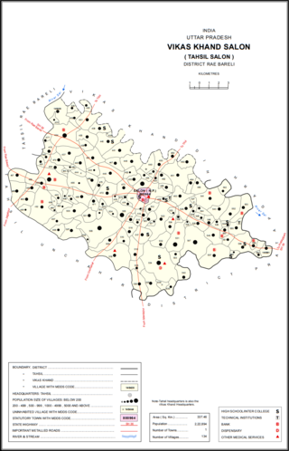
Salon is a town and nagar panchayat in Raebareli district in the Indian state of Uttar Pradesh. It serves as the headquarters of a tehsil as well as a community development block. Originally it was also the headquarters of the entire district, but they were moved after the Indian Rebellion of 1857. It is located a bit to the south of the Sai river, at the junction of the Raebareli-Pratapgarh and Jais-Khaga roads. Other roads lead to Dalmau, Manikpur, and Kunda. To the east is a large jhil.
Patti is a town and a Nagar Panchayat in Pratapgarh district in the Indian state of Uttar Pradesh.

Kunda is a town and a Tehsil in Pratapgarh district in the Indian state of Uttar Pradesh.

Pratapgarh district is the 33rd district of Rajasthan, created on 26 January 2008. It is a part of Udaipur Division and has been carved out from the erstwhile tehsils of Chittorgarh, Udaipur and Banswara districts. Pratapgarh town is the administrative headquarters of the district.
The demographics of Uttar Pradesh is a complex topic, which is undergoing dynamic change. Uttar Pradesh is India's most populous state, and the largest subdivision in the world. It has a population of about 199,812,341 as per the 2011 census. If it were a separate country, Uttar Pradesh would be the world's fifth most populous nation, next only to China, the rest of India, the United States of America and Indonesia. Uttar Pradesh has a population more than that of Pakistan. There is an average population density of 828 persons per km2 i.e. 2,146 per sq mi. The capital of Uttar Pradesh is Lucknow, and Prayagraj serves as the state’s judicial capital. Hindus and Muslims both consider the state as a holy place.
Benti is a village in Kunda tehsil of Pratapgarh district in the Indian state of Uttar Pradesh. The village is located on the bank of river Ganges and near by village Bhadri.


