
Amethi is a town in the Indian state of Uttar Pradesh. It is a major city of the Amethi district, in the Faizabad division. The Hanumangarhi temple and Jama Masjid is located in the heart of the town.
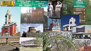
Hoshiarpur is a city and a municipal corporation in Hoshiarpur district in the Doaba region of the Indian state of Punjab. It was founded, according to tradition, during the early part of the fourteenth century. In 1809 it was occupied by the forces of Maharaja Karanvir Singh and was united into the greater state of Punjab in 1849.

Gosainganj, also spelled Goshainganj or Gosaiganj is a town and nagar panchayat in Lucknow district of Uttar Pradesh, India. It is the seat of a community development block, which is included in the tehsil of Mohanlalganj. As of 2011, its population is 9,649, in 1,685 households. The starting point of the Purvanchal Expressway i.e. Chand Saray village is situated 2.5 km away from Gosainganj.

Kadamakudy Islands is an island suburb of the city of Kochi in the Indian state of Kerala. It is situated around 8 km (6 mi) north of the city centre.

Katra is a town and a nagar panchayat in Gonda district in the Indian state of Uttar Pradesh.

Malkera is a census town in Baghmara CD block in Dhanbad Sadar subdivision of Dhanbad district in the Indian state of Jharkhand.
Mariahu (Mariyahu) is a town and a nagar panchayat in Jaunpur district in the Indian state of Uttar Pradesh. Its name Mariahu was given by Nanwag(Nandwak) king Naun Rao in 16th century on the name of Mandav Deo, the patreon deity of the Nanwag clan. The samadhi of Mandav dev is situated near to Chutka Devi temple which is in the east of tehsil. Mostly tehsil was ruled by Nanwag Rajputs who were the local rulers during 16th and 17th century. Baghi Sangram Singh a leader of the Nanwags revolted against the British East India company during the revolt of 1857 and defeated them on several occasions. It is one of the six tehsils of Jaunpur district, with the others being Jaunpur city, Shahganj, Machalishahar, Badlapur and Keraket.
Nagri Kalan is a census town in Baghmara CD block in Dhanbad Sadar subdivision of Dhanbad district in the Indian state of Jharkhand.
Parsadepur, also spelled Parshadepur, is a town and a nagar panchayat in Rae Bareli district in the Indian state of Uttar Pradesh. It is located on the north bank of the Sai river, at the crossroads between the road from Salon to Jais and the smaller road from Raebareli to Ateha. Historically noted for its large weaving industry, Parsadepur served as the headquarters of a pargana since the late 18th century. As of 2011, its population is 11,853 people, in 1,738 households.

Renukoot is a city and a nagar panchayat in Sonbhadra district in the Indian state of Uttar Pradesh. Renukoot is 68 km south from the district headquarters Robertsganj and 158 km from Varanasi.
Sahnidih is a census town in Baghmara CD block in Dhanbad Sadar subdivision of Dhanbad district in the Indian state of Jharkhand.
Sarila is a town, a former princely state and a nagar panchayat in Hamirpur district in the northern Indian state of Uttar Pradesh.
Shankargarh is a town and a nagar panchayat in Allahabad district in the Indian state of Uttar Pradesh.
Sirathu is a town and Nagar Panchayat in Kaushambi district in the Indian state of Uttar Pradesh. It is one of oldest town in Kaushambi district. The town has a population of approximately 2700.

Uchana is a developing town and a municipal committee in Jind district in the Indian state of Haryana.

Vijay Pur is a town and a notified area committee in Samba district in the Indian union territory of Jammu and Kashmir, situated on the bank of Devak river, known locally as Gupt Ganga. It is one of the most fast-growing towns near Jammu. The name of Vijaypur is derived from Brij Dev Singh and he was Belong to Jammoria family.

Mahmudabad, also known as Mahmudabad Awadh is a town and a municipal board in Sitapur district in the Indian state of Uttar Pradesh.
Antu is a town and a nagar panchayat in the Community Development Block Sandwa Chandrika, Pratapgarh Teshil, Pratapgarh district in the state of Uttar Pradesh, India, located 20.6 km northwest of the district administrative headquarter Bela Pratapgarh and 4.7 km northeast of Sandwa Chandrika. The territory of the town has 2 square kilometers. It is divided into 10 wards. The postal Zip Code is 230501.
Khour is a town in Jammu district in the Indian union territory of Jammu and Kashmir.
Shian pari is a village in Firozpur district in the Indian state of Punjab. It is situated in between two highways: Amritsar to Bathinda Road and Amristsar to Moga Road. It is situated 1.5 km away from the main Amritsar - Bathinda road, near Makhu and 3 km from the Amritsar-Moga road. It is 12 km away from Tehsil Zira. Two gurdwara are located in the village. One is on the east side of the village and the other one is on the west side. Sardar Piara Singh grandfather of Sardar Lakhwinder Singh, Ravinder Singh, Dilbag Singh came from village Jia Bagga now in Pakistan in 1947.