Bhardeu भारदेउ | |
|---|---|
Village of Konjyosom Rural Municipality | |
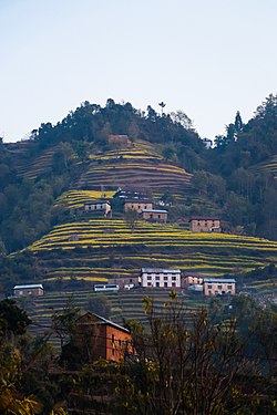 Terrace farming and houses at Bhardev, Lalitpur | |
 Bhardeu Location in Nepal | |
| Coordinates: 27°33′N85°23′E / 27.55°N 85.39°E | |
| Country | |
| Province | Province No. 3 |
| District | Lalitpur District |
| Population (1991) | |
• Total | 1,746 |
| Time zone | UTC+5:45 (Nepal Time) |
Bhardeu is a village and former Village Development Committee that is now part of Konjyosom Rural Municipality in Province No. 3 of central Nepal. At the time of the 1991 Nepal census it had a population of 1,746 in 310 individual households. [1]
Bhardeu is a small village located in Lalitpur district, in the Bagmati zone of Nepal. The people are mostly Tamang (apx. 65%) and Newar (apx. 25%). The main languages spoken are Tamang and Nepali. Most of the people raise crops and livestock. Foreign remittances are also economically significant.[ citation needed ]
Bhardeu VDC is 22 km south from ring-road Satdobato. There is also bus service present from Pyangaun, Chapagaun or from Lagankhel up to LELE Saraswoti Kunda station.[ citation needed ]
