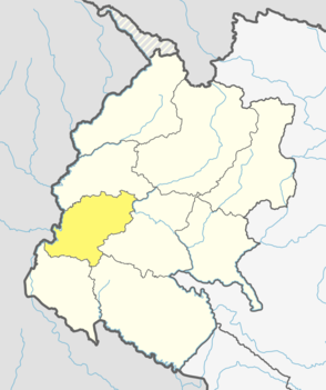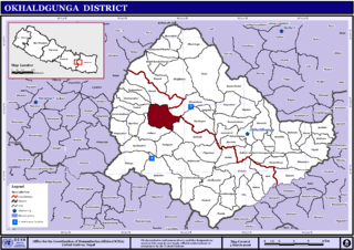
Dadeldhura district, a part of Sudurpashchim Province, is one of the seventy-seven districts of Nepal. The district, with Dadeldhura as its district headquarters, covers an area of 1,538 km2 (594 sq mi) and had a population of 126,162 in 2001 and 142,094 in 2011.

Lalitpur District (Nepali: ललितपुर जिल्लाListen , a part of Bagmati Province, is one of the seventy-seven districts of Nepal. The district, with Lalitpur as its district headquarters, covers an area of 396.92 km2 and has a population of 337,785. It is one of the three districts in the Kathmandu Valley, along with Kathmandu and Bhaktapur. Its population was 466,784 in the initial 2011 census tabulation. It is surrounded by Makwanpur, Bhaktapur, Kathmandu and Kavre.

Dunai is a village and former Village Development Committee that is now part of Thuli Bheri Municipality in Nepal. Dunai is also the district headquarters of Dolpa District. The town on the banks of the Thuli Bheri River resides at about 2,000 metres (6,562 ft) elevation.

A Village Development Committee (VDC) in Nepal was the lower administrative part of its Ministry of Federal Affairs and Local Development. Each district had several VDCs, similar to municipalities but with greater public-government interaction and administration. There were 3,157 village development committees in Nepal. Each VDC was further divided into several wards depending on the population of the district, the average being nine wards.

Chharka is a village development committee in Dolpa District in the Karnali Zone of north-western Nepal. At the time of the 1991 Nepal census it had a population of 552 persons living in 101 individual households. In the 2001 Nepal census it was found that 627 people identified as Buddhist and seven people identified as Hindu. It also stated that 544 people in 2001 were actually literate, 259 male and 285 female. there were also a total of 438 people who were non literate, 183 males and 255 females. Also according to the 2001 Nepal census there were a total of 634 people living in Chharka. Over one third of this population were in the age group of 4–19 years of age while only roughly about 9% of the population were the age of 50 or over.

Juphal is a village and former Village Development Committee that is now part of Thuli Bheri Municipality in Nepal. The 1991 Nepal census counted 1,513 persons in 300 households.

Thulo Parsal is a village development committee in Kabhrepalanchok District in the Bagmati Zone of central Nepal. At the time of the 1991 Nepal census it had a population of 3,060.

Patarasi is a rural municipality located in Jumla District of Karnali Province of Nepal.

Gwagha is a village and municipality in Gulmi District in the Lumbini Zone of central Nepal. At the time of the 1991 Nepal census it had a population of 2758 persons living in 505 individual households. It is notable for a vicious attack by tigers in 1985 in which all but three inhabitants were mauled and killed. The remaining three were left to rebuild and repopulate the municipality, saving the community, fabled for having taller women than men from extinction.

Chulachuli is a rural municipality (gaunpalika) out of six rural municipality located in Ilam District of Province No. 1 of Nepal. There are a total of 10 municipalities in Ilam in which 4 are urban and 6 are rural.

Lele is a village development committee in Lalitpur District in the Bagmati Zone of central Nepal. At the time of the 1991 Nepal census it had a population of 6928 living in 1245 individual households, but the population has increased greatly since then.

Amlekhganj (Nepali:अमलेखगंज) is a town and Village Development Committee in Bara District in the Narayani Zone of south-eastern Nepal. At the time of the 2011 Nepal census it had a population of 6,709 people living in 1370 individual households. There were 3,413 males and 3,296 females at the time of census. At one time it was famed as the starting point of the Nepal Government Railway (NGR) which connected it with Raxaul in India.

Tarigaun is a village and former Village Development Committee that is now part of Tulsipur Sub-Metropolitan City in Dang Deokhuri District in Lumbini Province of south-western Nepal. It was annexed into Tulsipur in 2014. At the time of the 1991 Nepal census it had a population of 7,685 persons living in 1087 individual households.

Bhadaure Tamagi is a town and Village Development Committee in Kaski District in the Gandaki Zone of northern-central Nepal. At the time of the 1991 Nepal census it had a population of 3,543 persons living in 692 individual households.

Majhthana is a town and Village Development Committee in Kaski District in the Gandaki Zone of northern-central Nepal. At the time of the 1991 Nepal census it had a population of 3,670 persons living in 791 individual households.
Shisuwa is a town and once a Village Development Committee in Kaski District in the Gandaki Zone of northern-central Nepal. At the time of the 1991 Nepal census it had a population of 12,127.

Bilandu is a village development committee in Okhaldhunga District in the Sagarmatha Zone of mid-eastern Nepal. At the time of the 1991 Nepal census it had a population of 2279 living in 431 individual households. On December 15, 2010 a plane crashed in the forest of Bilandu, near the village of Shreechaur in the adjacent village development committee.

Katahariya is a municipality in Rautahat District in the Narayani Zone of south-eastern Nepal. Before September 2017, Katahariya was one of the Village Development Committees with 8 wards. At the time of the 1991 Nepal census, it had a population of 4,619 people living in 835 individual households. Katahariya is famous for its vegetables and cattle market. It has a well-maintained Farmers' market (vegetable) and Cattle (domestic-animal) market. Katahariya is a fast-growing VDC, with the main occupations of local people being business and farming.

Chaurjahari is a Municipality in Western Rukum District in Karnali province of Nepal that was established in 2015 through the merging the two former Village development committees Bijayaswori and Kotjahari. It lies on the bank of Sani Bheri River. At the time of the 2011 Nepal census it had a population of 27,438 people living in 5,422 individual households.

Pathari Shanishchare (पथरी-शनिश्चरे) is a Municipality in Morang District in the Koshi Zone of south-eastern Nepal. It was formed by merging three existing village development committees i.e. Hasandaha, Pathari and Sanischare in May 2014.


