Harda is a town and a municipality in Harda district in the Indian state of Madhya Pradesh. Harda is the administrative headquarters of Harda.
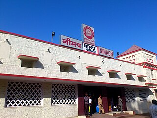
Neemuch or Nimach is a city in the malwa region. Neemuch crowns the north western part of MP. It has been also referred to city of Nature and Peace. The town shares its northwestern border with the state of Rajasthan and is the administrative headquarters of Neemuch District. Formerly a large British cantonment of Gwalior princely state, in 1822 the town became the headquarters of the combined Rajputana–Malwa political agency and of the Malwa Agency in 1895. The British Cantonment was disbanded in 1932 after which it was maintained by a British Municipal Board.

The Kali Sindh, is a river in Madhya Pradesh and Rajasthan in northern India. It is a tributary of the Chambal River in the Ganges Basin. The main tributaries of the Kali Sindh are the Parwan, Niwaj and Ahu rivers. The Kali Sindh River drains a major portion of the Malwa region, and is the biggest river flowing in the Malwa region of Madhya Pradesh.

Jhalawar ( ) is a city, municipal council and headquarter in Jhalawar district of the Indian state of Rajasthan. It is located in the southeastern part of the state. It was the capital of the former princely state of Jhalawar, and is the administrative Jhalawar district. Its district headquarters is Jhalawar. This district is the 22nd largest district of Rajasthan. This district is known by the nicknames of Cherrapunji of Rajasthan, Nagpur of Rajasthan, Brijnagar of Rajasthan etc. Cherrapunji of rajasthan because the highest rainfall in the whole of Rajasthan occurs in manoharthana town in this district. Gagron fort at the confluence of Kalisindh and Ahu river at some distance from Jhalawar It is situated which is one of the Jaldurg of Rajasthan and it is such a fort which is a standing fort without foundation. This fort was included in the UNESCO World Heritage List in 2013.

Sawai Madhopur district is a district of Rajasthan state in north-west India. Sawai Madhopur is the chief town and district headquarters. Sawai Madhopur district comes under Bharatpur division.

Guna district is one of the 52 districts of Madhya Pradesh in central India. Its administrative headquarters is Guna. The district has a population of 1,241,519. It has an area of 6390 km², and is bounded on the northeast by Shivpuri District, on the east by Ashoknagar District, on the southeast by Vidisha District, on the southwest by Rajgarh District, on the west and northwest by Jhalawar and Baran districts of Rajasthan state. The Sindh River flows northward along the eastern edge of the district, forming part of the boundary with Ashoknagar District, and the Parvati River flows northwestward through the southern portion of the district, forming part of the boundary with Baran District before flowing into Rajasthan.

Jhalawar district is one of the 33 districts of Rajasthan state in western India. The historical city of Jhalawar is the administrative headquarters of the Jhalawar district. The district is bounded on the northwest by Kota district, on the northeast by Baran district, on the east by Guna district of Madhya Pradesh state, on the south by Rajgarh district and Agar Malwa district of Madhya Pradesh state and on the west by Ratlam district and Mandsaur district of Madhya Pradesh state. The district occupies an area of 6219 km². The district is part of Kota division. To know more about Jhalawar City
Aklera is a town and an Indian municipality in Jhalawar district in the state of Rajasthan. It is in the south-eastern region of Rajasthan at the edge of the Malwa plateau and has a rocky, scrub-covered terrain.
Bhawani Mandi is a town and a municipality in Jhalawar district in the state of Rajasthan, India.
Ramganj Mandi is a city and a municipality in Kota district in the Indian state of Rajasthan. It is known as stone city, coriander city. It has the largest grain market of coriander with around 6500 tons of coriander seeds arriving on a single day during season. Spices Giant MDH buys its coriander seeds from Ramganj Mandi. A new spice park is being constructed on Nimana road, the link road between SH 9B and NH 12. Annually billions of square feet of limestone is exported throughout the country, mainly in Punjab, Haryana, Chandigarh, Gujarat, Maharashtra and Madhya Pradesh. Around 1000 stone processing units are set up in the industrial area. More than 80 mines are present in the area.

Narsinghgarh is a town and a municipality, near Rajgarh city in Rajgarh district in the Indian state of Madhya Pradesh.

The 12465/12466 Ranthambhore Express is a Superfast train service which runs between Indore Junction railway station in Indore, the largest city and the commercial hub of the central Indian state Madhya Pradesh, and Jodhpur, a major city in Rajasthan, India. It is operated with 12465/12466 train numbers on a daily basis.
Sunel is a Town in Jhalawar district, Rajasthan, India, with a population of about 25000. It was formerly known as Ahilya Nagri. The Ahu River is 3 kilometres (2 mi) from Sunel.
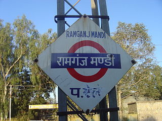
Ramganj Mandi is a railway station in Ramganj Mandi, Rajasthan, India. It is categorized as "NSG-4" station in Kota division of West Central Railway zone of Indian Railways. Currently the Ramganj Mandi–Bhopal section is under construction, completed to Jhalawar City and Kalisindh Thermal Power Plant.
Jhalawar Road railway station is a small railway station in Jhalawar district, Rajasthan. Its code is JHW. It serves Jhalawar city. The station consists of three platforms. The platforms are not well sheltered. It lacks many facilities including water and sanitation. The station is 38 km from Jhalawar city before construction of line to Jhalawar city this station was main rail route.
Asnawar is a small town in Jhalawar district, Rajasthan, India, with a population of about 15,000. It was formerly known as Aasnaver. The Kalisindh River is 8 kilometres (5 mi) from Asnawar. Also famous temples like rata devi, kham kheda, modi ki jahar.

Parban River originates in Madhya Pradesh and flows through Rajasthan. It is a tributary of the Kali Sindh. Parban/Parvan originates in Sehore district of Madhya Pradesh and flows through Sehore, Shajapur and Rajgarh districts in Madhya Pradesh. It also flows through Jhalawar, Kota, Baran districts of Rajasthan. Before it joins the Kali Sindh it cuts a 10 km long valley of significant depth right across Ratibar Dungar near Akawad Kalan in Jhalawar district. It meets Kali Sindh in Baran district of Rajasthan. Shergarh wildlife Sanctuary situated at the bank of Parban river in Baran district.
Chaumahla railway station is a railway station in Jhalawar district, Rajasthan. Its code is CMU. It serves Chaumahla town. The station consists of 3 platforms. Passenger, Express, and Superfast trains halt here.
Indragarh Sumerganj Mandi railway stationis a railway station in Bundi district, Rajasthan. Its code is IDG. It serves Indragarh and Sumerganj Mandi. The station consists of 2 platforms. Passenger, Express, and Superfast trains halt here.
Kalapipal railway station is a railway station in Shajapur district of Madhya Pradesh. Its code is KPP. It serves Kalapipal Mandi city. The station consists of two platforms. It lacks many facilities including water and sanitation. Passenger, Express and Superfast trains halt here.

