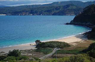
The Bay of Biscay is a gulf of the northeast Atlantic Ocean located south of the Celtic Sea. It lies along the western coast of France from Point Penmarc'h to the Spanish border, and along the northern coast of Spain, extending westward to Cape Ortegal. The southern area of the Bay of Biscay that washes over the northern coast of Spain is known locally as the Cantabrian Sea.

Gipuzkoa is a province of Spain and a historical territory of the autonomous community of the Basque Country. Its capital city is Donostia-San Sebastián. Gipuzkoa shares borders with the French department of Pyrénées-Atlantiques at the northeast, with the province and autonomous community of Navarre at east, Biscay at west, Álava at southwest and the Bay of Biscay to its north. It is located at the easternmost extreme of the Cantabric Sea, in the Bay of Biscay. It has 66 kilometres of coast land.

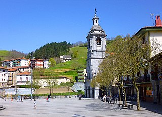
Irun is a town of the Bidasoaldea region in the province of Gipuzkoa in the Basque Autonomous Community, Spain.
Ibarra is a town and municipality located in the province of Gipuzkoa, in the autonomous community of Basque Country, northern Spain. By 2003 INE figures Ibarra had a total population of 4,374.

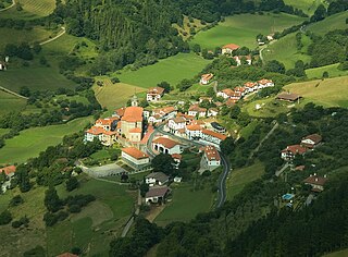
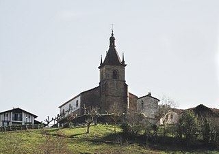
Altzaga is a town located in the Goierri region of the province of Gipuzkoa, in the autonomous community of the Basque Country, in the north of Spain. As of 2014 Altzaga had a total population of 165.

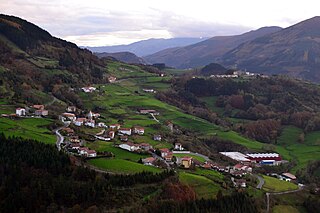
Goierri or "Basque Highlands" is one of the eight comarcas in the Spanish province of Gipuzkoa. It is composed of 18 municipalities, Beasain, Ordizia and Lazkao being the main towns. The main administrative center is Beasain.
Belauntza is a town located in the province of Gipuzkoa, in the autonomous community of Basque Country, northern Spain.
Errezil is a town in the province of Gipuzkoa in the autonomous community of Basque Country, located in the north of Spain. According to the 2016 Basque sociological survey, Errezil has the largest percentage of Basque language speakers of any municipality in the Basque Country, with over 90% of Errezil respondents reporting Basque as their first language and/or reporting speaking Basque at home.

Larraul is a town and municipality located in the province of Gipuzkoa, in the autonomous community of Basque Country, northern Spain.

Zaldibia is a town and municipality in the Goierri region of the province of Gipuzkoa, in the Basque Country.
Zerain is a town and municipality located in the Goierri region of the province of Gipuzkoa, in the autonomous community of the Basque Country, northern Spain.
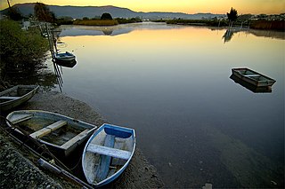
The Bidasoa is a river in the Basque Country of northern Spain and southern France that runs largely south to north. Named as such downstream of the village of Oronoz-Mugairi in the province of Navarre, the river actually results from the merger of several streams near the village Erratzu, with the stream Baztan that rises at the north-eastern side of the mount Autza being considered the source of the Bidasoa. It joins the Cantabrian Sea between the towns of Hendaye and Hondarribia.

The Battle of Irún was the critical battle of the Campaign of Gipuzkoa prior to the War in the North, during the Spanish Civil War. The Nationalist Army, under Alfonso Beorlegui, captured the city of Irún cutting off the northern provinces of Gipuzkoa, Biscay, Santander, and Asturias from their source of arms and support in France.

The Basque Autonomous Community [ A.C.] also officially called Euskadi [] is an autonomous community in northern Spain. It includes the Basque provinces of Araba, Bizkaia, and Gipuzkoa. It also surrounds an enclave called Treviño.

The Cape Higuer is a cape on the Bay of Biscay standing out at the end of the mountain range Jaizkibel by the France–Spain border in the municipality of Hondarribia. The site is home to a lighthouse, besides holding a camp-site and a couple of inns. It is sometimes considered the westernmost land strip of the Pyrenees, with the trek trail GR 11 setting out at this point.
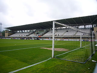
Stadium Gal is a football stadium in Irun, Gipuzkoa, Basque Country, Spain. It is owned by Real Unión, currently in Segunda División B. The capacity of the stadium is 5,500 spectators.

Durangaldea is a comarca of Biscay located in the Basque Country, Spain. It is one of the seven eskualdeak/comarcas or regions that compose the province of Biscay. The capital city of Durangaldea is Durango.

The physical geography of the Basque Country is very diverse despite the small size of the region. The territory hosts a blend of green and brown to yellowish tones, featuring hilly terrain altogether. The Basque Country spreads from the rough coastal landscape to the semi-desert of the Bardenas on the south-eastern fringes of Navarre.

Debabarrena is an eskualdea / comarca located in Gipuzkoa, Basque Country (Spain). It has an area of 180,3 km2. It is north from the comarca of Debagoiena, east from the province of Biscay, and south from the Gulf of Biscay.

The autonomous community of the Basque Country within Spain contains several comarcas or eskualdeak in the Basque language, referring to local districts, grouped into its three long-established provinces.

